Estimated Value: $389,395 - $418,000
4
Beds
2
Baths
2,500
Sq Ft
$161/Sq Ft
Est. Value
About This Home
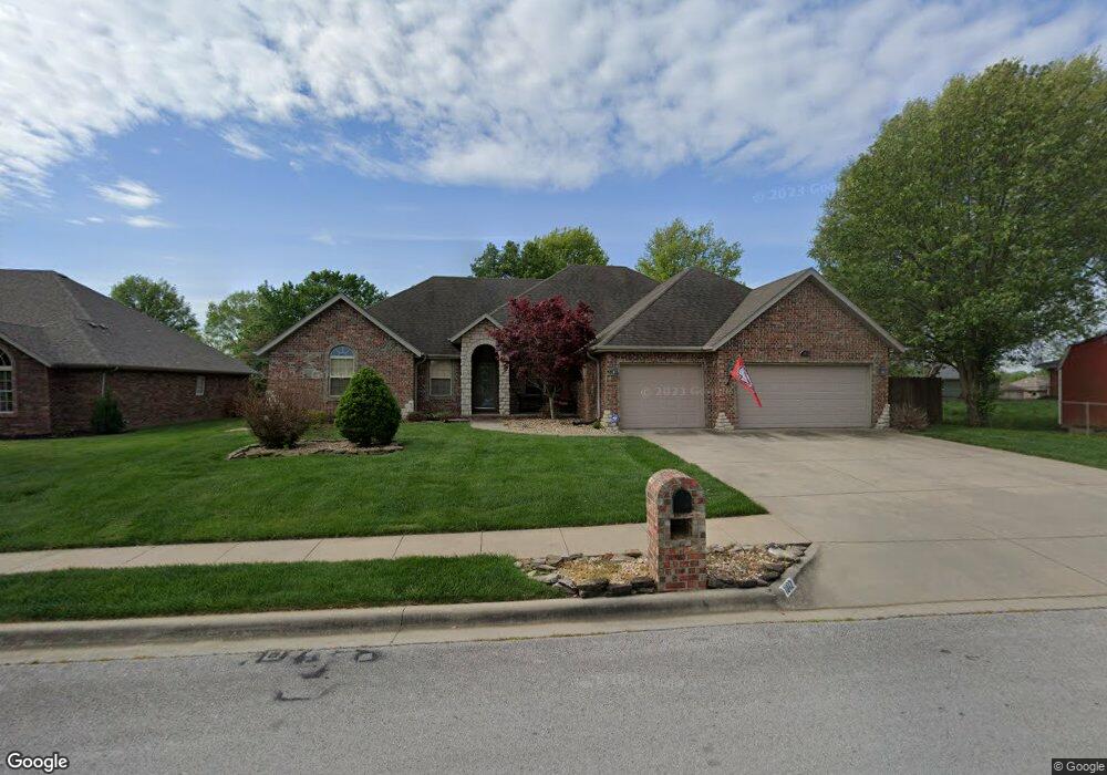
This home is located at 1012 Denali Dr, Nixa, MO 65714 and is currently estimated at $402,349, approximately $160 per square foot. 1012 Denali Dr is a home located in Christian County with nearby schools including Espy Elementary School, Nicholas A. Inman Intermediate School, and Nixa Junior High School.
Ownership History
Date
Name
Owned For
Owner Type
Purchase Details
Closed on
Jul 12, 2024
Sold by
Scott Michael A and Scott Lindsy D
Bought by
Downs Michael G and Downs Jennifer D
Current Estimated Value
Home Financials for this Owner
Home Financials are based on the most recent Mortgage that was taken out on this home.
Original Mortgage
$365,500
Outstanding Balance
$359,864
Interest Rate
7.03%
Mortgage Type
New Conventional
Estimated Equity
$42,485
Purchase Details
Closed on
Apr 17, 2017
Sold by
Mabe James P
Bought by
Scott Michael A and Scott Lindsy D
Home Financials for this Owner
Home Financials are based on the most recent Mortgage that was taken out on this home.
Original Mortgage
$256,405
Interest Rate
4.1%
Mortgage Type
New Conventional
Purchase Details
Closed on
May 19, 2015
Sold by
Rogers R Richard and Rogers Wilma J
Bought by
Mabe James P
Home Financials for this Owner
Home Financials are based on the most recent Mortgage that was taken out on this home.
Original Mortgage
$229,761
Interest Rate
3.7%
Mortgage Type
FHA
Purchase Details
Closed on
Jun 9, 2008
Sold by
Bell Euphena E
Bought by
Rogers R Richard and Rogers Wilma J
Home Financials for this Owner
Home Financials are based on the most recent Mortgage that was taken out on this home.
Original Mortgage
$240,000
Interest Rate
6.08%
Mortgage Type
Future Advance Clause Open End Mortgage
Purchase Details
Closed on
Oct 31, 2005
Sold by
Terrill Denzil
Bought by
Bell Raymond W and Bell Euphena E
Create a Home Valuation Report for This Property
The Home Valuation Report is an in-depth analysis detailing your home's value as well as a comparison with similar homes in the area
Home Values in the Area
Average Home Value in this Area
Purchase History
| Date | Buyer | Sale Price | Title Company |
|---|---|---|---|
| Downs Michael G | -- | Hogan Land Title | |
| Scott Michael A | -- | Great American Title | |
| Mabe James P | -- | Great American Title | |
| Rogers R Richard | -- | None Available | |
| Bell Raymond W | -- | Meridian Title Company |
Source: Public Records
Mortgage History
| Date | Status | Borrower | Loan Amount |
|---|---|---|---|
| Open | Downs Michael G | $365,500 | |
| Previous Owner | Scott Michael A | $256,405 | |
| Previous Owner | Mabe James P | $229,761 | |
| Previous Owner | Rogers R Richard | $240,000 |
Source: Public Records
Tax History
| Year | Tax Paid | Tax Assessment Tax Assessment Total Assessment is a certain percentage of the fair market value that is determined by local assessors to be the total taxable value of land and additions on the property. | Land | Improvement |
|---|---|---|---|---|
| 2025 | $2,895 | $49,380 | -- | -- |
| 2024 | $2,895 | $46,460 | -- | -- |
| 2023 | $2,895 | $46,460 | -- | -- |
| 2022 | $2,899 | $46,460 | $0 | $0 |
| 2021 | $2,901 | $46,460 | $0 | $0 |
| 2020 | $2,799 | $42,790 | $0 | $0 |
| 2019 | $2,799 | $42,790 | $0 | $0 |
| 2018 | $2,403 | $39,440 | $0 | $0 |
| 2017 | $2,403 | $39,440 | $0 | $0 |
| 2016 | $2,366 | $39,440 | $0 | $0 |
| 2015 | $2,370 | $39,440 | $39,440 | $0 |
| 2014 | $2,296 | $39,180 | $0 | $0 |
| 2013 | $23 | $39,180 | $0 | $0 |
| 2011 | $23 | $78,360 | $0 | $0 |
Source: Public Records
Map
Nearby Homes
- 805 W Briarwood Ln
- 717 N Milton Dr
- 1205 W Yellowstone St
- 713 Morning Glory Dr
- 207 Meadow St
- 711 Robinwood Ln
- 1334 W Mount Vernon St
- 1209 W Mount Vernon St
- 1344 W Berkshire Ave
- 912 Wesley Ave
- 1353 Norfolk Ave
- 000 (Tbd) Highway 160 (14 8 Acres) St
- 403 S Bryant St
- 120 N Nicholas Rd
- 000 West St
- 601 S Gregg Rd
- 310 Great Plains St
- 1404 Cody Rd
- Sw Corner Highway 160 & St S
- Tbd U S 160
Your Personal Tour Guide
Ask me questions while you tour the home.