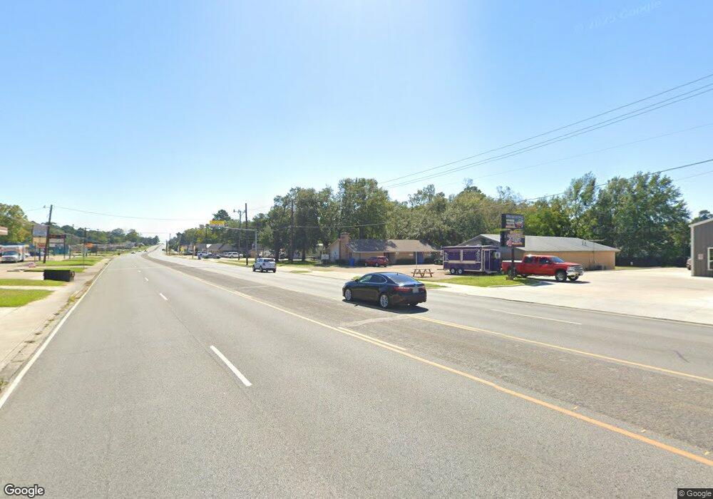
1012 E Denman Ave Lufkin, TX 75901
Estimated Value: $274,000 - $438,000
Studio
10
Baths
2,548
Sq Ft
$141/Sq Ft
Est. Value
About This Home
This home is located at 1012 E Denman Ave, Lufkin, TX 75901 and is currently estimated at $358,115, approximately $140 per square foot. 1012 E Denman Ave is a home located in Angelina County with nearby schools including Kurth Primary School, Anderson Elementary School, and Lufkin Middle School.
Ownership History
Date
Name
Owned For
Owner Type
Purchase Details
Closed on
Jul 1, 2019
Sold by
Royce Raymond and Heil Florence
Bought by
Johnson Mistie and Johnson Kevin
Current Estimated Value
Purchase Details
Closed on
Jan 5, 2016
Sold by
Wells Fargo Bank Na
Bought by
Heil Raymond Royce
Purchase Details
Closed on
Oct 6, 2015
Sold by
Matthews Terry L and Matthews Shannon D
Bought by
Wells Fargo Bank Na
Purchase Details
Closed on
Jul 2, 2012
Sold by
Teaker Katrina R
Bought by
Matthews Terry L and Matthews Shannon D
Home Financials for this Owner
Home Financials are based on the most recent Mortgage that was taken out on this home.
Original Mortgage
$233,197
Interest Rate
3.8%
Mortgage Type
FHA
Create a Home Valuation Report for This Property
The Home Valuation Report is an in-depth analysis detailing your home's value as well as a comparison with similar homes in the area
Purchase History
| Date | Buyer | Sale Price | Title Company |
|---|---|---|---|
| Johnson Mistie | -- | None Available | |
| Heil Raymond Royce | $131,000 | Linear Title & Closing Ltd | |
| Wells Fargo Bank Na | $159,495 | None Available | |
| Matthews Terry L | $233,197 | Angelina Title Llc |
Source: Public Records
Mortgage History
| Date | Status | Borrower | Loan Amount |
|---|---|---|---|
| Previous Owner | Matthews Terry L | $233,197 |
Source: Public Records
Tax History Compared to Growth
Tax History
| Year | Tax Paid | Tax Assessment Tax Assessment Total Assessment is a certain percentage of the fair market value that is determined by local assessors to be the total taxable value of land and additions on the property. | Land | Improvement |
|---|---|---|---|---|
| 2025 | $4,570 | $357,220 | $68,200 | $289,020 |
| 2024 | $3,808 | $356,560 | $68,200 | $288,360 |
| 2023 | $3,028 | $200,660 | $68,200 | $132,460 |
| 2022 | $2,938 | $167,570 | $46,800 | $120,770 |
| 2021 | $2,996 | $155,070 | $46,800 | $108,270 |
| 2020 | $2,415 | $125,340 | $30,680 | $94,660 |
| 2019 | $2,631 | $127,220 | $30,680 | $96,540 |
| 2018 | $3,759 | $211,970 | $30,680 | $181,290 |
| 2017 | $3,759 | $202,870 | $30,680 | $172,190 |
| 2016 | $3,663 | $197,560 | $30,680 | $166,880 |
| 2015 | $3,583 | $197,560 | $30,680 | $166,880 |
| 2014 | $3,583 | $196,970 | $30,680 | $166,290 |
Source: Public Records
Map
Nearby Homes
- 301 Cunningham Dr
- 1505 S Chestnut St Unit 1509
- 609 Willow Bend Dr
- 313 Hunters Creek Dr
- 619 Shadywood Dr
- 606 Englewood Dr
- 1612 S Chestnut St
- 1509 Lilac Ave
- 1709 Bennie St
- 115 Ward St
- 210 Madison St
- 1901 S 1st St
- 0 Tulane Dr
- 2000 Cunningham Dr
- 208 Sybil Dr
- 2410 Ford Chapel Rd
- 2713 S Medford Dr
- ID 13148,13149 Farm-To-market 841
- 322 Montrose St
- 107 W Kerr Ave
- 1016 E Denman Ave
- 1008 E Denman Ave
- 1205 S Chestnut St
- 1018 E Denman Ave
- 1215 Ray St
- 1020 E Denman Ave
- 1216 S Chestnut St
- 1217 Ray St
- 1303 S Chestnut St
- 1007 E Denman Ave
- 1218 Ray St
- 1014 Mitchell Ave
- 1219 Ray St
- 1309 S Chestnut St
- 1005 E Denman Ave
- 6 Bostick Place
- 1001 E Denman Ave
- 1202 S Chestnut St
- 1208 S Chestnut St
- 7 Bostick Place
