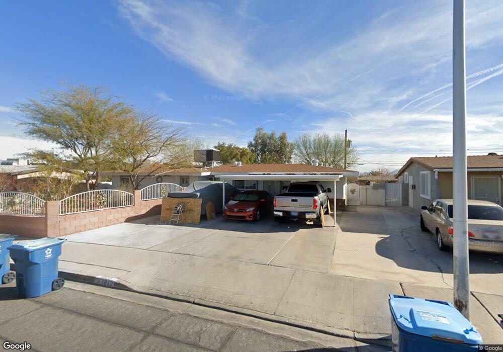
1012 Hazard Ave Unit 2 Las Vegas, NV 89108
Twin Lakes NeighborhoodEstimated Value: $310,064 - $357,000
3
Beds
2
Baths
1,456
Sq Ft
$232/Sq Ft
Est. Value
About This Home
This home is located at 1012 Hazard Ave Unit 2, Las Vegas, NV 89108 and is currently estimated at $337,766, approximately $231 per square foot. 1012 Hazard Ave Unit 2 is a home located in Clark County with nearby schools including Twin Lakes Elementary School, Robert O Gibson Middle School, and Western High School.
Ownership History
Date
Name
Owned For
Owner Type
Purchase Details
Closed on
Sep 22, 2003
Sold by
Vanbuskirk Andrew
Bought by
Heredia Juan C
Current Estimated Value
Home Financials for this Owner
Home Financials are based on the most recent Mortgage that was taken out on this home.
Original Mortgage
$91,600
Outstanding Balance
$42,960
Interest Rate
6.4%
Mortgage Type
Unknown
Estimated Equity
$294,806
Create a Home Valuation Report for This Property
The Home Valuation Report is an in-depth analysis detailing your home's value as well as a comparison with similar homes in the area
Home Values in the Area
Average Home Value in this Area
Purchase History
| Date | Buyer | Sale Price | Title Company |
|---|---|---|---|
| Heredia Juan C | $114,500 | Lawyers Title Of Nevada |
Source: Public Records
Mortgage History
| Date | Status | Borrower | Loan Amount |
|---|---|---|---|
| Open | Heredia Juan C | $91,600 | |
| Closed | Heredia Juan C | $22,900 |
Source: Public Records
Tax History Compared to Growth
Tax History
| Year | Tax Paid | Tax Assessment Tax Assessment Total Assessment is a certain percentage of the fair market value that is determined by local assessors to be the total taxable value of land and additions on the property. | Land | Improvement |
|---|---|---|---|---|
| 2025 | $621 | $47,077 | $28,000 | $19,077 |
| 2024 | $604 | $47,077 | $28,000 | $19,077 |
| 2023 | $604 | $46,626 | $29,400 | $17,226 |
| 2022 | $586 | $39,146 | $23,800 | $15,346 |
| 2021 | $569 | $35,302 | $21,000 | $14,302 |
| 2020 | $550 | $34,884 | $21,000 | $13,884 |
| 2019 | $534 | $29,869 | $16,450 | $13,419 |
| 2018 | $518 | $27,615 | $15,050 | $12,565 |
| 2017 | $844 | $25,750 | $13,300 | $12,450 |
| 2016 | $492 | $20,760 | $8,750 | $12,010 |
| 2015 | $490 | $17,599 | $5,950 | $11,649 |
| 2014 | $475 | $14,065 | $4,900 | $9,165 |
Source: Public Records
Map
Nearby Homes
- 1112 Hazard Ave
- 1101 Silver Lake Dr
- 812 Pyramid Dr
- 1317 Pyramid Dr
- 1325 Pyramid Dr
- 1313 Purple Sage Ave
- 1103 Arrowhead Ave
- 1204 Arrowhead Ave
- 1225 Arrowhead Ave
- 1300 Oak Tree Ln
- 3616 Roseglen Ct
- 3541 Arcadian Sea St
- 821 Mar Jay Ct
- 3871 Mountain Trail
- 1700 Ferrell St
- 2632 Chin Cactus Ct
- 3621 Arcadian Sea St
- 913 Jade Plant St
- 3541 Alpheus River Ave
- 2625 Chin Cactus Ct
- 1008 Hazard Ave
- 1014 Hazard Ave
- 1017 Baker Ave
- 1013 Baker Ave
- 1021 Baker Ave
- 1016 Indian Ln
- 1004 Hazard Ave
- 1100 Hazard Ave
- 1009 Baker Ave
- 1101 Baker Ave
- 1009 Hazard Ave
- 1105 Baker Ave
- 1005 Baker Ave
- 1012 Indian Ln Unit 2
- 1005 Hazard Ave
- 1104 Hazard Ave
- 1000 Hazard Ave
- 1109 Baker Ave
- 1004 Indian Ln
- 1001 Baker Ave