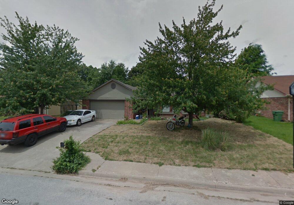
1012 N 29th St Rogers, AR 72756
Estimated Value: $275,000 - $284,198
3
Beds
2
Baths
1,666
Sq Ft
$167/Sq Ft
Est. Value
About This Home
This home is located at 1012 N 29th St, Rogers, AR 72756 and is currently estimated at $278,550, approximately $167 per square foot. 1012 N 29th St is a home located in Benton County with nearby schools including Joe Mathias Elementary School, Oakdale Middle School, and Rogers Heritage High School.
Ownership History
Date
Name
Owned For
Owner Type
Purchase Details
Closed on
Oct 4, 2000
Bought by
Porter
Current Estimated Value
Purchase Details
Closed on
Jun 12, 2000
Bought by
Dod 06-12-2000
Purchase Details
Closed on
Apr 14, 2000
Bought by
Prince Tr
Purchase Details
Closed on
Apr 12, 2000
Bought by
Prince Family Trust
Purchase Details
Closed on
Mar 28, 2000
Bought by
Prince
Purchase Details
Closed on
Dec 18, 1992
Bought by
Marquez
Purchase Details
Closed on
Jun 4, 1992
Bought by
Abbie Tr
Create a Home Valuation Report for This Property
The Home Valuation Report is an in-depth analysis detailing your home's value as well as a comparison with similar homes in the area
Home Values in the Area
Average Home Value in this Area
Purchase History
| Date | Buyer | Sale Price | Title Company |
|---|---|---|---|
| Porter | $82,000 | -- | |
| Dod 06-12-2000 | -- | -- | |
| Prince Tr | -- | -- | |
| Prince Family Trust | -- | -- | |
| Prince | $79,000 | -- | |
| Marquez | $67,000 | -- | |
| Abbie Tr | $12,000 | -- |
Source: Public Records
Tax History
| Year | Tax Paid | Tax Assessment Tax Assessment Total Assessment is a certain percentage of the fair market value that is determined by local assessors to be the total taxable value of land and additions on the property. | Land | Improvement |
|---|---|---|---|---|
| 2025 | $1,562 | $49,907 | $19,000 | $30,907 |
| 2024 | $1,454 | $49,907 | $19,000 | $30,907 |
| 2023 | $1,385 | $31,650 | $9,000 | $22,650 |
| 2022 | $1,002 | $31,650 | $9,000 | $22,650 |
| 2021 | $936 | $31,650 | $9,000 | $22,650 |
| 2020 | $875 | $23,200 | $2,400 | $20,800 |
| 2019 | $825 | $23,200 | $2,400 | $20,800 |
| 2018 | $800 | $23,200 | $2,400 | $20,800 |
| 2017 | $642 | $23,200 | $2,400 | $20,800 |
| 2016 | $642 | $23,200 | $2,400 | $20,800 |
| 2015 | $963 | $18,210 | $3,600 | $14,610 |
| 2014 | $613 | $18,210 | $3,600 | $14,610 |
Source: Public Records
Map
Nearby Homes
- 2706 W Easy St
- 3505 W Center St
- Lots 87-92 Mockingbird Ln
- 3603 W Hemlock St
- 2913 Richwood Cir
- 3506 W Olive St
- 3407 W Mockingbird Ln
- 2710 W Wood St
- 700 Woodland Dr
- 601 N Valley West Dr
- 2419 W Meadow Dr
- 1303 N Flamingo Rd
- 1105 Westridge Ln
- 600 N 37th St
- 3507 W Beechwood Dr
- 11 units total W Beechwood Dr
- 905 N Cardinal Dr
- 1204 N Cardinal Dr
- 2822 Highland Dr
- 2309 W Meadow Ln
- 1014 N 29th St
- 1010 N 29th St
- 1011 N 30th St
- 1018 N 29th St
- 1008 N 29th St
- 2810 W Sunset Dr
- 3000 W Bishop Dr
- 3001 W Margaret Place
- 1009 N 30th St
- 2811 W Sunset Dr
- 2811 W Margaret St
- 1020 N 29th St
- 1006 N 29th St
- 1201 N 30th St
- 3002 W Bishop Dr
- 1007 N 30th St
- 2809 W Sunset Dr
- 2809 W Margaret St
- 2810 W Bishop Dr
Your Personal Tour Guide
Ask me questions while you tour the home.