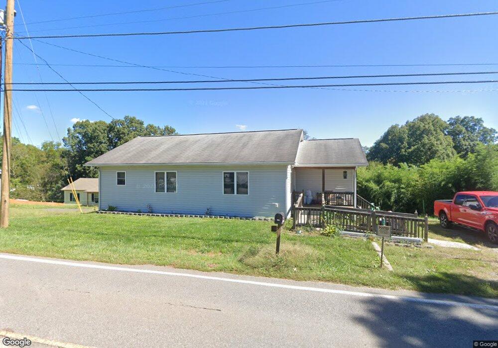
1012 N Canton Rd Canton, NC 28716
Estimated Value: $285,000 - $385,000
3
Beds
2
Baths
1,288
Sq Ft
$264/Sq Ft
Est. Value
About This Home
This home is located at 1012 N Canton Rd, Canton, NC 28716 and is currently estimated at $339,656, approximately $263 per square foot. 1012 N Canton Rd is a home located in Haywood County with nearby schools including North Canton Elementary School, Canton Middle, and Pisgah High School.
Ownership History
Date
Name
Owned For
Owner Type
Purchase Details
Closed on
Feb 13, 2015
Sold by
Wells Michael Anthony and Wells Dicie Green
Bought by
Wells Michael Anthony
Current Estimated Value
Home Financials for this Owner
Home Financials are based on the most recent Mortgage that was taken out on this home.
Original Mortgage
$112,000
Outstanding Balance
$85,942
Interest Rate
3.81%
Mortgage Type
New Conventional
Estimated Equity
$253,714
Purchase Details
Closed on
Jul 13, 2004
Bought by
Wells Dicie Green and Wells Michael Anthony
Create a Home Valuation Report for This Property
The Home Valuation Report is an in-depth analysis detailing your home's value as well as a comparison with similar homes in the area
Home Values in the Area
Average Home Value in this Area
Purchase History
| Date | Buyer | Sale Price | Title Company |
|---|---|---|---|
| Wells Michael Anthony | -- | None Available | |
| Wells Dicie Green | -- | -- |
Source: Public Records
Mortgage History
| Date | Status | Borrower | Loan Amount |
|---|---|---|---|
| Open | Wells Michael Anthony | $112,000 |
Source: Public Records
Tax History Compared to Growth
Tax History
| Year | Tax Paid | Tax Assessment Tax Assessment Total Assessment is a certain percentage of the fair market value that is determined by local assessors to be the total taxable value of land and additions on the property. | Land | Improvement |
|---|---|---|---|---|
| 2025 | -- | $163,600 | $22,000 | $141,600 |
| 2024 | $1,173 | $163,600 | $22,000 | $141,600 |
| 2023 | $1,173 | $163,600 | $22,000 | $141,600 |
| 2022 | $1,149 | $163,600 | $22,000 | $141,600 |
| 2021 | $1,149 | $163,600 | $22,000 | $141,600 |
| 2020 | $1,012 | $130,300 | $22,000 | $108,300 |
| 2019 | $1,017 | $130,300 | $22,000 | $108,300 |
| 2018 | $1,017 | $130,300 | $22,000 | $108,300 |
| 2017 | $1,017 | $130,300 | $0 | $0 |
| 2016 | $1,076 | $143,300 | $0 | $0 |
| 2015 | $1,061 | $143,300 | $0 | $0 |
| 2014 | $954 | $143,300 | $0 | $0 |
Source: Public Records
Map
Nearby Homes
- 1060 N Canton Rd
- 636 Silkwood Dr
- 607 Silkwood Dr
- 657 N Canton Rd
- 1414 Beaverdam St
- 74 Buckeye Cove Rd
- 58 Mcclellan Dr
- 284 Northridge Dr
- 1294 Beaverdam Rd
- 618 Beaverdam St
- 40 Warner Rd
- 30 Valley Hill Dr
- 229 Crabtree Mountain Rd
- 204 Mountain Spring Ln
- 28 Plemmons St
- 161 Ferguson St
- 72 Boydston St
- 70 1st St
- 821 N Main St
- 761 N Main St
- 1040 N Canton Rd
- 4 Lori Hill Dr
- 1003 N Canton Rd
- 26 Lori Hill Dr
- 980 N Canton Rd
- 955 N Canton Rd
- 930 N Canton Rd
- 1121 N Canton Rd
- 947 N Canton Rd
- 1136 N Canton Rd
- 1137 N Canton Rd
- 901 N Canton Rd
- 544 Paxton Dr
- 524 Paxton Dr
- 884 N Canton Rd
- 67 Walters Ln
- 557 Paxton Dr
- 580 Paxton Dr
- 40 Brady Cir
- 830 N Canton Rd