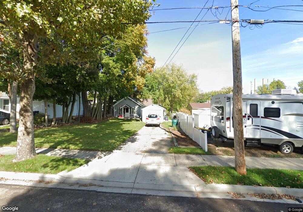
1012 Poxson Ave Lansing, MI 48910
Greencroft Park NeighborhoodEstimated Value: $59,000 - $97,000
--
Bed
1
Bath
400
Sq Ft
$185/Sq Ft
Est. Value
About This Home
This home is located at 1012 Poxson Ave, Lansing, MI 48910 and is currently estimated at $73,838, approximately $184 per square foot. 1012 Poxson Ave is a home located in Ingham County with nearby schools including Averill Elementary School, Attwood School, and J.W. Sexton High School.
Ownership History
Date
Name
Owned For
Owner Type
Purchase Details
Closed on
Oct 23, 2013
Sold by
Firstbank
Bought by
Perrien Dana A
Current Estimated Value
Purchase Details
Closed on
Jun 25, 2010
Sold by
Firstbank West Michigan
Bought by
Perrien Dana A
Purchase Details
Closed on
Oct 1, 2009
Sold by
Miller Cristian J and Miller Heather R
Bought by
Firstbank West Michigan
Purchase Details
Closed on
Nov 15, 2001
Sold by
Stobert Dorothy M
Bought by
Miller Christian
Purchase Details
Closed on
Jan 23, 2001
Sold by
Stobert Dorothy M and Stobert K H
Bought by
Stobert Dorothy M and Dorothy M Stobert Trust #1
Purchase Details
Closed on
Aug 11, 2000
Sold by
Stobert Dorothy M and Stobert K H
Bought by
Miller Christian
Create a Home Valuation Report for This Property
The Home Valuation Report is an in-depth analysis detailing your home's value as well as a comparison with similar homes in the area
Home Values in the Area
Average Home Value in this Area
Purchase History
| Date | Buyer | Sale Price | Title Company |
|---|---|---|---|
| Perrien Dana A | -- | None Available | |
| Perrien Dana A | -- | None Available | |
| Firstbank West Michigan | $11,039 | None Available | |
| Miller Christian | -- | -- | |
| Stobert Dorothy M | -- | -- | |
| Miller Christian | $15,000 | -- |
Source: Public Records
Tax History Compared to Growth
Tax History
| Year | Tax Paid | Tax Assessment Tax Assessment Total Assessment is a certain percentage of the fair market value that is determined by local assessors to be the total taxable value of land and additions on the property. | Land | Improvement |
|---|---|---|---|---|
| 2025 | $1,352 | $26,500 | $6,100 | $20,400 |
| 2024 | $10 | $21,900 | $6,100 | $15,800 |
| 2023 | $1,271 | $19,700 | $6,100 | $13,600 |
| 2022 | $1,151 | $19,700 | $7,700 | $12,000 |
| 2021 | $1,127 | $18,200 | $7,500 | $10,700 |
| 2020 | $1,120 | $17,300 | $7,500 | $9,800 |
| 2019 | $1,856 | $16,500 | $7,500 | $9,000 |
| 2018 | $1,027 | $16,600 | $7,500 | $9,100 |
| 2017 | $982 | $16,600 | $7,500 | $9,100 |
| 2016 | $1,665 | $16,400 | $7,500 | $8,900 |
| 2015 | $1,665 | $16,000 | $15,010 | $990 |
| 2014 | $1,665 | $15,700 | $15,010 | $690 |
Source: Public Records
Map
Nearby Homes
- 2112 Stirling Ave
- 2011 S Martin Luther King jr Blvd
- 2310 Stirling Ave
- 2001 S Martin Luther King Junior Blvd
- 907 Lenore Ave
- 1913 Stirling Ave
- 1032 Kelsey Ave
- 815 Woodbine Ave
- 2421 Stirling Ave
- 2313 S Rundle Ave
- 1120 Kelsey Ave
- 712 Lenore Ave
- 2118 Marion Ave
- 2515 S Martin Luther King Junior Blvd
- 1114 Goodrich St
- 1312 W Mount Hope Ave
- 1116 George St
- 1315 Goodrich St
- 1420 Poxson Ave
- 1404 Kelsey Ave
- 1016 Poxson Ave
- 1020 Poxson Ave
- 2114 Stirling Ave
- 1000 Poxson Ave
- 1015 Cooper Ave
- 2108 Stirling Ave
- 1017 Cooper Ave
- 1024 Poxson Ave
- 2104 Stirling Ave
- 1021 Cooper Ave
- 1001 Poxson Ave
- 1005 Poxson Ave
- 1017 Poxson Ave
- 1028 Poxson Ave
- 1027 Cooper Ave
- 1007 Cooper Ave
- 1021 Poxson Ave
- 2204 Stirling Ave
- 1025 Poxson Ave
- 1032 Poxson Ave