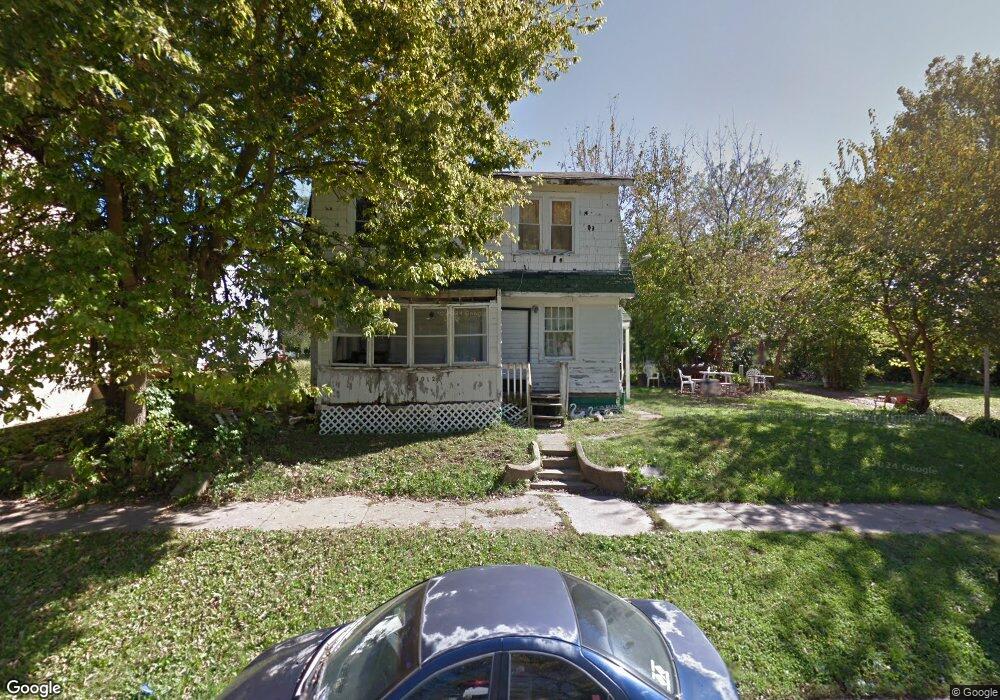
1012 S Maffit St Decatur, IL 62521
Mueller Park NeighborhoodEstimated Value: $48,500
3
Beds
1
Bath
1,248
Sq Ft
$39/Sq Ft
Est. Value
About This Home
This home is located at 1012 S Maffit St, Decatur, IL 62521 and is currently priced at $48,500, approximately $38 per square foot. 1012 S Maffit St is a home located in Macon County with nearby schools including South Shores Elementary School, Stephen Decatur Middle School, and Robertson Charter School.
Ownership History
Date
Name
Owned For
Owner Type
Purchase Details
Closed on
Sep 14, 2021
Sold by
Macon County
Bought by
City Of Decatur
Current Estimated Value
Purchase Details
Closed on
Dec 8, 2020
Sold by
Macon County Clerk
Bought by
Macon County
Purchase Details
Closed on
Oct 17, 2014
Sold by
Cohen Alvin A
Bought by
Allen Otis L
Purchase Details
Closed on
Jun 27, 2007
Sold by
Lloyd Jeff
Bought by
Cohen Alvin A
Home Financials for this Owner
Home Financials are based on the most recent Mortgage that was taken out on this home.
Original Mortgage
$8,000
Interest Rate
6.26%
Mortgage Type
Credit Line Revolving
Purchase Details
Closed on
Jan 1, 1994
Create a Home Valuation Report for This Property
The Home Valuation Report is an in-depth analysis detailing your home's value as well as a comparison with similar homes in the area
Home Values in the Area
Average Home Value in this Area
Purchase History
| Date | Buyer | Sale Price | Title Company |
|---|---|---|---|
| City Of Decatur | -- | None Available | |
| Macon County | -- | None Available | |
| Allen Otis L | -- | None Available | |
| Cohen Alvin A | $5,500 | None Available | |
| -- | $3,000 | -- |
Source: Public Records
Mortgage History
| Date | Status | Borrower | Loan Amount |
|---|---|---|---|
| Previous Owner | Cohen Alvin A | $8,000 |
Source: Public Records
Tax History Compared to Growth
Tax History
| Year | Tax Paid | Tax Assessment Tax Assessment Total Assessment is a certain percentage of the fair market value that is determined by local assessors to be the total taxable value of land and additions on the property. | Land | Improvement |
|---|---|---|---|---|
| 2024 | -- | $0 | $0 | $0 |
| 2023 | -- | $0 | $0 | $0 |
| 2022 | $0 | $0 | $0 | $0 |
| 2021 | $0 | $72 | $36 | $36 |
| 2020 | $0 | $0 | $0 | $0 |
| 2019 | $407 | $3,828 | $363 | $3,465 |
| 2018 | $337 | $3,203 | $180 | $3,023 |
| 2017 | $345 | $3,289 | $185 | $3,104 |
| 2016 | $351 | $3,323 | $187 | $3,136 |
| 2015 | $334 | $3,265 | $184 | $3,081 |
| 2014 | $312 | $3,232 | $182 | $3,050 |
| 2013 | $320 | $3,354 | $189 | $3,165 |
Source: Public Records
Map
Nearby Homes
- 1232 S Silas St
- 1283 S Illinois St
- 1347 S Maffit St
- 1104 E Moore St
- 1263 E Dickinson Ave
- 1408 E Buena Vista Ave
- 409 Southmoreland Place
- 318 S Martin Luther King Junior Dr
- 1232 E Johns Ave
- 632 S 17th St
- 22 Eastmoreland Ln
- 1605 E Clay St
- 1952 Florida Ct
- 1155 S 20th St
- 1127 S 21st St
- 1764 E Johns Ave
- 1645 E Wood St
- 1753 E Clay St
- 1136 S 21st St
- 580 Powers Ln
- 903 E Cleveland Ave
- 913 E Cleveland Ave
- 1046 S Maffit St
- 925 E Cleveland Ave
- 1015 S Maffit St
- 1005 S Maffit St
- 1025 S Maffit St
- 1052 S Maffit St
- 860 E Cleveland Ave
- 1060 S Maffit St
- 920 E Cleveland Ave
- 1087 S Maffit St
- 955 S Maffit St
- 955 S Maffit St Unit PACKAGE OF 6
- 961 E Cleveland Ave
- 845 E Cleveland Ave
- 1023 S Silas St
- 945 S Maffit St
- 1043 S Silas St
- 1019 S Silas St