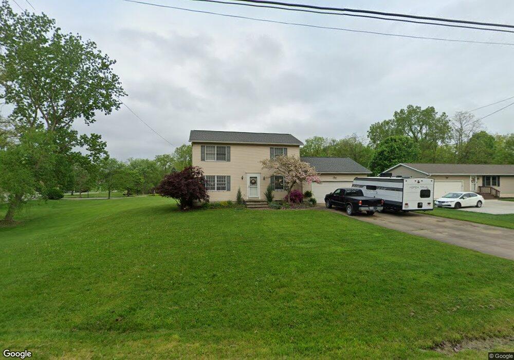
1012 S Munroe Rd Tallmadge, OH 44278
Estimated Value: $248,000 - $302,000
4
Beds
2
Baths
1,452
Sq Ft
$187/Sq Ft
Est. Value
About This Home
This home is located at 1012 S Munroe Rd, Tallmadge, OH 44278 and is currently estimated at $271,125, approximately $186 per square foot. 1012 S Munroe Rd is a home located in Summit County with nearby schools including Tallmadge Middle School, Tallmadge High School, and Cornerstone Community School.
Ownership History
Date
Name
Owned For
Owner Type
Purchase Details
Closed on
Sep 28, 1994
Sold by
Fiehn Beverly J
Bought by
Durkee Paul G
Current Estimated Value
Home Financials for this Owner
Home Financials are based on the most recent Mortgage that was taken out on this home.
Original Mortgage
$80,000
Interest Rate
8.6%
Mortgage Type
New Conventional
Create a Home Valuation Report for This Property
The Home Valuation Report is an in-depth analysis detailing your home's value as well as a comparison with similar homes in the area
Home Values in the Area
Average Home Value in this Area
Purchase History
| Date | Buyer | Sale Price | Title Company |
|---|---|---|---|
| Durkee Paul G | $100,000 | -- |
Source: Public Records
Mortgage History
| Date | Status | Borrower | Loan Amount |
|---|---|---|---|
| Closed | Durkee Paul G | $80,000 |
Source: Public Records
Tax History Compared to Growth
Tax History
| Year | Tax Paid | Tax Assessment Tax Assessment Total Assessment is a certain percentage of the fair market value that is determined by local assessors to be the total taxable value of land and additions on the property. | Land | Improvement |
|---|---|---|---|---|
| 2025 | $3,687 | $72,258 | $16,457 | $55,801 |
| 2024 | $3,687 | $72,258 | $16,457 | $55,801 |
| 2023 | $3,687 | $72,258 | $16,457 | $55,801 |
| 2022 | $3,732 | $59,812 | $13,601 | $46,211 |
| 2021 | $3,748 | $59,812 | $13,601 | $46,211 |
| 2020 | $3,719 | $59,810 | $13,600 | $46,210 |
| 2019 | $3,654 | $52,520 | $12,240 | $40,280 |
| 2018 | $3,229 | $52,520 | $12,240 | $40,280 |
| 2017 | $2,950 | $52,520 | $12,240 | $40,280 |
| 2016 | $3,176 | $47,450 | $12,240 | $35,210 |
| 2015 | $2,950 | $47,450 | $12,240 | $35,210 |
| 2014 | $2,931 | $47,450 | $12,240 | $35,210 |
| 2013 | $2,936 | $48,410 | $12,240 | $36,170 |
Source: Public Records
Map
Nearby Homes
- 1165 Broadview Rd
- 750 Danner Rd
- 1034 Southeast Ave
- 128 Byatt Rd
- 685 Beechview Dr
- 459 Alaho St
- 498 Eastwood Ave
- 280 Woodside Ln
- 549 S Munroe Rd
- 523 S Munroe Rd
- 187 Oakview Cir
- 689 Alaho St
- 505 Moody St
- 2354 Savoy Ave
- 915 Treat Blvd
- 2360 Newton St
- 2356 Newton St
- 2352 Newton St
- 2330 Eastwood Ave
- V/L Southeast Ave
- 679 Newton St
- 1002 S Munroe Rd
- 665 Newton St
- 988 S Munroe Rd
- 1007 S Munroe Rd
- 995 S Munroe Rd
- 972 S Munroe Rd
- 975 S Munroe Rd
- 652 Newton St
- 985 S Munroe Rd
- 719 Newton St
- 692 Newton St
- 646 Newton St
- 708 Newton St
- 963 S Munroe Rd
- 725 Newton St
- 718 Newton St
- 1062 S Munroe Rd
- 634 Newton St
- 726 Newton St