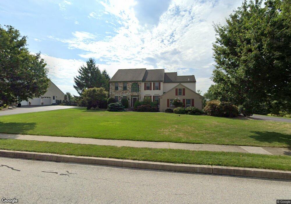
1012 Skyline Cir Norristown, PA 19403
Estimated Value: $695,000 - $889,000
4
Beds
3
Baths
3,031
Sq Ft
$265/Sq Ft
Est. Value
About This Home
This home is located at 1012 Skyline Cir, Norristown, PA 19403 and is currently estimated at $803,546, approximately $265 per square foot. 1012 Skyline Cir is a home located in Montgomery County with nearby schools including Skyview Upper Elementary School, Arrowhead Elementary School, and Arcola Intermediate School.
Ownership History
Date
Name
Owned For
Owner Type
Purchase Details
Closed on
Sep 1, 2006
Sold by
Vargas Teresa A and Vargas Hugo M
Bought by
Reilly John F and Reilly Connie R
Current Estimated Value
Home Financials for this Owner
Home Financials are based on the most recent Mortgage that was taken out on this home.
Original Mortgage
$175,000
Interest Rate
6.24%
Purchase Details
Closed on
Nov 25, 2001
Sold by
Banmiller Gale L
Bought by
Vargas Hugo M and Vargas Teresa A
Create a Home Valuation Report for This Property
The Home Valuation Report is an in-depth analysis detailing your home's value as well as a comparison with similar homes in the area
Home Values in the Area
Average Home Value in this Area
Purchase History
| Date | Buyer | Sale Price | Title Company |
|---|---|---|---|
| Reilly John F | $513,000 | None Available | |
| Vargas Hugo M | $425,000 | -- |
Source: Public Records
Mortgage History
| Date | Status | Borrower | Loan Amount |
|---|---|---|---|
| Previous Owner | Reilly John F | $175,000 |
Source: Public Records
Tax History Compared to Growth
Tax History
| Year | Tax Paid | Tax Assessment Tax Assessment Total Assessment is a certain percentage of the fair market value that is determined by local assessors to be the total taxable value of land and additions on the property. | Land | Improvement |
|---|---|---|---|---|
| 2025 | $10,657 | $261,290 | -- | -- |
| 2024 | $10,657 | $261,290 | -- | -- |
| 2023 | $10,252 | $261,290 | $0 | $0 |
| 2022 | $9,972 | $261,290 | $0 | $0 |
| 2021 | $9,716 | $261,290 | $0 | $0 |
| 2020 | $9,489 | $261,290 | $0 | $0 |
| 2019 | $10,529 | $292,640 | $106,130 | $186,510 |
| 2018 | $10,529 | $292,640 | $106,130 | $186,510 |
| 2017 | $10,054 | $292,640 | $106,130 | $186,510 |
| 2016 | $9,939 | $292,640 | $106,130 | $186,510 |
| 2015 | $9,553 | $292,640 | $106,130 | $186,510 |
| 2014 | $9,553 | $292,640 | $106,130 | $186,510 |
Source: Public Records
Map
Nearby Homes
- 1102 Redtail Rd
- 617 Meadowlark Rd
- 3026 Highley Rd
- 35 Buckwalter Rd
- 2825 Egypt Rd
- LOT 24 Egypt Rd
- Laney Craftsman
- 18 Pheasant Rd
- 12 Hunt Club Dr
- 250 Black Rock Rd
- 2016 Bayless Place Unit CONDO Q-4
- 636 Hillside Ave
- 123 Glenwood Ave
- 106 Glenwood Ave
- 38 S Grange Ave
- 23 Ironwood Dr
- 308 Hillside Ave
- 3 Ironwood Dr
- 11 Wilson Blvd
- 12 Wilson Blvd
- 1014 Skyline Cir
- 1010 Skyline Cir
- 1007 Skyline Cir
- 1016 Skyline Cir
- 1008 Skyline Cir
- 2908 Eagleville Rd
- 1028 Skyline Cir
- 1026 Skyline Cir
- 1030 Skyline Cir
- 1024 Skyline Cir
- 17 Featherbed Ln
- 1006 Skyline Cir
- 1032 Skyline Cir
- 2914 Eagleville Rd
- 1305 Cooper Cir
- 1020 Skyline Cir
- 1512 Pintail Dr
- 1022 Skyline Cir
- 1034 Skyline Cir
- 1304 Cooper Cir