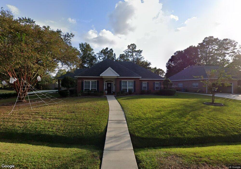
1012 Smoketree Dr Covington, LA 70433
Estimated Value: $458,000 - $518,000
Studio
--
Bath
3,006
Sq Ft
$161/Sq Ft
Est. Value
About This Home
This home is located at 1012 Smoketree Dr, Covington, LA 70433 and is currently estimated at $482,708, approximately $160 per square foot. 1012 Smoketree Dr is a home located in St. Tammany Parish with nearby schools including Pontchartrain Elementary School, Tchefuncte Middle School, and Mandeville Junior High School.
Ownership History
Date
Name
Owned For
Owner Type
Purchase Details
Closed on
Sep 19, 2017
Sold by
Garcia Mary Todd Willingham
Bought by
Meith Jaclyn Elizabeth and Meith Justin D
Current Estimated Value
Home Financials for this Owner
Home Financials are based on the most recent Mortgage that was taken out on this home.
Original Mortgage
$233,600
Outstanding Balance
$192,975
Interest Rate
3.86%
Mortgage Type
New Conventional
Estimated Equity
$289,733
Create a Home Valuation Report for This Property
The Home Valuation Report is an in-depth analysis detailing your home's value as well as a comparison with similar homes in the area
Home Values in the Area
Average Home Value in this Area
Purchase History
| Date | Buyer | Sale Price | Title Company |
|---|---|---|---|
| Meith Jaclyn Elizabeth | $292,000 | Allegiance Title |
Source: Public Records
Mortgage History
| Date | Status | Borrower | Loan Amount |
|---|---|---|---|
| Open | Meith Jaclyn Elizabeth | $233,600 |
Source: Public Records
Tax History
| Year | Tax Paid | Tax Assessment Tax Assessment Total Assessment is a certain percentage of the fair market value that is determined by local assessors to be the total taxable value of land and additions on the property. | Land | Improvement |
|---|---|---|---|---|
| 2025 | $3,437 | $36,155 | $5,800 | $30,355 |
| 2024 | $3,437 | $36,155 | $5,800 | $30,355 |
| 2023 | $3,564 | $28,471 | $5,800 | $22,671 |
| 2022 | $277,971 | $28,471 | $5,800 | $22,671 |
| 2021 | $2,774 | $28,471 | $5,800 | $22,671 |
| 2020 | $2,772 | $28,471 | $5,800 | $22,671 |
| 2019 | $3,626 | $26,446 | $5,100 | $21,346 |
| 2018 | $3,631 | $26,446 | $5,100 | $21,346 |
| 2017 | $3,665 | $26,446 | $5,100 | $21,346 |
| 2016 | $3,693 | $26,446 | $5,100 | $21,346 |
| 2015 | $2,411 | $24,306 | $5,100 | $19,206 |
| 2014 | $2,386 | $24,306 | $5,100 | $19,206 |
| 2013 | -- | $24,306 | $5,100 | $19,206 |
Source: Public Records
Map
Nearby Homes
- 511 River Oaks Dr
- 423 River Oaks Dr
- 800 Tradition Dr
- 0 Woodberry Dr Unit 2540496
- 454 Rutherford Dr
- 125 Bent Tree Ct
- 1516 Aristocrat Ct
- 633 Avenue de Bellevue
- LOT 6 Rhonda Ct
- 0 U S 190 Service Rd
- 0 U S 190 Service Rd Unit 2434896
- 0 U S 190 Service Rd Unit 2542160
- 305 Avenue Palais Royal
- 305 Avenue Palais Royal None
- Lot 17 Holiday Square Blvd
- 0 Ponchitolawa Dr
- 1008 Smoketree Dr
- 506 River Oaks Dr
- 510 River Oaks Dr
- 510 River Oaks Dr
- 92 Smoketree Dr
- 94 Smoketree Dr
- 0 Smoketree Dr
- 1004 Smoketree Dr
- 1011 Smoketree Dr
- 1017 Smoketree Dr
- 1016 Smoketree Dr
- 1015 Smoketree Dr
- 514 River Oaks Dr
- Lot 94 Smoketree Dr
- 1102 Abelia Ct
- 600 River Oaks Dr
- 604 River Oaks Dr
- 901 Walking Stick Ct
- 1106 Abelia Ct
Your Personal Tour Guide
Ask me questions while you tour the home.