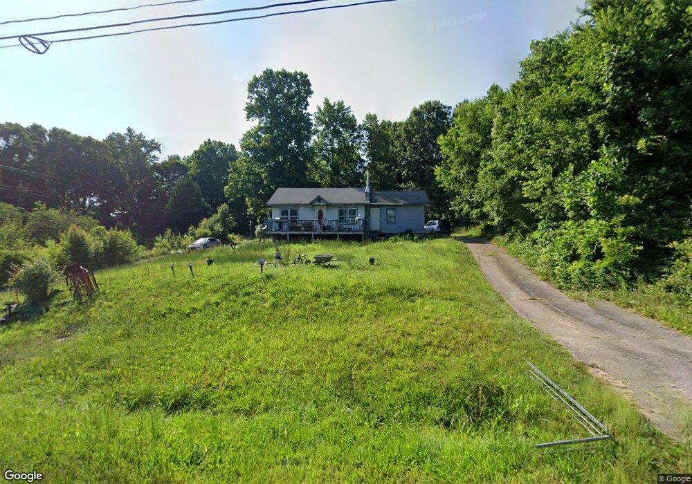
1012 Us 70 W Morganton, NC 28655
Estimated Value: $99,000 - $190,000
2
Beds
2
Baths
1,108
Sq Ft
$136/Sq Ft
Est. Value
About This Home
This home is located at 1012 Us 70 W, Morganton, NC 28655 and is currently estimated at $150,632, approximately $135 per square foot. 1012 Us 70 W is a home with nearby schools including Glen Alpine Elementary School, Table Rock Middle School, and Freedom High School.
Ownership History
Date
Name
Owned For
Owner Type
Purchase Details
Closed on
Mar 31, 2025
Sold by
Wishon Robin Jane and Clemmons Samantha Delilah
Bought by
Clevinger Brian Wayne
Current Estimated Value
Purchase Details
Closed on
Apr 28, 2017
Sold by
Vaughn Grantee Allen Dean
Bought by
Bollinger Mary Harrison
Purchase Details
Closed on
Feb 24, 2012
Sold by
Woodard David W and Woodard Shelly A
Bought by
Cooper Frank and Black Aaron D
Create a Home Valuation Report for This Property
The Home Valuation Report is an in-depth analysis detailing your home's value as well as a comparison with similar homes in the area
Home Values in the Area
Average Home Value in this Area
Purchase History
| Date | Buyer | Sale Price | Title Company |
|---|---|---|---|
| Clevinger Brian Wayne | -- | None Listed On Document | |
| Bollinger Mary Harrison | -- | Attorney | |
| Cooper Frank | $22,500 | None Available |
Source: Public Records
Tax History
| Year | Tax Paid | Tax Assessment Tax Assessment Total Assessment is a certain percentage of the fair market value that is determined by local assessors to be the total taxable value of land and additions on the property. | Land | Improvement |
|---|---|---|---|---|
| 2025 | $404 | $62,118 | $13,171 | $48,947 |
| 2024 | $407 | $62,118 | $13,171 | $48,947 |
| 2023 | $407 | $62,118 | $13,171 | $48,947 |
| 2022 | $143 | $17,706 | $9,060 | $8,646 |
| 2021 | $143 | $17,706 | $9,060 | $8,646 |
| 2020 | $143 | $17,706 | $9,060 | $8,646 |
| 2019 | $143 | $17,706 | $9,060 | $8,646 |
| 2018 | $133 | $16,767 | $9,060 | $7,707 |
| 2017 | $133 | $16,767 | $9,060 | $7,707 |
| 2016 | $131 | $16,767 | $9,060 | $7,707 |
| 2015 | $131 | $16,767 | $9,060 | $7,707 |
| 2014 | $131 | $16,828 | $9,121 | $7,707 |
| 2013 | $131 | $16,828 | $9,121 | $7,707 |
Source: Public Records
Map
Nearby Homes
- 3133 Ed Bowman St
- 620 Linville St
- 4271 Alpine Trail
- 102 Cuthberson St
- 3843 Silver Creek Terrace
- 312 Causby Rd
- 3996 Palmer Cir
- 4655 Mcalpine Ave
- 2533 Lail Rd
- 0 Plantation Dr
- 109 Turkey Tail Ln Unit 8 & 10
- 3674 Lr Walker Rd
- 00 Snowhill Church Rd
- 3991 Silver Creek Terrace
- 113 N Park Dr Unit 11 & 12
- 0 N Park Dr Unit 7 CAR4185864
- 0 N Park Dr Unit 6
- 1113 Greene Ct Unit 36
- 1077 Greene Ct Unit 34
- 1119 Greene Ct Unit 37
- 4195 Chambers Chapel Cir
- 991 Us 70 W
- 974 U S 70
- 4221 Chambers Chapel Cir Unit 4225
- 975 Us 70 W
- 1042 Us 70 W
- 4210 Chambers Chapel Cir
- 4180 Chambers Chapel Cir
- 1045 Us 70 W
- 3295 Junior Fox Rd
- 4198 Chambers Chapel Cir
- 4225 Chambers Chapel Cir
- 4226 Chambers Chapel Cir
- 955 Us 70 W
- 944 U S 70
- 4247 Chambers Chapel Cir
- 4140 Perry Powell Rd
- 4058 Chambers Chapel Cir
- 4186 Chambers Chapel Cir
- 939 Us 70 W