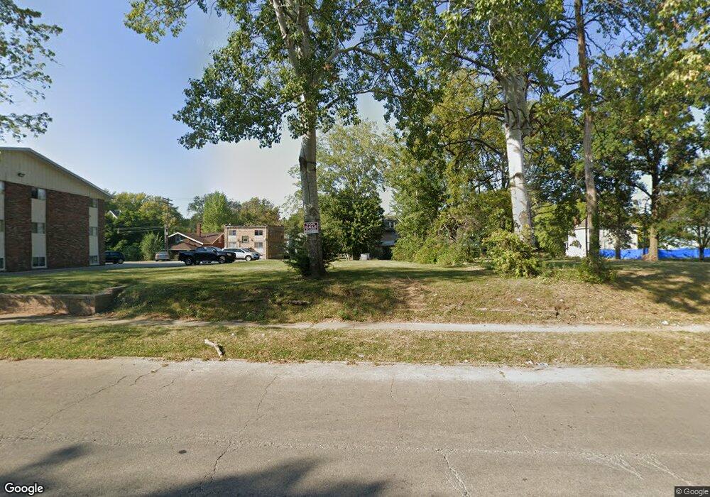
1012 W Wood St Decatur, IL 62522
Near West NeighborhoodEstimated Value: $12,438 - $303,000
--
Bed
2
Baths
985
Sq Ft
$114/Sq Ft
Est. Value
About This Home
This home is located at 1012 W Wood St, Decatur, IL 62522 and is currently estimated at $111,860, approximately $113 per square foot. 1012 W Wood St is a home located in Macon County with nearby schools including Dennis Lab School, St. Patrick School, and Teen Challenge-Home For Girls.
Ownership History
Date
Name
Owned For
Owner Type
Purchase Details
Closed on
May 7, 2020
Sold by
Muniz Nathan A
Bought by
Ohana Land Llc
Current Estimated Value
Purchase Details
Closed on
Feb 1, 2015
Purchase Details
Closed on
Apr 16, 2013
Sold by
Detrinidad Moises R and Rivera Maximo H
Bought by
Federal National Mortgage Association
Purchase Details
Closed on
Mar 15, 2007
Sold by
River Maximo H
Bought by
River Maximo H and Detridad Moises
Purchase Details
Closed on
Feb 28, 2007
Sold by
Tirado Robert
Bought by
Rivera Maximo H
Purchase Details
Closed on
Nov 6, 2006
Sold by
Marine Bank
Bought by
Tirado Robert
Create a Home Valuation Report for This Property
The Home Valuation Report is an in-depth analysis detailing your home's value as well as a comparison with similar homes in the area
Home Values in the Area
Average Home Value in this Area
Purchase History
| Date | Buyer | Sale Price | Title Company |
|---|---|---|---|
| Ohana Land Llc | -- | None Available | |
| -- | $300 | -- | |
| Federal National Mortgage Association | -- | None Available | |
| River Maximo H | -- | None Available | |
| Rivera Maximo H | $10,000 | None Available | |
| Tirado Robert | $15,000 | Central Illinois Title Co |
Source: Public Records
Tax History Compared to Growth
Tax History
| Year | Tax Paid | Tax Assessment Tax Assessment Total Assessment is a certain percentage of the fair market value that is determined by local assessors to be the total taxable value of land and additions on the property. | Land | Improvement |
|---|---|---|---|---|
| 2024 | $189 | $1,952 | $1,952 | $0 |
| 2023 | $187 | $1,883 | $1,883 | $0 |
| 2022 | $178 | $1,742 | $1,742 | $0 |
| 2021 | $167 | $1,627 | $1,627 | $0 |
| 2020 | $165 | $1,551 | $1,551 | $0 |
| 2019 | $165 | $1,551 | $1,551 | $0 |
| 2018 | $163 | $1,556 | $1,556 | $0 |
| 2017 | $167 | $1,598 | $1,598 | $0 |
| 2016 | $171 | $1,614 | $1,614 | $0 |
| 2015 | $162 | $1,585 | $1,585 | $0 |
| 2014 | $724 | $7,501 | $1,569 | $5,932 |
| 2013 | $743 | $7,783 | $1,628 | $6,155 |
Source: Public Records
Map
Nearby Homes
- 1005 W Main St
- 899 W Main St
- 958 W William St
- 657 W Wood St
- 717 W Prairie Ave Unit 2
- 441 S Seigel St
- 612 W Macon St
- 254 N Pine St
- 617 W Decatur St
- 628 W Forest Ave
- 609 W William St
- 650 S Crea St
- 450 W Macon St
- 437 Powers Ln
- 440 W Macon St
- 636 S Sycamore St
- 452 W Prairie Ave
- 442 W Prairie Ave
- 1391 W Decatur St
- 233 N Edward St
- 1004 W Wood St
- 207 S Haworth Ave
- 1013 W Wood St
- 1015 W Main St
- 976 W Wood St
- 1009 W Main St
- 1009 W Main St Unit 1009 W.Main
- 1040 W Wood St
- 1027 W Main St
- 1005* W Main St
- 968 W Wood St
- 134 S Haworth Ave
- 1037 W Wood St
- 237 S Haworth Ave
- 969 W Wood St
- 222 S Haworth Ave Unit 9
- 222 S Haworth Ave Unit 6
- 1043 W Wood St
- 985 W Main St
- 960 W Wood St
