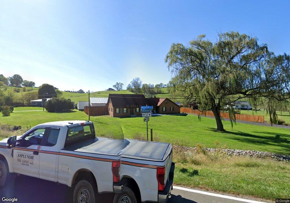
1012 Whitetop Rd Chilhowie, VA 24319
Estimated Value: $311,000 - $319,000
3
Beds
3
Baths
2,376
Sq Ft
$133/Sq Ft
Est. Value
About This Home
This home is located at 1012 Whitetop Rd, Chilhowie, VA 24319 and is currently estimated at $315,605, approximately $132 per square foot. 1012 Whitetop Rd is a home located in Smyth County with nearby schools including Chilhowie Elementary School, Chilhowie Middle School, and Chilhowie High School.
Ownership History
Date
Name
Owned For
Owner Type
Purchase Details
Closed on
Sep 15, 2010
Sold by
Hsbc Bank Usa N A
Bought by
Williams Heather B and Williams Curtis L
Current Estimated Value
Home Financials for this Owner
Home Financials are based on the most recent Mortgage that was taken out on this home.
Original Mortgage
$107,825
Outstanding Balance
$71,200
Interest Rate
4.44%
Mortgage Type
New Conventional
Estimated Equity
$244,405
Purchase Details
Closed on
May 12, 2010
Sold by
Debord Harold S and Debord Sharon E
Bought by
Hsbc Bank Usa Na
Create a Home Valuation Report for This Property
The Home Valuation Report is an in-depth analysis detailing your home's value as well as a comparison with similar homes in the area
Home Values in the Area
Average Home Value in this Area
Purchase History
| Date | Buyer | Sale Price | Title Company |
|---|---|---|---|
| Williams Heather B | $113,500 | -- | |
| Hsbc Bank Usa Na | $181,536 | -- |
Source: Public Records
Mortgage History
| Date | Status | Borrower | Loan Amount |
|---|---|---|---|
| Open | Williams Heather B | $107,825 |
Source: Public Records
Tax History Compared to Growth
Tax History
| Year | Tax Paid | Tax Assessment Tax Assessment Total Assessment is a certain percentage of the fair market value that is determined by local assessors to be the total taxable value of land and additions on the property. | Land | Improvement |
|---|---|---|---|---|
| 2025 | $1,768 | $299,700 | $18,000 | $281,700 |
| 2024 | $1,768 | $299,700 | $18,000 | $281,700 |
| 2023 | $1,310 | $177,000 | $15,000 | $162,000 |
| 2022 | $1,310 | $177,000 | $15,000 | $162,000 |
| 2021 | $1,310 | $177,000 | $15,000 | $162,000 |
| 2020 | $1,310 | $177,000 | $15,000 | $162,000 |
| 2019 | $1,265 | $171,000 | $15,000 | $156,000 |
| 2018 | $1,265 | $171,000 | $15,000 | $156,000 |
| 2017 | $1,265 | $171,000 | $15,000 | $156,000 |
| 2016 | $1,265 | $171,000 | $15,000 | $156,000 |
| 2015 | $1,265 | $0 | $0 | $0 |
| 2014 | $1,288 | $0 | $0 | $0 |
Source: Public Records
Map
Nearby Homes
- 218 Green Acres Dr
- 23 Christin Ln
- 21 Christin Ln
- 25 Christin Ln
- 11 Elem St
- TBD Lot#19 Christin Ln
- TBD Lot#15 Chestnutwood Dr
- TBD Lot#42 Brooke St
- TBD Lot#8 Elem Dr
- TBD Lo #24 Christin Ln
- TBD Lot#12 Chestnutwood Dr
- TBD Lot#46 Chestnutwood Dr
- TBD Lot#37 Brooke St
- TBD Lot#13 Chestnutwood Dr
- TBD Lot#4 Elem Dr
- TBD Lot#3 Elem Dr
- TBD Lot#45 Chestnutwood Dr
- TBD Lot#17 Bryant Dr
- TBD Lot#10 Elem Dr
- TBD Lot#40 Brooke St
- 1118 Whitetop Rd
- 1008 Whitetop Rd
- 1103 Whitetop Rd
- 1122 Whitetop Rd
- 1115 Whitetop Rd
- 1121 Whitetop Rd
- 296 Packing House Rd
- 963 Whitetop Rd
- 1167 Whitetop Rd
- 1467 High Meadows Ln
- 1180 Whitetop Rd
- 1257 Whitetop Rd
- 1484 High Meadows Ln
- 275 Packing House Rd
- 1193 Whitetop Rd
- 1210 Whitetop Rd
- TBD High Meadows Ln
- 000 High Meadows Ln
- 200 Shuler Hollow Rd
- 100 Colefarm Ln