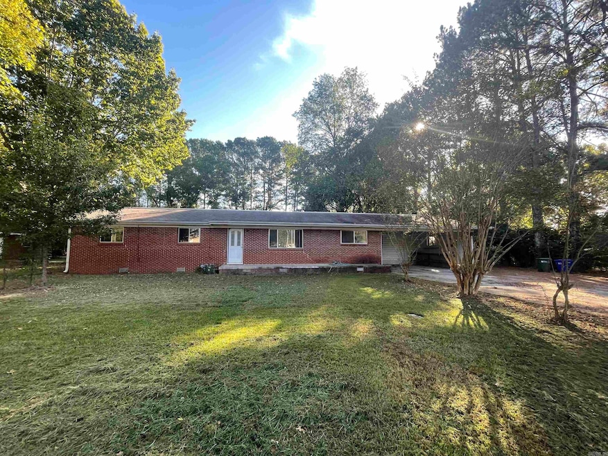
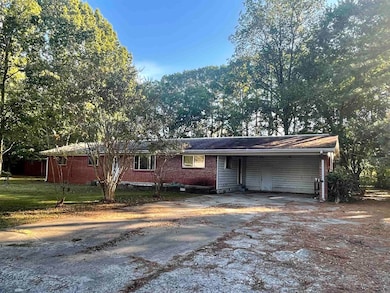
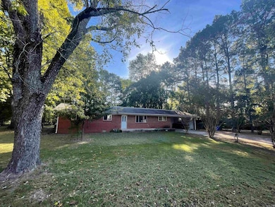
1012 Woodside Dr Conway, AR 72032
Estimated payment $1,172/month
Highlights
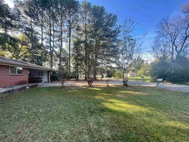
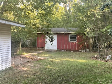
- 1.64 Acre Lot
- Wooded Lot
- Wood Flooring
- Conway Junior High School Rated A-
- Ranch Style House
- Bonus Room
About This Home
Incredible Opportunity. Investor liquidating properties. This one is special. Proximity to several new commercial projects going up on the East side. Just east of Harps. 1.64 Acres and a 1700 sq/ft home. Cosmetic updates needed to get back to rent ready. Walk through video posted on youtube. Buyer Agents Welcome!
Home Details
Home Type
- Single Family
Est. Annual Taxes
- $1,393
Year Built
- Built in 1966
Lot Details
- 1.64 Acre Lot
- Partially Fenced Property
- Level Lot
- Wooded Lot
Home Design
- Ranch Style House
- Traditional Architecture
- Brick Exterior Construction
- Combination Foundation
- Architectural Shingle Roof
- Ridge Vents on the Roof
- Metal Siding
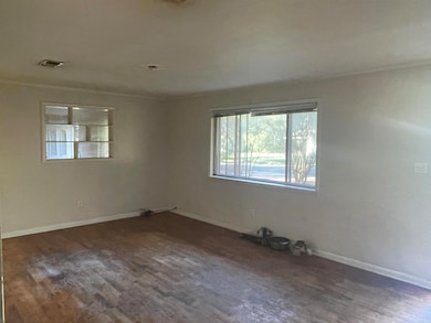
Interior Spaces
- 1,720 Sq Ft Home
- Ceiling Fan
- Insulated Windows
- Insulated Doors
- Family Room
- Formal Dining Room
- Bonus Room
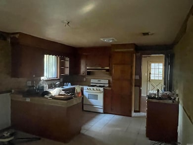
Kitchen
- Breakfast Bar
- Gas Range
Flooring
- Wood
- Tile
Bedrooms and Bathrooms
- 3 Bedrooms
Parking
- 2 Car Garage
- Carport
Outdoor Features
- Patio
- Outdoor Storage
- Porch
Schools
- Conway Elementary And Middle School
- Conway High School
Utilities
- Central Heating and Cooling System
- Underground Utilities
- Co-Op Electric
Map
Home Values in the Area
Average Home Value in this Area
Tax History
| Year | Tax Paid | Tax Assessment Tax Assessment Total Assessment is a certain percentage of the fair market value that is determined by local assessors to be the total taxable value of land and additions on the property. | Land | Improvement |
|---|---|---|---|---|
| 2025 | $1,459 | $40,700 | $6,280 | $34,420 |
| 2024 | $1,393 | $40,700 | $6,280 | $34,420 |
| 2023 | $1,326 | $26,210 | $6,280 | $19,930 |
| 2022 | $930 | $26,210 | $6,280 | $19,930 |
| 2021 | $871 | $26,210 | $6,280 | $19,930 |
| 2020 | $812 | $23,450 | $6,280 | $17,170 |
| 2019 | $812 | $23,450 | $6,280 | $17,170 |
| 2018 | $837 | $23,450 | $6,280 | $17,170 |
| 2017 | $837 | $23,450 | $6,280 | $17,170 |
| 2016 | $837 | $23,450 | $6,280 | $17,170 |
| 2015 | $1,187 | $23,450 | $6,280 | $17,170 |
| 2014 | $837 | $23,450 | $6,280 | $17,170 |
Property History
| Date | Event | Price | List to Sale | Price per Sq Ft |
|---|---|---|---|---|
| 10/23/2025 10/23/25 | For Sale | $200,000 | -- | $116 / Sq Ft |
Purchase History
| Date | Type | Sale Price | Title Company |
|---|---|---|---|
| Special Warranty Deed | $91,000 | -- | |
| Warranty Deed | $91,000 | Associates Closing & Title | |
| Deed | $112,000 | -- | |
| Trustee Deed | $111,983 | None Available | |
| Deed | -- | -- |
Source: Cooperative Arkansas REALTORS® MLS
MLS Number: 25042548
APN: 710-07741-000
Disclaimer: Certain information contained herein is derived from information provided by parties other than Homes.com. All information provided is deemed reliable, but is not guaranteed to be accurate and should be independently verified.
![]() IDX information is provided exclusively for personal, non-commercial use, and may not be used for any purpose other than to identify prospective properties consumers may be interested in purchasing.
IDX information is provided exclusively for personal, non-commercial use, and may not be used for any purpose other than to identify prospective properties consumers may be interested in purchasing.
- 2505 Florence Mattison Dr
- 18 Hazelwood Rd
- 30 Hazelwood Rd
- 1810 Angeline Dr
- 2365 E Oak St
- 1440 Ola St
- 60 Sandpiper Ct
- 520 Evening Dr
- 2130 Shade Tree Dr
- 2485 E Oak St
- TBD Grandview Heights
- 62 Addi Ln
- 00 Wright Estate Dr
- 82 Addi Ln
- 2415 E Oak St
- 24 Lots Hays Add
- 425 Cheyenne Ln
- 355 Navajo Trail
- 440 Bernard Dr
- 00 Victory Ln
- 1295 E German Ln
- 1425 Ola St
- 2010 Rich Smith Ln
- 525 3rd Ave
- 1320 Lewis Rd
- 100 Bill Hegemen Blvd
- 375 Monroe St
- 401 2nd St
- 300 Bruce St
- 320-330 Griffith St
- 867 Fendley Dr
- 1161 Spencer St
- 1039 Faulkner St
- 199-B S Center St
- 1200 Covington Way
- 1930 College Ave
- 955 S German Ln
- 2004 Hairston Ave
- 2017 Hairston Ave
- 105 Mitchell St
