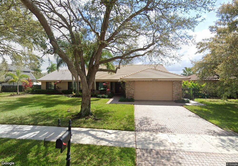
10120 SW 18th St Davie, FL 33324
Outer Davie NeighborhoodEstimated Value: $930,000 - $1,038,000
--
Bed
--
Bath
2,861
Sq Ft
$345/Sq Ft
Est. Value
About This Home
This home is located at 10120 SW 18th St, Davie, FL 33324 and is currently estimated at $987,614, approximately $345 per square foot. 10120 SW 18th St is a home located in Broward County with nearby schools including Fox Trail Elementary School, Indian Ridge Middle School, and Western High School.
Ownership History
Date
Name
Owned For
Owner Type
Purchase Details
Closed on
Jul 22, 1999
Sold by
Musto Michael M and Musto Robyn L
Bought by
Kissell David E and Kissell Kathleen
Current Estimated Value
Home Financials for this Owner
Home Financials are based on the most recent Mortgage that was taken out on this home.
Original Mortgage
$240,000
Outstanding Balance
$66,961
Interest Rate
7.51%
Mortgage Type
New Conventional
Estimated Equity
$920,653
Purchase Details
Closed on
Mar 2, 1994
Sold by
Pasadena Est Inc
Bought by
Musto Michael M and Musto Robyn L
Home Financials for this Owner
Home Financials are based on the most recent Mortgage that was taken out on this home.
Original Mortgage
$194,000
Interest Rate
6.97%
Create a Home Valuation Report for This Property
The Home Valuation Report is an in-depth analysis detailing your home's value as well as a comparison with similar homes in the area
Home Values in the Area
Average Home Value in this Area
Purchase History
| Date | Buyer | Sale Price | Title Company |
|---|---|---|---|
| Kissell David E | $270,000 | -- | |
| Musto Michael M | $215,800 | -- |
Source: Public Records
Mortgage History
| Date | Status | Borrower | Loan Amount |
|---|---|---|---|
| Open | Kissell David E | $240,000 | |
| Previous Owner | Musto Michael M | $194,000 |
Source: Public Records
Tax History Compared to Growth
Tax History
| Year | Tax Paid | Tax Assessment Tax Assessment Total Assessment is a certain percentage of the fair market value that is determined by local assessors to be the total taxable value of land and additions on the property. | Land | Improvement |
|---|---|---|---|---|
| 2025 | $7,367 | $384,870 | -- | -- |
| 2024 | $7,221 | $374,030 | -- | -- |
| 2023 | $7,221 | $363,140 | $0 | $0 |
| 2022 | $6,772 | $352,570 | $0 | $0 |
| 2021 | $6,557 | $342,310 | $0 | $0 |
| 2020 | $6,506 | $337,590 | $0 | $0 |
| 2019 | $6,301 | $330,000 | $0 | $0 |
| 2018 | $6,113 | $323,850 | $0 | $0 |
| 2017 | $6,000 | $317,190 | $0 | $0 |
| 2016 | $5,955 | $310,670 | $0 | $0 |
| 2015 | $6,091 | $308,520 | $0 | $0 |
| 2014 | $6,156 | $306,080 | $0 | $0 |
| 2013 | -- | $424,160 | $150,350 | $273,810 |
Source: Public Records
Map
Nearby Homes
- 1541 SW 102nd Terrace
- 9440 Live Oak Place Unit 307
- 9450 Live Oak Place Unit 109
- 9410 Live Oak Place Unit 103
- 9410 Live Oak Place Unit 109
- 9460 Live Oak Place Unit 309
- 9431 Live Oak Place Unit 203
- 9400 Live Oak Place Unit 305
- 10345 SW 23rd Ct
- 1510 SW 96th Terrace
- 1911 Sabal Palm Dr Unit 307
- 1811 Sabal Palm Dr Unit 208
- 9531 Seagrape Dr Unit 304
- 9531 Seagrape Dr Unit 205
- 10991 Northstar St
- 9470 Poinciana Place Unit 103
- 9470 Poinciana Place Unit 308
- 9520 Seagrape Dr Unit 306
- 1931 Sabal Palm Dr Unit 301
- 1900 Sabal Palm Dr Unit 201
- 10132 SW 18th St
- 1815 SW 101st Ave
- 1835 SW 101st Ave
- 10121 SW 18th St
- 10141 SW 18th St
- 10154 SW 18th St
- 10181 SW 18th St
- 10101 SW 18th St
- 1855 SW 101st Ave
- 10176 SW 18th St
- 1832 SW 101st Ave
- 10201 SW 18th St
- 1816 SW 101st Ave
- 1800 SW 101st Ave
- 1848 SW 101st Ave
- 1875 SW 101st Ave
- 1864 SW 101st Ave
- 10211 SW 18th St
- 10198 SW 18th St
- 1895 SW 101st Ave