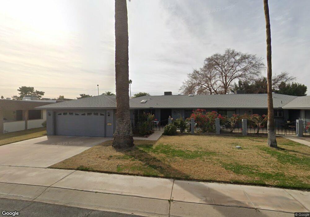
10121 W Bolivar Dr Sun City, AZ 85351
Estimated Value: $214,942 - $280,000
--
Bed
2
Baths
1,430
Sq Ft
$180/Sq Ft
Est. Value
About This Home
This home is located at 10121 W Bolivar Dr, Sun City, AZ 85351 and is currently estimated at $257,736, approximately $180 per square foot. 10121 W Bolivar Dr is a home located in Maricopa County with nearby schools including Desert Mirage Elementary School, Ombudsman - Northwest Charter, and Peoria Accelerated High School.
Ownership History
Date
Name
Owned For
Owner Type
Purchase Details
Closed on
Apr 5, 2016
Sold by
Agle Robert L
Bought by
Vannurden Ronald and Eder Elizabeth K
Current Estimated Value
Purchase Details
Closed on
Jan 28, 2003
Sold by
Agle Robert L and Agle Marion J
Bought by
Seghetti Karen S and Agle Raymond L
Purchase Details
Closed on
Mar 5, 1999
Sold by
Shaw Marcella N
Bought by
Agle Robert L and Agle Marion J
Home Financials for this Owner
Home Financials are based on the most recent Mortgage that was taken out on this home.
Original Mortgage
$57,500
Interest Rate
6.79%
Mortgage Type
New Conventional
Create a Home Valuation Report for This Property
The Home Valuation Report is an in-depth analysis detailing your home's value as well as a comparison with similar homes in the area
Home Values in the Area
Average Home Value in this Area
Purchase History
| Date | Buyer | Sale Price | Title Company |
|---|---|---|---|
| Vannurden Ronald | $160,000 | None Available | |
| Seghetti Karen S | -- | -- | |
| Agle Robert L | $82,500 | -- |
Source: Public Records
Mortgage History
| Date | Status | Borrower | Loan Amount |
|---|---|---|---|
| Previous Owner | Agle Robert L | $57,500 |
Source: Public Records
Tax History Compared to Growth
Tax History
| Year | Tax Paid | Tax Assessment Tax Assessment Total Assessment is a certain percentage of the fair market value that is determined by local assessors to be the total taxable value of land and additions on the property. | Land | Improvement |
|---|---|---|---|---|
| 2025 | $988 | $12,229 | -- | -- |
| 2024 | $891 | $11,647 | -- | -- |
| 2023 | $891 | $19,020 | $3,800 | $15,220 |
| 2022 | $838 | $16,260 | $3,250 | $13,010 |
| 2021 | $866 | $12,950 | $2,590 | $10,360 |
| 2020 | $843 | $12,950 | $2,590 | $10,360 |
| 2019 | $831 | $13,670 | $2,730 | $10,940 |
| 2018 | $960 | $12,110 | $2,420 | $9,690 |
| 2017 | $773 | $10,630 | $2,120 | $8,510 |
| 2016 | $724 | $8,750 | $1,750 | $7,000 |
| 2015 | $693 | $8,510 | $1,700 | $6,810 |
Source: Public Records
Map
Nearby Homes
- 10134 W Forrester Dr
- 10137 W Forrester Dr Unit 20
- 10127 W Forrester Dr
- 10229 W Bolivar Dr
- 10114 W Candlewood Dr
- 10112 W Forrester Dr
- 13410 N Cedar Dr Unit 20
- 13620 N Hawthorn Dr
- 10114 W Royal Oak Rd Unit 20
- 13636 N Redwood Dr Unit 203
- 10012 W Bolivar Dr
- 13614 N Hawthorn Dr
- 13828 N Whispering Lake Dr
- 13832 N Crown Point
- 10309 W Floriade Dr Unit 18
- 13606 N Redwood Dr Unit 209
- 13836 N Kaanapali Dr
- 13605 N Redwood Dr
- 13626 N Tan Tara Point
- 13433 N Emberwood Dr
- 10125 W Bolivar Dr
- 10119 W Bolivar Dr
- 10127 W Bolivar Dr Unit 162
- 10117 W Bolivar Dr
- 10126 W Forrester Dr Unit 20
- 10128 W Forrester Dr
- 10124 W Forrester Dr
- 10130 W Forrester Dr Unit 117
- 10131 W Bolivar Dr Unit 161
- 10122 W Forrester Dr Unit 113
- 10124 W Bolivar Dr Unit 392
- 10132 W Forrester Dr
- 10113 W Bolivar Dr Unit 167
- 10128 W Bolivar Dr
- 10132 W Bolivar Dr
- 10120 W Forrester Dr Unit 112
- 10135 W Bolivar Dr
- 10112 W Bolivar Dr Unit 20
- 10118 W Forrester Dr
- 10125 W Forrester Dr