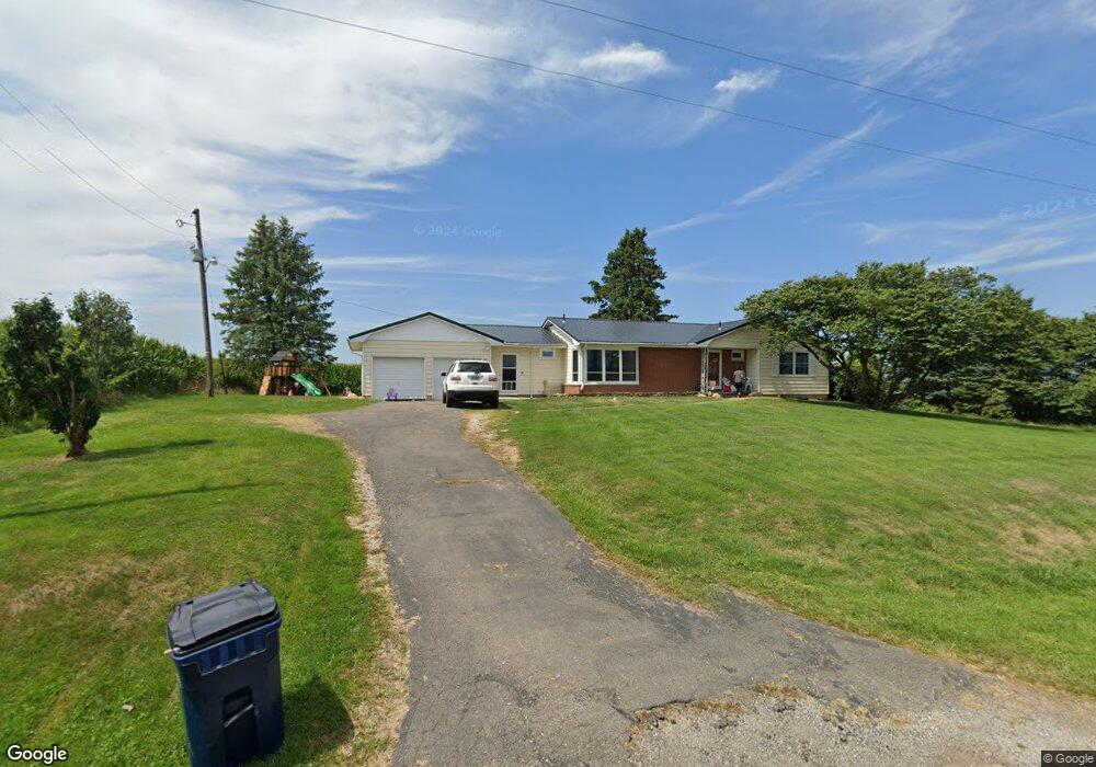
10122 Lancer Rd Hebron, OH 43025
Estimated Value: $295,000 - $349,000
3
Beds
2
Baths
1,482
Sq Ft
$214/Sq Ft
Est. Value
About This Home
This home is located at 10122 Lancer Rd, Hebron, OH 43025 and is currently estimated at $317,769, approximately $214 per square foot. 10122 Lancer Rd is a home located in Licking County with nearby schools including Jackson Intermediate School, Lakewood Middle School, and Lakewood High School.
Ownership History
Date
Name
Owned For
Owner Type
Purchase Details
Closed on
Oct 31, 2019
Sold by
George Jonathan Todd and George Marian P L
Bought by
Gray Jordon Lee and Gray Tracey Lee
Current Estimated Value
Home Financials for this Owner
Home Financials are based on the most recent Mortgage that was taken out on this home.
Original Mortgage
$144,750
Outstanding Balance
$126,752
Interest Rate
3.37%
Mortgage Type
FHA
Estimated Equity
$191,017
Purchase Details
Closed on
Nov 7, 2017
Sold by
Estate Of Donna Jean George
Bought by
George Charles
Create a Home Valuation Report for This Property
The Home Valuation Report is an in-depth analysis detailing your home's value as well as a comparison with similar homes in the area
Home Values in the Area
Average Home Value in this Area
Purchase History
| Date | Buyer | Sale Price | Title Company |
|---|---|---|---|
| Gray Jordon Lee | $150,000 | Ambassador Title | |
| George Charles | -- | None Available |
Source: Public Records
Mortgage History
| Date | Status | Borrower | Loan Amount |
|---|---|---|---|
| Open | Gray Jordon Lee | $144,750 |
Source: Public Records
Tax History Compared to Growth
Tax History
| Year | Tax Paid | Tax Assessment Tax Assessment Total Assessment is a certain percentage of the fair market value that is determined by local assessors to be the total taxable value of land and additions on the property. | Land | Improvement |
|---|---|---|---|---|
| 2024 | $2,641 | $70,250 | $9,630 | $60,620 |
| 2023 | $2,648 | $70,250 | $9,630 | $60,620 |
| 2022 | $2,294 | $52,400 | $7,320 | $45,080 |
| 2021 | $2,365 | $52,400 | $7,320 | $45,080 |
| 2020 | $2,369 | $52,400 | $7,320 | $45,080 |
| 2019 | $2,137 | $43,340 | $5,220 | $38,120 |
| 2018 | $1,684 | $0 | $0 | $0 |
| 2017 | $1,684 | $0 | $0 | $0 |
| 2016 | $1,206 | $0 | $0 | $0 |
| 2015 | $1,133 | $0 | $0 | $0 |
| 2014 | $2,373 | $0 | $0 | $0 |
| 2013 | $1,123 | $0 | $0 | $0 |
Source: Public Records
Map
Nearby Homes
- 149 Amherst Dr
- 541 Lakeshore Dr E
- 459 Lakeshore Dr E
- 206 Freeman Memorial Dr
- 22 Barton Place
- 955 Lakeshore Dr E
- 0 Harbor View Dr Unit 223038206
- 11790 Avondale Rd E
- 141 Sandpiper Dr
- 36 High St
- 4401 Hunts Landing Rd Unit 202
- 4401 Hunts Landing Rd Unit 304
- 4401 Hunts Landing Rd Unit 204
- 10800 Honey Creek Rd
- 4455 Hunts Landing Rd Unit 8
- 613 Newport Ln
- 610 Newport Ln
- 142 Narragansett Dr
- 11290 Honey Creek Rd
- 10790 Township Road 500
- 5533 Cristland Hill Rd
- 5169 Cristland Hill Rd
- 10476 Columbus Ave
- 9861 Lancer Rd
- 0 Cristland Hill Rd
- 10479 Columbus Ave
- 5468 Cristland Hill Rd
- 10498 Columbus Ave
- 10498 Columbus Ave
- 10522 Columbus Ave
- 5556 Cristland Hill Rd
- 10537 Columbus Ave
- 5566 Cristland Hill Rd
- 4720 Cristland Hill Rd
- 5598 Cristland Hill Rd
- 5637 Cristland Hill Rd
- 5637 Cristland Hill Rd
- 10600 Columbus Ave
- 10645 Columbus Ave
- 10606 Columbus Ave