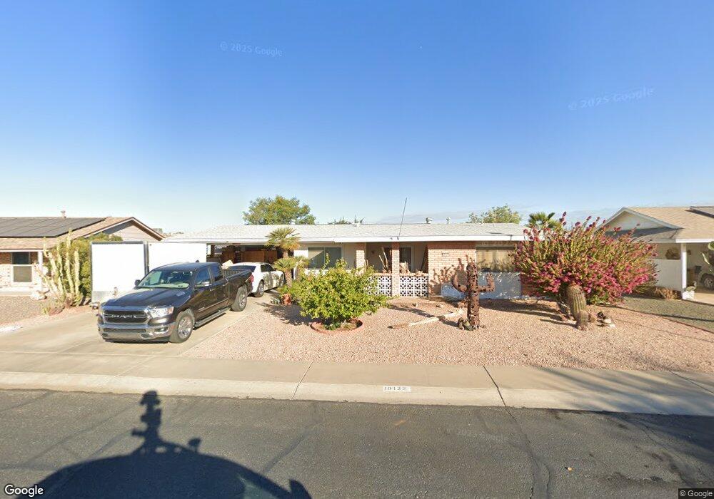
10122 W Cheryl Dr Sun City, AZ 85351
Estimated Value: $250,508 - $311,000
2
Beds
2
Baths
1,541
Sq Ft
$184/Sq Ft
Est. Value
About This Home
This home is located at 10122 W Cheryl Dr, Sun City, AZ 85351 and is currently estimated at $283,877, approximately $184 per square foot. 10122 W Cheryl Dr is a home located in Maricopa County with nearby schools including Ombudsman - Northwest Charter and Peoria Accelerated High School.
Ownership History
Date
Name
Owned For
Owner Type
Purchase Details
Closed on
Nov 9, 2016
Sold by
Cummins Troy L
Bought by
Cummins Troy L and Cummins Curtis
Current Estimated Value
Purchase Details
Closed on
May 20, 2015
Sold by
Cummins Troy L and Robello Keo N
Bought by
Cummins Troy L
Home Financials for this Owner
Home Financials are based on the most recent Mortgage that was taken out on this home.
Original Mortgage
$104,000
Outstanding Balance
$80,001
Interest Rate
3.64%
Mortgage Type
New Conventional
Estimated Equity
$203,876
Purchase Details
Closed on
Dec 22, 2009
Sold by
Herda Edward J and Herda Dorothy E
Bought by
Cummins Troy L and Robello Keo N
Home Financials for this Owner
Home Financials are based on the most recent Mortgage that was taken out on this home.
Original Mortgage
$88,929
Interest Rate
5.4%
Mortgage Type
FHA
Create a Home Valuation Report for This Property
The Home Valuation Report is an in-depth analysis detailing your home's value as well as a comparison with similar homes in the area
Home Values in the Area
Average Home Value in this Area
Purchase History
| Date | Buyer | Sale Price | Title Company |
|---|---|---|---|
| Cummins Troy L | -- | None Available | |
| Cummins Troy L | -- | None Available | |
| Cummins Troy L | $95,000 | First American Title Ins Co |
Source: Public Records
Mortgage History
| Date | Status | Borrower | Loan Amount |
|---|---|---|---|
| Open | Cummins Troy L | $104,000 | |
| Closed | Cummins Troy L | $88,929 |
Source: Public Records
Tax History Compared to Growth
Tax History
| Year | Tax Paid | Tax Assessment Tax Assessment Total Assessment is a certain percentage of the fair market value that is determined by local assessors to be the total taxable value of land and additions on the property. | Land | Improvement |
|---|---|---|---|---|
| 2025 | $1,106 | $12,314 | -- | -- |
| 2024 | $1,005 | $11,728 | -- | -- |
| 2023 | $1,005 | $21,870 | $4,370 | $17,500 |
| 2022 | $947 | $17,170 | $3,430 | $13,740 |
| 2021 | $960 | $16,060 | $3,210 | $12,850 |
| 2020 | $935 | $13,920 | $2,780 | $11,140 |
| 2019 | $851 | $12,870 | $2,570 | $10,300 |
| 2018 | $797 | $11,670 | $2,330 | $9,340 |
| 2017 | $788 | $10,310 | $2,060 | $8,250 |
| 2016 | $739 | $9,700 | $1,940 | $7,760 |
| 2015 | $701 | $8,700 | $1,740 | $6,960 |
Source: Public Records
Map
Nearby Homes
- 10131 W Cheryl Dr Unit 6D
- 10166 W Cinnebar Ave
- 10034 W Concord Ave
- 10240 W Concord Ave
- 10302 W Cheryl Dr Unit D
- 9939 W Ironwood Dr Unit 6D
- 10022 W Mountain View Rd
- 9834 N Balboa Dr
- 10316 W Salem Dr Unit 6D
- 9925 W Mountain View Rd Unit 27
- 9815 N 103rd Ave
- 9891 N Balboa Dr
- 10109 W Mountain View Rd
- 9915 W Mountain View Rd
- 10027 W Tarrytown Ave Unit 6
- 10341 W Clair Dr
- 10405 W Andover Ave
- 10440 W Cheryl Dr
- 10102 W Deanne Dr Unit 6
- 10014 W Mission Ln
- 10128 W Cheryl Dr
- 10123 W Cumberland Dr
- 10129 W Cumberland Dr
- 10117 W Cumberland Dr
- 10132 W Cheryl Dr
- 10110 W Cheryl Dr
- 10121 W Cheryl Dr
- 10135 W Cumberland Dr Unit 6
- 10127 W Cheryl Dr
- 10115 W Cheryl Dr
- 10111 W Cumberland Dr
- 10138 W Cheryl Dr
- 10102 W Cheryl Dr
- 10139 W Cumberland Dr
- 9838 N 101st Ave
- 10126 W Cumberland Dr
- 10120 W Cumberland Dr
- 10137 W Cheryl Dr
- 10148 W Cinnebar Ave