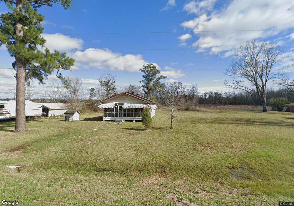
10124 Highway 937 Saint Amant, LA 70774
Saint Amant NeighborhoodEstimated Value: $141,399 - $159,000
--
Bed
--
Bath
--
Sq Ft
3.88
Acres
About This Home
This home is located at 10124 Highway 937, Saint Amant, LA 70774 and is currently estimated at $151,600. 10124 Highway 937 is a home located in Ascension Parish with nearby schools including St. Amant Primary School, St. Amant Middle School, and St. Amant High School.
Ownership History
Date
Name
Owned For
Owner Type
Purchase Details
Closed on
Jul 11, 2019
Sold by
Gregory Tucker Robert
Bought by
Scott Raymond M and Scott Heather
Current Estimated Value
Home Financials for this Owner
Home Financials are based on the most recent Mortgage that was taken out on this home.
Original Mortgage
$500,000
Outstanding Balance
$421,210
Interest Rate
2.1%
Mortgage Type
New Conventional
Estimated Equity
-$269,610
Create a Home Valuation Report for This Property
The Home Valuation Report is an in-depth analysis detailing your home's value as well as a comparison with similar homes in the area
Home Values in the Area
Average Home Value in this Area
Purchase History
| Date | Buyer | Sale Price | Title Company |
|---|---|---|---|
| Scott Raymond M | $75,000 | Stewart Title | |
| Scott Raymond M | $75,000 | Stewart Title |
Source: Public Records
Mortgage History
| Date | Status | Borrower | Loan Amount |
|---|---|---|---|
| Open | Scott Raymond M | $500,000 |
Source: Public Records
Tax History Compared to Growth
Tax History
| Year | Tax Paid | Tax Assessment Tax Assessment Total Assessment is a certain percentage of the fair market value that is determined by local assessors to be the total taxable value of land and additions on the property. | Land | Improvement |
|---|---|---|---|---|
| 2024 | -- | $3,110 | $1,480 | $1,630 |
| 2023 | $292 | $2,860 | $1,230 | $1,630 |
| 2022 | $292 | $2,860 | $1,230 | $1,630 |
| 2021 | $292 | $2,860 | $1,230 | $1,630 |
| 2020 | $294 | $2,860 | $1,230 | $1,630 |
| 2019 | $397 | $3,840 | $2,210 | $1,630 |
| 2018 | $392 | $3,840 | $2,210 | $1,630 |
| 2017 | $392 | $3,840 | $2,210 | $1,630 |
| 2015 | $394 | $3,840 | $2,210 | $1,630 |
| 2014 | $414 | $4,040 | $2,410 | $1,630 |
Source: Public Records
Map
Nearby Homes
- 47387 La Hwy 937
- 9434 Rod Anderson Rd
- 9476 Rod Anderson Rd
- 0.53 Acres Split Log Rd
- 9366 Poirrier Rd
- 47422 Saint Amant Ln
- 11321 Louisiana 22
- 9365 E La Hwy 936
- TBD La Hwy 22
- TBA Louisiana 22
- 10451 John Savoy Rd
- 10333 John Savoy Rd
- Lot # 78 Phillips Rd
- 8314 Phillips Rd
- 10197 Louisiana 936
- Lot C-3-A Taylor Sheets Rd
- 46335 Family Acres Rd
- 45538 Doc Ln
- 9139 Louisiana 936
- 10013 Louisiana 936
- 10124 Highway 937
- 10108 Highway 937
- 10108 Highway 937
- 10142 Louisiana 937
- 10078 Highway 937
- 10178 Highway 937
- 10206 Highway 937
- 10028 Highway 937
- 10029 Highway 937
- 48074 Sam Martin Rd
- 48084 Sam Martin Rd
- 48080 Sam Martin Rd
- 47504 Highway 937
- 47444 Highway 937
- 10264 Highway 937
- 47371 Highway 22
- 47456 Highway 937
- 48045 Sam Martin Rd
- 9546 Split Log Rd
- 10267 La Hwy 937