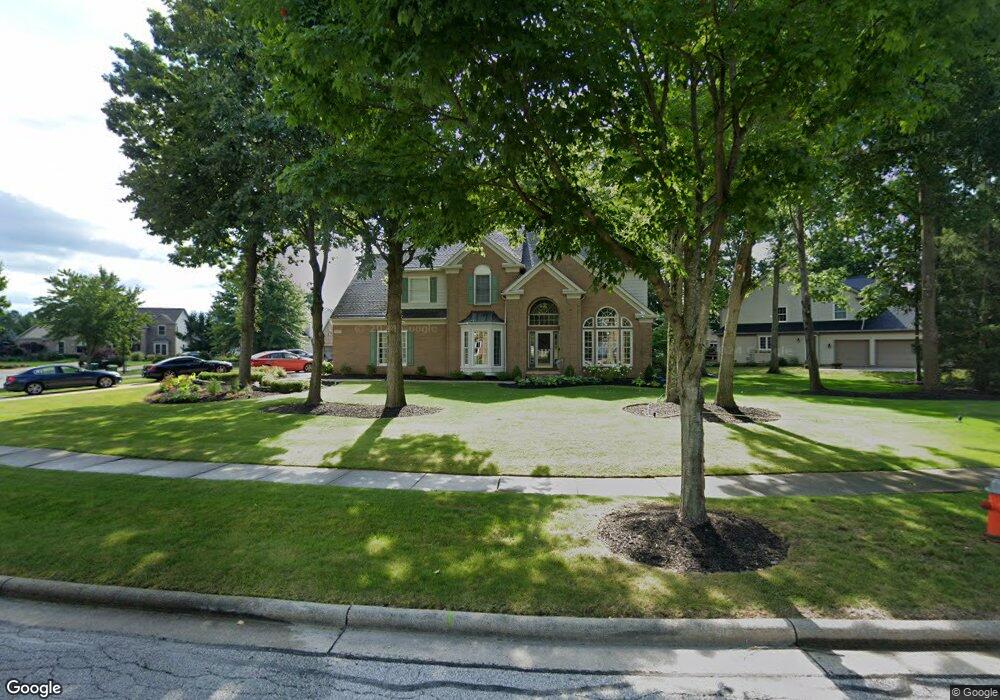
10127 Timothy Ln Twinsburg, OH 44087
Estimated Value: $493,185 - $549,000
4
Beds
3
Baths
2,895
Sq Ft
$181/Sq Ft
Est. Value
About This Home
This home is located at 10127 Timothy Ln, Twinsburg, OH 44087 and is currently estimated at $524,546, approximately $181 per square foot. 10127 Timothy Ln is a home located in Summit County with nearby schools including Wilcox Primary School, Samuel Bissell Elementary School, and Dodge Intermediate School.
Ownership History
Date
Name
Owned For
Owner Type
Purchase Details
Closed on
May 12, 2001
Sold by
Linscott Walt A and Linscott Milessa W
Bought by
Sharp Raymond P and Sharp Jane E
Current Estimated Value
Home Financials for this Owner
Home Financials are based on the most recent Mortgage that was taken out on this home.
Original Mortgage
$258,400
Interest Rate
7.11%
Create a Home Valuation Report for This Property
The Home Valuation Report is an in-depth analysis detailing your home's value as well as a comparison with similar homes in the area
Home Values in the Area
Average Home Value in this Area
Purchase History
| Date | Buyer | Sale Price | Title Company |
|---|---|---|---|
| Sharp Raymond P | $323,000 | Guardian Title |
Source: Public Records
Mortgage History
| Date | Status | Borrower | Loan Amount |
|---|---|---|---|
| Closed | Sharp Raymond P | $258,400 |
Source: Public Records
Tax History Compared to Growth
Tax History
| Year | Tax Paid | Tax Assessment Tax Assessment Total Assessment is a certain percentage of the fair market value that is determined by local assessors to be the total taxable value of land and additions on the property. | Land | Improvement |
|---|---|---|---|---|
| 2025 | $7,550 | $147,217 | $22,449 | $124,768 |
| 2024 | $7,550 | $156,870 | $22,449 | $134,421 |
| 2023 | $7,550 | $156,870 | $22,449 | $134,421 |
| 2022 | $6,570 | $121,772 | $17,402 | $104,370 |
| 2021 | $6,601 | $121,772 | $17,402 | $104,370 |
| 2020 | $6,402 | $121,770 | $17,400 | $104,370 |
| 2019 | $6,275 | $111,530 | $17,400 | $94,130 |
| 2018 | $6,149 | $111,530 | $17,400 | $94,130 |
| 2017 | $5,202 | $111,530 | $17,400 | $94,130 |
| 2016 | $5,170 | $100,000 | $17,400 | $82,600 |
| 2015 | $5,202 | $100,000 | $17,400 | $82,600 |
| 2014 | $5,191 | $100,000 | $17,400 | $82,600 |
| 2013 | $5,226 | $100,750 | $17,400 | $83,350 |
Source: Public Records
Map
Nearby Homes
- 10169 Timothy Ln
- 2978 Framingham Ln
- 2923 Alling Dr
- 10502 White Ash Trail
- 10085 Glen Eagle Ln Unit 35AG
- 2668 Walton Blvd
- 10393 N Pond Ln
- 3331 Shale Dr
- 10375 W Cobblestone Ln Unit 2
- 34105 Blue Heron Dr
- 2590 Post Rd
- 9740 Burton Dr
- 9933 Cynthia Dr
- 2825 Veron Ln
- 3110 Blue Jaye Ln
- 3320 Blossom Trail
- 7485 Stockwood Dr
- 3336 Blossom Trail
- 3314 Fenmore Ln
- 10132 Scenic View Dr
- 10101 Timothy Ln
- 10155 Timothy Ln
- 10122 Timothy Ln
- 2867 Hawkins Ln
- 2875 Hawkins Ln
- 10114 Timothy Ln
- 10130 Timothy Ln
- 10138 Timothy Ln
- 10106 Timothy Ln
- 10146 Timothy Ln
- 10098 Timothy Ln
- 10177 Timothy Ln
- 2883 Hawkins Ln
- 10154 Timothy Ln
- 10090 Timothy Ln
- 10162 Timothy Ln
- 10170 Timothy Ln
- 10202 Brighton Cir Unit 9
- 10204 Brighton Cir
- 10206 Brighton Cir