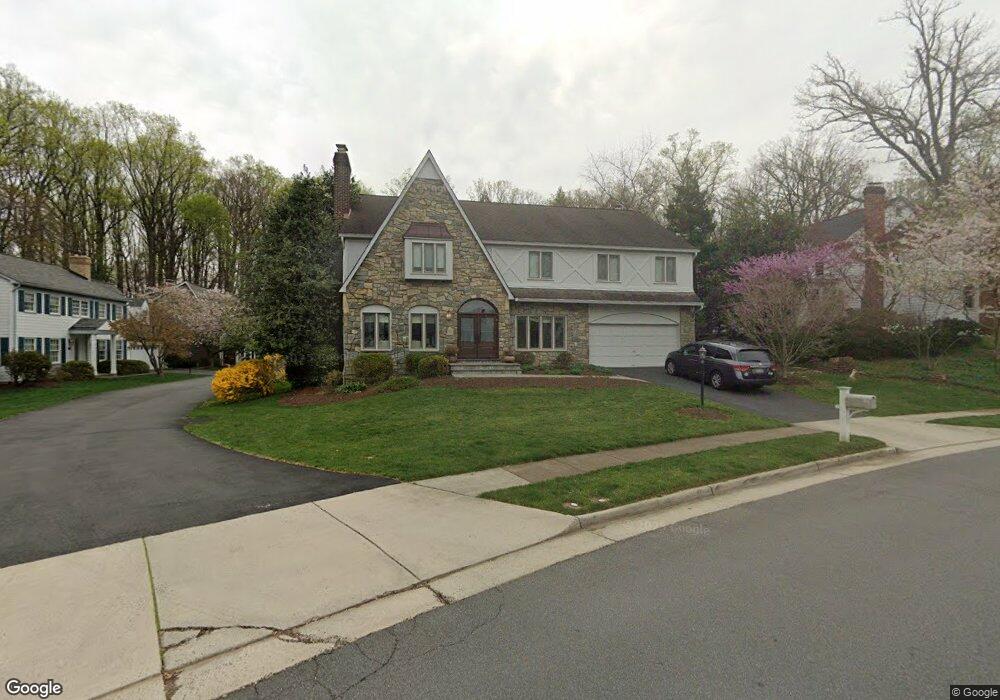
1013 Broad Branch Ct McLean, VA 22101
Estimated Value: $1,942,000 - $2,595,000
4
Beds
5
Baths
5,693
Sq Ft
$377/Sq Ft
Est. Value
About This Home
This home is located at 1013 Broad Branch Ct, McLean, VA 22101 and is currently estimated at $2,147,095, approximately $377 per square foot. 1013 Broad Branch Ct is a home located in Fairfax County with nearby schools including Churchill Road Elementary School, Cooper Middle School, and Langley High School.
Ownership History
Date
Name
Owned For
Owner Type
Purchase Details
Closed on
Jun 13, 2011
Sold by
Berube Co Executor Anne D and Christensen Co Executor Megan A
Bought by
Brenner Guy
Current Estimated Value
Home Financials for this Owner
Home Financials are based on the most recent Mortgage that was taken out on this home.
Original Mortgage
$936,000
Outstanding Balance
$648,581
Interest Rate
4.74%
Mortgage Type
New Conventional
Estimated Equity
$1,498,514
Create a Home Valuation Report for This Property
The Home Valuation Report is an in-depth analysis detailing your home's value as well as a comparison with similar homes in the area
Home Values in the Area
Average Home Value in this Area
Purchase History
| Date | Buyer | Sale Price | Title Company |
|---|---|---|---|
| Brenner Guy | $1,170,000 | -- |
Source: Public Records
Mortgage History
| Date | Status | Borrower | Loan Amount |
|---|---|---|---|
| Open | Brenner Guy | $936,000 |
Source: Public Records
Tax History
| Year | Tax Paid | Tax Assessment Tax Assessment Total Assessment is a certain percentage of the fair market value that is determined by local assessors to be the total taxable value of land and additions on the property. | Land | Improvement |
|---|---|---|---|---|
| 2025 | $19,251 | $1,757,060 | $724,000 | $1,033,060 |
| 2024 | $19,251 | $1,582,380 | $614,000 | $968,380 |
| 2023 | $17,206 | $1,451,680 | $569,000 | $882,680 |
| 2022 | $17,108 | $1,425,900 | $556,000 | $869,900 |
| 2021 | $16,478 | $1,343,740 | $540,000 | $803,740 |
| 2020 | $16,379 | $1,326,880 | $540,000 | $786,880 |
| 2019 | $16,193 | $1,310,250 | $540,000 | $770,250 |
| 2018 | $14,826 | $1,289,250 | $519,000 | $770,250 |
| 2017 | $14,985 | $1,236,480 | $516,000 | $720,480 |
| 2016 | $14,390 | $1,188,770 | $496,000 | $692,770 |
Source: Public Records
Map
Nearby Homes
- 1146 Wimbledon Dr
- 1109 Ingleside Ave
- 1101 Dead Run Dr
- 6619 Weatheford Ct
- 6625 Weatheford Ct
- 6910 Bright Ave
- 6871 Churchill Rd
- 1104 Sharon Ct
- 1201 Allendale Rd
- 913 Whann Ave
- 6601 Madison Mclean Dr
- 6634 Madison Mclean Dr
- 7022 Hector Rd
- 1105 Carper St
- 6804 Benjamin St
- 7011 Elizabeth Dr
- 6800 Fleetwood Rd Unit 705
- 1008 Jarvis Ct
- 6909 Chelsea Rd
- 7009 Benjamin St
- 1015 Broad Branch Ct
- 1009 Broad Branch Ct
- 1005 Broad Branch Ct
- 1007 Broad Branch Ct
- 1019 Broad Branch Ct
- 1004 Broad Branch Ct
- 1014 Broad Branch Ct
- 1016 Broad Branch Ct
- 1021 Broad Branch Ct
- 1000 Broad Branch Ct
- 1023 Broad Branch Ct
- 1024 Broad Branch Ct
- 1025 Douglass Dr
- 1025 Broad Branch Ct
- 1026 Broad Branch Ct
- 6800 Langley Springs Ct
- 6801 Langley Springs Ct
- 6791 Father John Ct
- 1028 Broad Branch Ct
- 1027 Broad Branch Ct
Your Personal Tour Guide
Ask me questions while you tour the home.