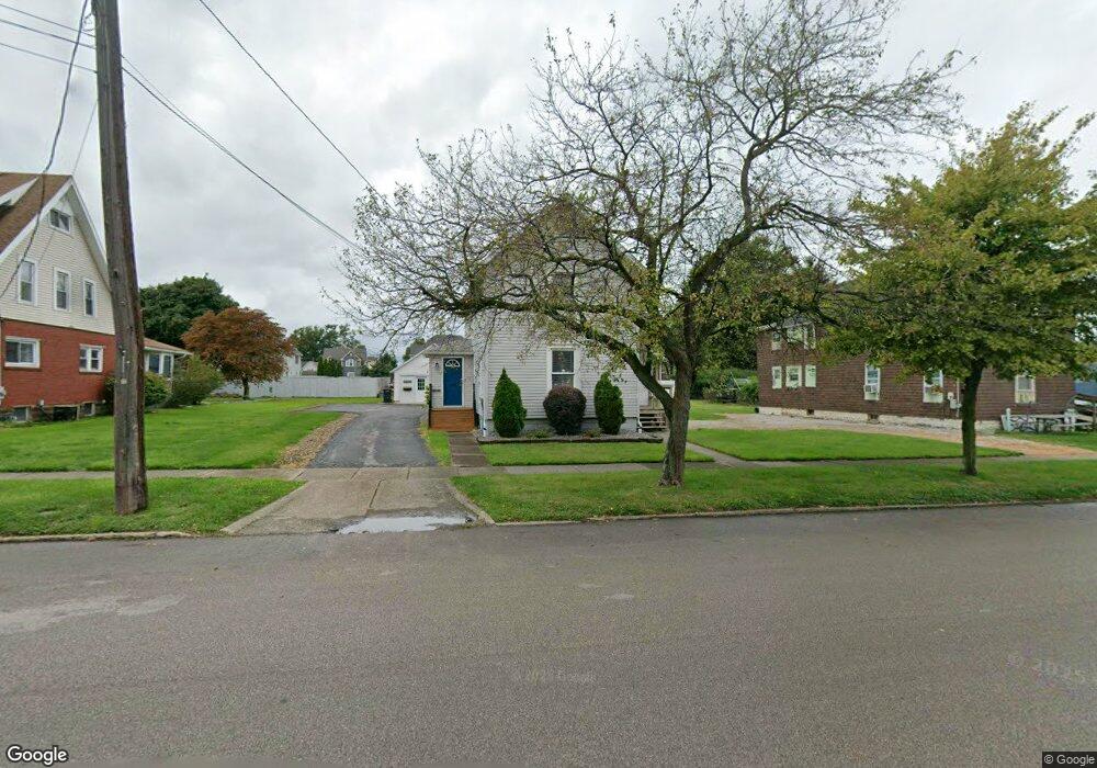
1013 Broad St Conneaut, OH 44030
Estimated Value: $118,000 - $138,152
4
Beds
2
Baths
1,984
Sq Ft
$64/Sq Ft
Est. Value
About This Home
This home is located at 1013 Broad St, Conneaut, OH 44030 and is currently estimated at $127,288, approximately $64 per square foot. 1013 Broad St is a home located in Ashtabula County with nearby schools including Lakeshore Primary Elementary School, Gateway Elementary School, and Conneaut Middle School.
Ownership History
Date
Name
Owned For
Owner Type
Purchase Details
Closed on
Dec 5, 2006
Sold by
Robison James F and Robison Susan L
Bought by
Robison James F and Robison Susan L
Current Estimated Value
Purchase Details
Closed on
Oct 3, 1994
Sold by
Hanas George C
Bought by
Morton Carter J and Morton Darlene A
Create a Home Valuation Report for This Property
The Home Valuation Report is an in-depth analysis detailing your home's value as well as a comparison with similar homes in the area
Home Values in the Area
Average Home Value in this Area
Purchase History
| Date | Buyer | Sale Price | Title Company |
|---|---|---|---|
| Robison James F | -- | Attorney | |
| Morton Carter J | $34,750 | -- |
Source: Public Records
Tax History Compared to Growth
Tax History
| Year | Tax Paid | Tax Assessment Tax Assessment Total Assessment is a certain percentage of the fair market value that is determined by local assessors to be the total taxable value of land and additions on the property. | Land | Improvement |
|---|---|---|---|---|
| 2024 | $2,671 | $36,510 | $7,490 | $29,020 |
| 2023 | $1,285 | $36,510 | $7,490 | $29,020 |
| 2022 | $998 | $27,310 | $5,780 | $21,530 |
| 2021 | $1,015 | $27,310 | $5,780 | $21,530 |
| 2020 | $1,015 | $27,310 | $5,780 | $21,530 |
| 2019 | $1,376 | $24,720 | $5,500 | $19,220 |
| 2018 | $1,313 | $24,720 | $5,500 | $19,220 |
| 2017 | $1,366 | $24,720 | $5,500 | $19,220 |
| 2016 | $1,407 | $28,850 | $6,410 | $22,440 |
| 2015 | $1,421 | $28,850 | $6,410 | $22,440 |
| 2014 | $1,258 | $28,850 | $6,410 | $22,440 |
| 2013 | $1,067 | $25,170 | $9,140 | $16,030 |
Source: Public Records
Map
Nearby Homes
- 290 Park Ave
- 1025 Harbor St Unit 35
- 973 Buffalo St
- 0 Harbor St Unit 5122727
- 982 Day St
- 794 Buffalo St
- 770 Buffalo St
- 169 River St
- 703 Sandusky St
- 688 Grove St
- 716 Chestnut St
- 644 Mill St
- 630 Mill St
- 554 Sandusky St
- 536 Mill St
- 533 Mill St
- 0 Chestnut St Unit 5120761
- 381 Bliss Ave
- 179 Hayward Ave
- 405 Bliss Ave
- 1019 Broad St
- 1003 Broad St
- 1016 Buffalo St
- 1036 Buffalo St
- 1010 Broad St
- 1022 Buffalo St
- 1012 Buffalo St
- 985 Broad State Rd 7 St
- 985 Broad St
- 979 Broad St
- 1000 Buffalo St
- 1023 Buffalo St
- 1013 Buffalo St
- 980 Broad St
- 1017 Buffalo St
- 996 Buffalo St
- 976 Broad St
- 971 Broad St
- 992 Buffalo St
- 967 Broad St