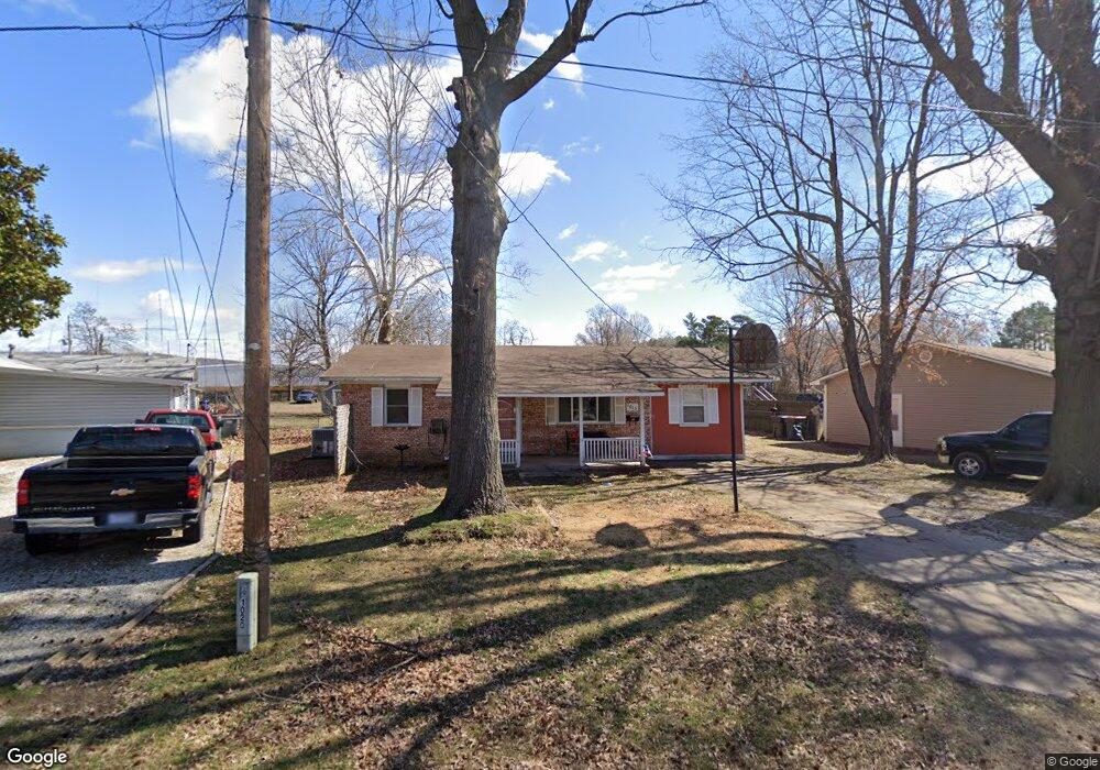
1013 Brogdon St Springdale, AR 72764
Estimated Value: $163,839 - $230,000
--
Bed
1
Bath
1,075
Sq Ft
$185/Sq Ft
Est. Value
About This Home
This home is located at 1013 Brogdon St, Springdale, AR 72764 and is currently estimated at $198,460, approximately $184 per square foot. 1013 Brogdon St is a home located in Washington County with nearby schools including J. O. Kelly Middle School, Linda Childers Knapp Elementary School, and Lee Elementary School.
Ownership History
Date
Name
Owned For
Owner Type
Purchase Details
Closed on
Jun 8, 2018
Sold by
Luker Christopher L and Luker Chris L
Bought by
Luker Christopher L and Luker Dalene A
Current Estimated Value
Home Financials for this Owner
Home Financials are based on the most recent Mortgage that was taken out on this home.
Original Mortgage
$82,163
Outstanding Balance
$71,306
Interest Rate
4.75%
Mortgage Type
FHA
Estimated Equity
$127,154
Purchase Details
Closed on
Sep 1, 1993
Bought by
Luker Christopher L
Purchase Details
Closed on
Jun 12, 1992
Bought by
Luker Chris L and Pinkley Cynthia
Purchase Details
Closed on
Oct 12, 1988
Bought by
Neverman, Bryce Jay & Diane Fox
Purchase Details
Closed on
Jan 1, 1985
Bought by
Sullivan Douglas T
Create a Home Valuation Report for This Property
The Home Valuation Report is an in-depth analysis detailing your home's value as well as a comparison with similar homes in the area
Home Values in the Area
Average Home Value in this Area
Purchase History
| Date | Buyer | Sale Price | Title Company |
|---|---|---|---|
| Luker Christopher L | -- | Servicelink | |
| Luker Christopher L | -- | -- | |
| Luker Chris L | -- | -- | |
| Neverman, Bryce Jay & Diane Fox | $38,000 | -- | |
| Sullivan Douglas T | -- | -- |
Source: Public Records
Mortgage History
| Date | Status | Borrower | Loan Amount |
|---|---|---|---|
| Open | Luker Christopher L | $82,163 |
Source: Public Records
Tax History Compared to Growth
Tax History
| Year | Tax Paid | Tax Assessment Tax Assessment Total Assessment is a certain percentage of the fair market value that is determined by local assessors to be the total taxable value of land and additions on the property. | Land | Improvement |
|---|---|---|---|---|
| 2025 | $304 | $31,190 | $14,000 | $17,190 |
| 2024 | $365 | $31,190 | $14,000 | $17,190 |
| 2023 | $416 | $31,190 | $14,000 | $17,190 |
| 2022 | $426 | $18,690 | $7,000 | $11,690 |
| 2021 | $391 | $18,690 | $7,000 | $11,690 |
| 2020 | $357 | $18,690 | $7,000 | $11,690 |
| 2019 | $322 | $13,220 | $5,750 | $7,470 |
| 2018 | $347 | $13,220 | $5,750 | $7,470 |
| 2017 | $340 | $13,220 | $5,750 | $7,470 |
| 2016 | $340 | $13,220 | $5,750 | $7,470 |
| 2015 | $340 | $13,220 | $5,750 | $7,470 |
| 2014 | $345 | $12,786 | $3,356 | $9,430 |
Source: Public Records
Map
Nearby Homes
- 114 E Bailey Ave
- 1015 Mill St
- 209 Sanders Ave
- 613 Mill St
- 713 Harris St
- 1100 E Huntsville Ave
- 2977 Kings Dr
- 1440 Tumbleweed Dr
- 2996 Twin County St
- 616 W Center Ave
- 5613 Southwood Ave
- 985 Remington Dr
- 1203 Christian Ave
- 710 E Meadow Ave
- 3339 Alliance Dr
- 1278 Moody Ln
- 2012 Larkspur St
- 1409 Crawford Ave
- 1407 Davis Ave
- 1950 Sweetwater Ranch Ave
- 1011 Brogdon St
- 1015 Brogdon St
- 1017 Brogdon St
- 296 Old Wire Rd
- 1020 Brogdon St
- 1018 Brogdon St
- 316 Old Wire Rd
- 1022 Brogdon St
- 1016 Brogdon St
- 338 Old Wire Rd
- 1024 Brogdon St
- 278 Old Wire Rd
- 1014 Brogdon St
- 1019 Brogdon St
- 360 Old Wire Rd
- 1021 Mill St
- 1023 Mill St
- 384 Old Wire Rd
- 236 Old Wire Rd
- 112 E Bailey Ave