Estimated Value: $147,110 - $194,000
3
Beds
1
Bath
1,117
Sq Ft
$149/Sq Ft
Est. Value
About This Home
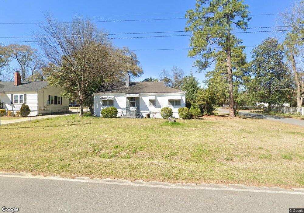
This home is located at 1013 Duncan Ave, Perry, GA 31069 and is currently estimated at $166,028, approximately $148 per square foot. 1013 Duncan Ave is a home located in Houston County with nearby schools including Tucker Elementary School, Perry Middle School, and Perry High School.
Ownership History
Date
Name
Owned For
Owner Type
Purchase Details
Closed on
Mar 2, 2000
Sold by
Dole Jesselyn G Estate
Bought by
Griggs Harry F and Durrance Stanford
Current Estimated Value
Purchase Details
Closed on
Apr 21, 1995
Sold by
Brooks Virgil P Estate
Bought by
Haskins Clifton and Haskins Judene S
Purchase Details
Closed on
Jan 7, 1992
Sold by
Affidavit - Landfill
Bought by
Dole Jesselyn G and Griggs Harry F
Purchase Details
Closed on
Apr 5, 1984
Sold by
Griggs Fred
Bought by
Dole Jesselyn G and Griggs Harry F
Purchase Details
Closed on
Aug 4, 1983
Sold by
Gordon Nettie L Estate
Bought by
Dole Jesselyn Etal
Purchase Details
Closed on
Nov 29, 1949
Bought by
Brooks Virgil P
Create a Home Valuation Report for This Property
The Home Valuation Report is an in-depth analysis detailing your home's value as well as a comparison with similar homes in the area
Home Values in the Area
Average Home Value in this Area
Purchase History
| Date | Buyer | Sale Price | Title Company |
|---|---|---|---|
| Griggs Harry F | -- | -- | |
| Haskins Clifton | $37,500 | -- | |
| Dole Jesselyn G | -- | -- | |
| Dole Jesselyn G | -- | -- | |
| Dole Jesselyn Etal | -- | -- | |
| Gordon Nettie L Estate Etal | -- | -- | |
| Brooks Virgil P | $1,000 | -- |
Source: Public Records
Tax History Compared to Growth
Tax History
| Year | Tax Paid | Tax Assessment Tax Assessment Total Assessment is a certain percentage of the fair market value that is determined by local assessors to be the total taxable value of land and additions on the property. | Land | Improvement |
|---|---|---|---|---|
| 2024 | $1,301 | $35,400 | $5,400 | $30,000 |
| 2023 | $1,114 | $30,120 | $5,400 | $24,720 |
| 2022 | $630 | $27,400 | $5,400 | $22,000 |
| 2021 | $574 | $24,840 | $5,400 | $19,440 |
| 2020 | $573 | $24,680 | $5,400 | $19,280 |
| 2019 | $573 | $24,680 | $5,400 | $19,280 |
| 2018 | $573 | $24,680 | $5,400 | $19,280 |
| 2017 | $574 | $24,680 | $5,400 | $19,280 |
| 2016 | $575 | $24,680 | $5,400 | $19,280 |
| 2015 | $576 | $24,680 | $5,400 | $19,280 |
| 2014 | -- | $24,680 | $5,400 | $19,280 |
| 2013 | -- | $24,680 | $5,400 | $19,280 |
Source: Public Records
Map
Nearby Homes
- 903 Massee Ln
- 905 Massee Ln
- 624 Pine Ridge St
- 1207 Tucker Rd
- 630 Pine Ridge St
- 706 Hillcrest Ave
- 625 Cooper St
- 113 Pridgen Pass
- 0 Carroll Aly
- 104 Pridgen Pass
- 126 Bramblewood Ln
- 1212 Swift St
- 104 Gunner Ln
- 1207 Swift St
- 202 Martin Luther King jr Dr
- 202 Martin Luther King Junior Dr
- 914 Bess St
- 1406 Main St
- 1343 Wf Ragin Dr
- 1432 Duncan Ave
- 1011 Duncan Ave
- 1015 Duncan Ave
- 1009 Duncan Ave
- 703 Tolleson Ave
- 1007 Duncan Ave
- 704 Tolleson Ave
- 1012 Duncan Ave
- 1012 Duncan Ave Unit 232
- 1017 Duncan Ave
- 1010 Duncan Ave
- 1016 Duncan Ave
- 706 Tolleson Ave
- 1005 Duncan Ave
- 1018 Duncan Ave
- 705 Tolleson Ave
- 627 Tolleson Ave
- 1004 Cater St
- 1006 Duncan Ave
- 703 Evergreen St
- 625 Tolleson Ave