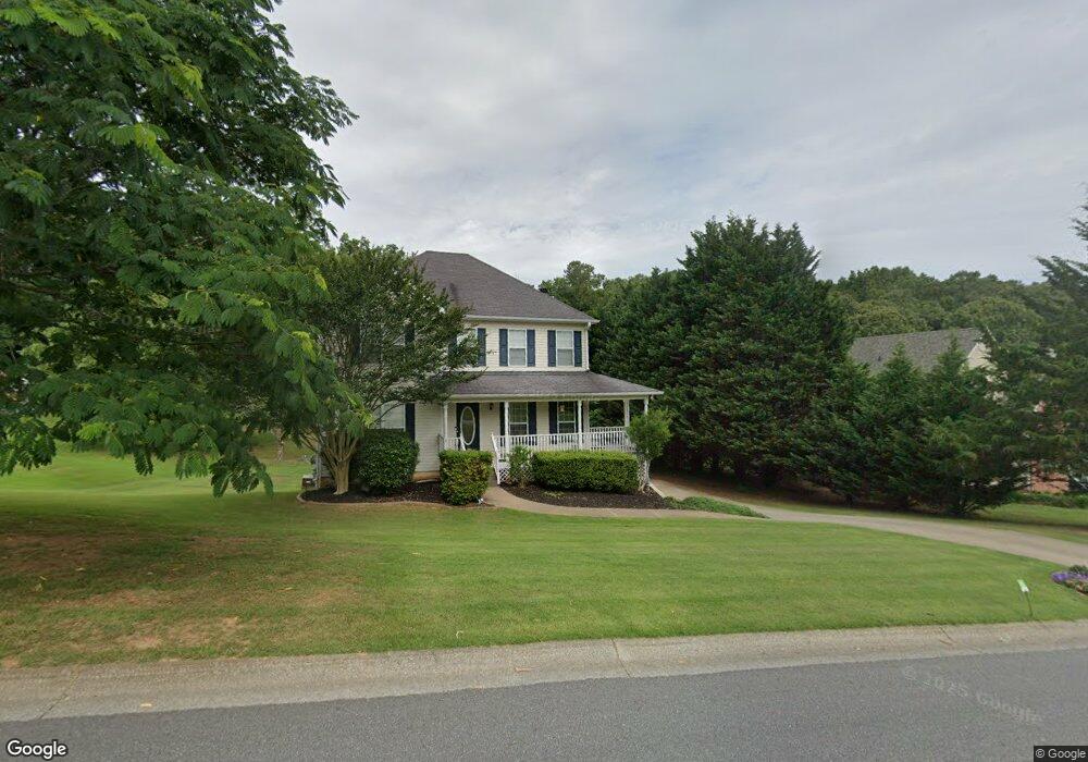
1013 Fieldstone Dr Unit 1013 Canton, GA 30114
Estimated Value: $423,083 - $433,000
3
Beds
3
Baths
2,632
Sq Ft
$163/Sq Ft
Est. Value
About This Home
This home is located at 1013 Fieldstone Dr Unit 1013, Canton, GA 30114 and is currently estimated at $428,042, approximately $162 per square foot. 1013 Fieldstone Dr Unit 1013 is a home located in Cherokee County with nearby schools including J. Knox Elementary School, Teasley Middle School, and Cherokee High School.
Ownership History
Date
Name
Owned For
Owner Type
Purchase Details
Closed on
May 21, 2014
Sold by
Ah4r I Ga Llc
Bought by
Amh 2014 1 Borrower Llc
Current Estimated Value
Purchase Details
Closed on
Aug 7, 2012
Sold by
Boykin Robert
Bought by
Ah4r I Ga Llc
Purchase Details
Closed on
May 2, 2005
Sold by
Swanger Todd A and Swanger Cathy
Bought by
Boykin Robert and Boykin Brigette
Home Financials for this Owner
Home Financials are based on the most recent Mortgage that was taken out on this home.
Original Mortgage
$191,500
Interest Rate
5.8%
Purchase Details
Closed on
Jun 18, 1999
Sold by
Cronan Michael G
Bought by
Swanger Todd A
Home Financials for this Owner
Home Financials are based on the most recent Mortgage that was taken out on this home.
Original Mortgage
$126,800
Interest Rate
7.13%
Create a Home Valuation Report for This Property
The Home Valuation Report is an in-depth analysis detailing your home's value as well as a comparison with similar homes in the area
Home Values in the Area
Average Home Value in this Area
Purchase History
| Date | Buyer | Sale Price | Title Company |
|---|---|---|---|
| Amh 2014 1 Borrower Llc | -- | -- | |
| Ah4r I Ga Llc | $144,001 | -- | |
| Boykin Robert | $191,500 | -- | |
| Swanger Todd A | $158,600 | -- |
Source: Public Records
Mortgage History
| Date | Status | Borrower | Loan Amount |
|---|---|---|---|
| Previous Owner | Boykin Robert | $191,500 | |
| Previous Owner | Swanger Todd A | $126,800 |
Source: Public Records
Tax History Compared to Growth
Tax History
| Year | Tax Paid | Tax Assessment Tax Assessment Total Assessment is a certain percentage of the fair market value that is determined by local assessors to be the total taxable value of land and additions on the property. | Land | Improvement |
|---|---|---|---|---|
| 2025 | $4,268 | $162,512 | $34,000 | $128,512 |
| 2024 | $4,153 | $159,796 | $34,000 | $125,796 |
| 2023 | $4,333 | $166,720 | $34,000 | $132,720 |
| 2022 | $2,524 | $96,040 | $20,000 | $76,040 |
| 2021 | $2,726 | $96,040 | $20,000 | $76,040 |
| 2020 | $2,729 | $96,040 | $20,000 | $76,040 |
| 2019 | $2,656 | $93,480 | $20,000 | $73,480 |
| 2018 | $2,489 | $87,080 | $14,800 | $72,280 |
| 2017 | $2,157 | $187,200 | $14,800 | $60,080 |
| 2016 | $2,167 | $186,100 | $14,800 | $59,640 |
| 2015 | $2,186 | $185,900 | $14,800 | $59,560 |
| 2014 | $1,697 | $144,000 | $14,800 | $42,800 |
Source: Public Records
Map
Nearby Homes
- 7840 Knox Bridge Hwy
- 320 River Green Ave
- 537 Oriole Farm Trail Unit 4L
- 208 Westbury Ct
- 150 Jaime Dr
- 616 Parkview Dr
- 117 Market Ln
- 331 Oakview Way
- 708 Woodlake Ct
- 222 Patti Place
- 405 Trumpet Cir
- 234 Oakview Dr
- 1209 Lakeside Overlook
- 119 Oakview Passage
- 710 Bedford Trace Unit 3
- 845 Lakemont Dr
- 609 Arches Park Ln
- 993 Woodbury Rd
- 201 River Green Ave
- 619 River Bend Way
- 1013 Fieldstone Dr
- 1013 Fieldstone Dr Unit I
- 1009 Fieldstone Dr
- 1017 Fieldstone Dr Unit 1
- 100 Bridle Ct
- 1005 Fieldstone Dr
- 1021 Fieldstone Dr
- 1008 Fieldstone Dr
- 200 Bridle Ct
- 205 Bridle Ct
- 206 Bridle Ct
- 214 Bridle Ct
- 0 Bridle Ln Unit 5937492
- 0 Bridle Ridge Unit 5935014
- 0 Bridle Ln Unit 8289615
- 1004 Fieldstone Dr
- 1025 Fieldstone Dr Unit 1
- 1012 Fieldstone Dr
- 7389 Knox Bridge Hwy
- 1014 Fieldstone Dr