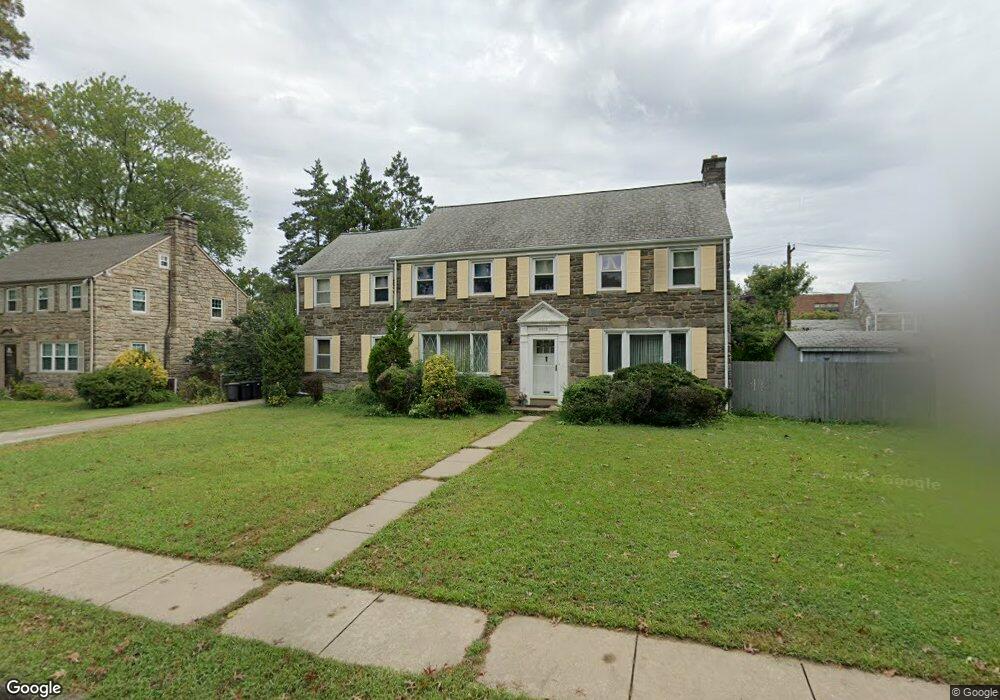
1013 Foss Ave Drexel Hill, PA 19026
Estimated Value: $472,000 - $513,000
4
Beds
2
Baths
2,394
Sq Ft
$204/Sq Ft
Est. Value
About This Home
This home is located at 1013 Foss Ave, Drexel Hill, PA 19026 and is currently estimated at $488,134, approximately $203 per square foot. 1013 Foss Ave is a home located in Delaware County with nearby schools including Hillcrest El School, Drexel Hill Middle School, and Upper Darby High School.
Ownership History
Date
Name
Owned For
Owner Type
Purchase Details
Closed on
Apr 29, 2005
Sold by
Frascella Anthony J and Frascella Leona M
Bought by
Organ Daniel F and Organ Elena M
Current Estimated Value
Home Financials for this Owner
Home Financials are based on the most recent Mortgage that was taken out on this home.
Original Mortgage
$285,000
Outstanding Balance
$149,650
Interest Rate
5.95%
Mortgage Type
Fannie Mae Freddie Mac
Estimated Equity
$338,484
Create a Home Valuation Report for This Property
The Home Valuation Report is an in-depth analysis detailing your home's value as well as a comparison with similar homes in the area
Home Values in the Area
Average Home Value in this Area
Purchase History
| Date | Buyer | Sale Price | Title Company |
|---|---|---|---|
| Organ Daniel F | $385,000 | -- |
Source: Public Records
Mortgage History
| Date | Status | Borrower | Loan Amount |
|---|---|---|---|
| Open | Organ Daniel F | $285,000 |
Source: Public Records
Tax History Compared to Growth
Tax History
| Year | Tax Paid | Tax Assessment Tax Assessment Total Assessment is a certain percentage of the fair market value that is determined by local assessors to be the total taxable value of land and additions on the property. | Land | Improvement |
|---|---|---|---|---|
| 2025 | $10,222 | $241,710 | $58,010 | $183,700 |
| 2024 | $10,222 | $241,710 | $58,010 | $183,700 |
| 2023 | $10,126 | $241,710 | $58,010 | $183,700 |
| 2022 | $9,854 | $241,710 | $58,010 | $183,700 |
| 2021 | $13,286 | $241,710 | $58,010 | $183,700 |
| 2020 | $11,529 | $178,230 | $54,180 | $124,050 |
| 2019 | $11,327 | $178,230 | $54,180 | $124,050 |
| 2018 | $11,196 | $178,230 | $0 | $0 |
| 2017 | $10,905 | $178,230 | $0 | $0 |
| 2016 | $978 | $178,230 | $0 | $0 |
| 2015 | $978 | $178,230 | $0 | $0 |
| 2014 | $978 | $178,230 | $0 | $0 |
Source: Public Records
Map
Nearby Homes
- 1025 Shadeland Ave
- 1037 Cobbs St
- 904 Harper Ave
- 930 Ormond Ave
- 912 Edmonds Ave
- 1200 Ormond Ave
- 844 Mason Ave
- 1228 Old Ln
- 828 Mason Ave
- 1217 Ormond Ave
- 1133 Agnew Dr
- 1241 Cornell Ave
- 1113 Harding Dr
- 1048 Morgan Ave
- 831 Lindale Ave
- 1113 Drexel Ave
- 909 Kenwood Rd
- 910 Fariston Dr
- 1101 Wilson Dr
- 6 N Lexington Ave