Estimated Value: $153,445 - $422,000
--
Bed
--
Bath
2,128
Sq Ft
$155/Sq Ft
Est. Value
About This Home
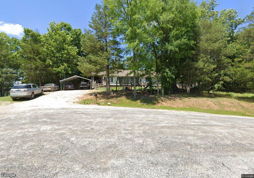
This home is located at 1013 Hawks Nest Rd, York, SC 29745 and is currently estimated at $329,361, approximately $154 per square foot. 1013 Hawks Nest Rd is a home located in York County with nearby schools including Jefferson Elementary School, York Intermediate School, and York Middle School.
Ownership History
Date
Name
Owned For
Owner Type
Purchase Details
Closed on
Jun 30, 2013
Sold by
Evans Christopher Dean
Bought by
Bond Rita Virginia
Current Estimated Value
Purchase Details
Closed on
Nov 2, 2011
Sold by
Bond Rita Virginia
Bought by
Evans Christopher Dean
Purchase Details
Closed on
Dec 28, 2005
Sold by
Vanderbilt Mortgage & Finance Inc
Bought by
Evans Rita V
Home Financials for this Owner
Home Financials are based on the most recent Mortgage that was taken out on this home.
Original Mortgage
$107,488
Interest Rate
6.18%
Mortgage Type
FHA
Purchase Details
Closed on
Dec 10, 2004
Sold by
Garvin Michael D and Garvin Amanda
Bought by
Vanderbilt Mortgage & Finance Inc
Create a Home Valuation Report for This Property
The Home Valuation Report is an in-depth analysis detailing your home's value as well as a comparison with similar homes in the area
Home Values in the Area
Average Home Value in this Area
Purchase History
| Date | Buyer | Sale Price | Title Company |
|---|---|---|---|
| Bond Rita Virginia | -- | -- | |
| Evans Christopher Dean | -- | -- | |
| Evans Rita V | $111,500 | -- | |
| Vanderbilt Mortgage & Finance Inc | $85,500 | -- |
Source: Public Records
Mortgage History
| Date | Status | Borrower | Loan Amount |
|---|---|---|---|
| Previous Owner | Evans Rita V | $107,488 |
Source: Public Records
Tax History Compared to Growth
Tax History
| Year | Tax Paid | Tax Assessment Tax Assessment Total Assessment is a certain percentage of the fair market value that is determined by local assessors to be the total taxable value of land and additions on the property. | Land | Improvement |
|---|---|---|---|---|
| 2024 | $506 | $3,019 | $1,397 | $1,622 |
| 2023 | $517 | $3,019 | $1,397 | $1,622 |
| 2022 | $518 | $3,019 | $1,397 | $1,622 |
| 2021 | -- | $3,019 | $1,397 | $1,622 |
| 2020 | $517 | $3,019 | $0 | $0 |
| 2019 | $531 | $2,980 | $0 | $0 |
| 2018 | $510 | $2,980 | $0 | $0 |
| 2017 | $485 | $2,980 | $0 | $0 |
| 2016 | $478 | $2,980 | $0 | $0 |
| 2014 | $444 | $4,470 | $1,800 | $2,670 |
| 2013 | $444 | $4,170 | $1,800 | $2,370 |
Source: Public Records
Map
Nearby Homes
- 1371 Hawks Nest Rd
- 2099 Cedar Rd
- 2078 Garvin Rd
- 1975 Bowlin Ln
- 2209 Cedar Rd
- 1302 Bryson Creek Dr
- 249 Brown Neal Rd
- 1348 Bryson Creek Dr
- 108 Daves Rd
- 243 Love St
- 665 N Burris Rd
- 150 Orindawood Dr
- 1865 McConnells Hwy W
- 2420 Creekside Dr
- 1406 Old Puckett Place Unit 14
- 1066 Cameron Rd
- 000 Creekside Dr Unit 65,66,67
- 00 Hord Rd
- 1265 N Burris Rd
- 1386 Old Pinckney Rd
- 1051 Hawks Nest Rd
- 65 AC Hawks Nest Rd
- 1061 Hawks Nest Rd
- 1001 Hawks Nest Rd
- 975 Hawks Nest Rd
- 1175 Hawks Nest Rd
- 1148 Hawks Nest Rd
- 149 Ac Hawks Nest Rd
- 5-6 Tracts Hawks Nest Rd
- 156 Ac Hawks Nest Rd
- 32.5 AC Hawks Nest Rd Unit 2
- 32.5 AC Hawks Nest Rd
- Tract A & B Hawks Nest Rd
- 1330 Hawks Nest Rd
- 1085 Turkey Creek Ridge Rd
- 1407 Hawks Nest Rd
- 1325 Hawks Nest Rd
- 1367 Hawks Nest Rd
- 1111 & 1075 Turkey Creek Ridge Rd
- 895 Turkey Creek Ridge Rd