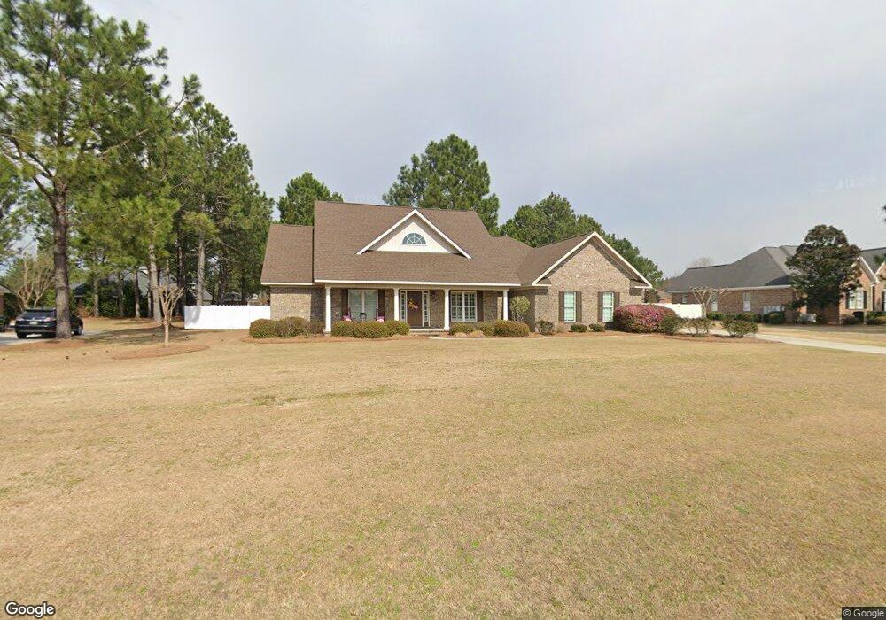
1013 Johnson Dr Statesboro, GA 30461
Estimated Value: $443,363 - $508,000
4
Beds
2
Baths
2,263
Sq Ft
$210/Sq Ft
Est. Value
About This Home
This home is located at 1013 Johnson Dr, Statesboro, GA 30461 and is currently estimated at $475,341, approximately $210 per square foot. 1013 Johnson Dr is a home located in Bulloch County with nearby schools including Brooklet Elementary School, Southeast Bulloch High School, and Southeast Bulloch Middle School.
Ownership History
Date
Name
Owned For
Owner Type
Purchase Details
Closed on
Nov 26, 2007
Sold by
Not Provided
Bought by
Thomas Matthew L and Thomas Jodi C
Current Estimated Value
Home Financials for this Owner
Home Financials are based on the most recent Mortgage that was taken out on this home.
Original Mortgage
$220,500
Outstanding Balance
$139,495
Interest Rate
6.29%
Mortgage Type
New Conventional
Estimated Equity
$335,846
Purchase Details
Closed on
May 21, 2007
Sold by
Not Provided
Bought by
Thomas Matthew L and Thomas Jodi C
Create a Home Valuation Report for This Property
The Home Valuation Report is an in-depth analysis detailing your home's value as well as a comparison with similar homes in the area
Home Values in the Area
Average Home Value in this Area
Purchase History
| Date | Buyer | Sale Price | Title Company |
|---|---|---|---|
| Thomas Matthew L | $245,000 | -- | |
| Thomas Matthew L | $35,535 | -- |
Source: Public Records
Mortgage History
| Date | Status | Borrower | Loan Amount |
|---|---|---|---|
| Open | Thomas Matthew L | $220,500 |
Source: Public Records
Tax History Compared to Growth
Tax History
| Year | Tax Paid | Tax Assessment Tax Assessment Total Assessment is a certain percentage of the fair market value that is determined by local assessors to be the total taxable value of land and additions on the property. | Land | Improvement |
|---|---|---|---|---|
| 2024 | $3,427 | $157,880 | $26,000 | $131,880 |
| 2023 | $3,382 | $142,760 | $16,000 | $126,760 |
| 2022 | $2,699 | $125,453 | $16,000 | $109,453 |
| 2021 | $2,460 | $111,717 | $16,000 | $95,717 |
| 2020 | $2,396 | $108,259 | $16,000 | $92,259 |
| 2019 | $2,306 | $103,734 | $11,360 | $92,374 |
| 2018 | $2,379 | $102,948 | $11,360 | $91,588 |
| 2017 | $2,314 | $99,132 | $11,360 | $87,772 |
| 2016 | $2,298 | $96,186 | $11,360 | $84,826 |
| 2015 | $2,272 | $94,750 | $11,360 | $83,390 |
| 2014 | $2,101 | $94,750 | $11,360 | $83,390 |
Source: Public Records
Map
Nearby Homes
- 1016 Johnson Dr
- 6302 C T Place
- 4026 Denton Loop
- 252 Hagin Ln
- 1603 Lennox Rd
- 1008 Cobb Rd
- 893 W Lane St
- 0 E Highway 80 Hwy Unit 10490324
- 1805 Nottingham Rd
- 19477 Us Highway 80 E
- 302 Providence Trace
- 302 Providence Trc
- 10544 Burkhalter Rd
- 713 W Lane St
- 202 Birdsill St
- 684 Frances Ln
- 208 Birdsill St
- 210 Birdsill St
- 0 George Moore Rd Unit SA333925
- 0 George Moore Rd Unit 10559523
- 1011 Johnson Dr
- 1015 Johnson Dr
- 6004 Collins Terrace
- 6002 Collins Terrace
- 1009 Johnson Dr
- 1010 Johnson Dr
- 1017 Johnson Dr
- 4029 Denton Loop
- 1012 Johnson Dr
- 1014 Johnson Dr
- 6006 Collins Terrace
- 3006 Mccall Blvd
- 1008 Johnson Dr Unit 5
- 1008 Johnson Dr
- 3004 Mccall Blvd
- 4005 Denton Loop
- 2042 Pippin Place Unit 255
- 2034 Pippin Place Unit 258
- 2011 Pippin Place Unit 188
- 2024 Pippin Place