Estimated Value: $406,551 - $460,000
4
Beds
3
Baths
2,119
Sq Ft
$205/Sq Ft
Est. Value
About This Home
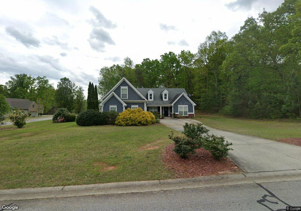
This home is located at 1013 Kimberly Cir, Hull, GA 30646 and is currently estimated at $433,638, approximately $204 per square foot. 1013 Kimberly Cir is a home located in Madison County with nearby schools including Madison County High School.
Ownership History
Date
Name
Owned For
Owner Type
Purchase Details
Closed on
May 21, 2010
Sold by
R & B Financial Investments Llc
Bought by
James Jason T and James Elizabeth W
Current Estimated Value
Home Financials for this Owner
Home Financials are based on the most recent Mortgage that was taken out on this home.
Original Mortgage
$160,734
Outstanding Balance
$110,080
Interest Rate
5.5%
Mortgage Type
FHA
Estimated Equity
$323,558
Purchase Details
Closed on
Jan 5, 2010
Sold by
Miller William Kent
Bought by
R & B Financial Investments Llc
Purchase Details
Closed on
Oct 31, 2006
Sold by
Clarksboro Builders Llc
Bought by
Miller William Kent and Miller Sherry J
Home Financials for this Owner
Home Financials are based on the most recent Mortgage that was taken out on this home.
Original Mortgage
$189,900
Interest Rate
9.63%
Mortgage Type
New Conventional
Create a Home Valuation Report for This Property
The Home Valuation Report is an in-depth analysis detailing your home's value as well as a comparison with similar homes in the area
Home Values in the Area
Average Home Value in this Area
Purchase History
| Date | Buyer | Sale Price | Title Company |
|---|---|---|---|
| James Jason T | $162,900 | -- | |
| R & B Financial Investments Llc | $131,751 | -- | |
| Miller William Kent | $189,900 | -- |
Source: Public Records
Mortgage History
| Date | Status | Borrower | Loan Amount |
|---|---|---|---|
| Open | James Jason T | $160,734 | |
| Previous Owner | Miller William Kent | $189,900 |
Source: Public Records
Tax History Compared to Growth
Tax History
| Year | Tax Paid | Tax Assessment Tax Assessment Total Assessment is a certain percentage of the fair market value that is determined by local assessors to be the total taxable value of land and additions on the property. | Land | Improvement |
|---|---|---|---|---|
| 2024 | $3,785 | $145,436 | $14,400 | $131,036 |
| 2023 | $4,177 | $136,834 | $14,400 | $122,434 |
| 2022 | $3,347 | $121,330 | $14,400 | $106,930 |
| 2021 | $3,119 | $102,176 | $14,400 | $87,776 |
| 2020 | $2,896 | $94,196 | $14,400 | $79,796 |
| 2019 | $2,534 | $81,498 | $14,400 | $67,098 |
| 2018 | $2,470 | $79,182 | $14,400 | $64,782 |
| 2017 | $2,162 | $75,081 | $14,400 | $60,681 |
| 2016 | $1,894 | $65,989 | $14,400 | $51,589 |
| 2015 | $1,861 | $64,813 | $10,000 | $54,813 |
| 2014 | $1,782 | $61,680 | $10,000 | $51,680 |
| 2013 | -- | $61,680 | $10,000 | $51,680 |
Source: Public Records
Map
Nearby Homes
- 1176 Kimberly Cir
- 149 Candlestick Dr
- 103 Three Rivers Ct
- 8986 Highway 29 S
- 424 Belhaven Ln
- 685 Bedford Dr
- 181 Bedford Dr
- 136 Wellington Dr
- 481 Bedford Dr
- 1329 Spratlin Mill Dr
- 525 Virginia Ln
- 0 Woodland Creek Place Unit 10421130
- 838 Virginia Ln
- 151 Rolling Woods Ln
- 1045 Garnett Ward Rd Unit 4
- 1061 Garnett Ward Rd Unit 3
- 1067 Garnett Ward Rd Unit 2
- 1097 Garnett Ward Rd Unit 1
- 210 Joe Graham Rd
- 7241 Highway 29 S
- 1055 Kimberly Cir
- 1020 Kimberly Cir
- 1004 Kimberly Cir
- 140 Kimberly Way
- 1034 Kimberly Cir
- 170 Kimberly Way
- 980 Kimberly Cir
- 125 Kimberly Way
- 1089 Kimberly Cir
- 1056 Kimberly Cir
- 0 Kimberly Way
- 1131 Kimberly Cir
- 110 Kimberly Way
- 800 Kimberly Cir
- 771 Kimberly Cir
- 780 Kimberly Cir
- 90 Kimberly Way
- 1076 Kimberly Cir
- 1151 Kimberly Cir
- 85 Kimberly Way