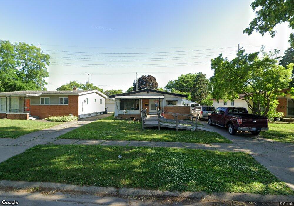
1013 Macdonald Ave Flint, MI 48507
Circle Drive NeighborhoodEstimated Value: $76,360 - $107,000
3
Beds
2
Baths
941
Sq Ft
$95/Sq Ft
Est. Value
About This Home
This home is located at 1013 Macdonald Ave, Flint, MI 48507 and is currently estimated at $89,840, approximately $95 per square foot. 1013 Macdonald Ave is a home located in Genesee County with nearby schools including Freeman Elementary School, Flint Southwestern Classical Academy, and International Academy of Flint (K-12).
Ownership History
Date
Name
Owned For
Owner Type
Purchase Details
Closed on
Aug 4, 2016
Sold by
Genesee County Land Bank Authority
Bought by
Coleman Terry D
Current Estimated Value
Purchase Details
Closed on
Dec 17, 2015
Sold by
Genesee County
Bought by
Genesee County Land Bank
Purchase Details
Closed on
Jul 21, 1999
Sold by
Osborn Family Trust and Sue Nancy Sue
Bought by
Osborn Nancy S
Home Financials for this Owner
Home Financials are based on the most recent Mortgage that was taken out on this home.
Original Mortgage
$53,500
Interest Rate
9.37%
Mortgage Type
Purchase Money Mortgage
Purchase Details
Closed on
Jul 15, 1999
Sold by
Curtis Judy C
Bought by
Osborn Nancy S
Home Financials for this Owner
Home Financials are based on the most recent Mortgage that was taken out on this home.
Original Mortgage
$53,500
Interest Rate
9.37%
Mortgage Type
Purchase Money Mortgage
Create a Home Valuation Report for This Property
The Home Valuation Report is an in-depth analysis detailing your home's value as well as a comparison with similar homes in the area
Home Values in the Area
Average Home Value in this Area
Purchase History
We collect this data history from publicly available records. To have your information removed, we recommend requesting removal directly through your county’s website.
| Date | Buyer | Sale Price | Title Company |
|---|---|---|---|
| Coleman Terry D | $7,000 | None Available | |
| Genesee County Land Bank | -- | None Available | |
| Osborn Nancy S | -- | Greco Title | |
| Osborn Nancy S | -- | Greco Title | |
| Osborn Nancy S | -- | Greco Title |
Source: Public Records
Mortgage History
We collect this data history from publicly available records. To have your information removed, we recommend requesting removal directly through your county’s website.
| Date | Status | Borrower | Loan Amount |
|---|---|---|---|
| Previous Owner | Osborn Nancy S | $53,500 |
Source: Public Records
Tax History
| Year | Tax Paid | Tax Assessment Tax Assessment Total Assessment is a certain percentage of the fair market value that is determined by local assessors to be the total taxable value of land and additions on the property. | Land | Improvement |
|---|---|---|---|---|
| 2025 | $979 | $40,900 | $0 | $0 |
| 2024 | $964 | $35,800 | $0 | $0 |
| 2023 | $944 | $30,000 | $0 | $0 |
| 2022 | $0 | $23,000 | $0 | $0 |
| 2021 | $956 | $21,800 | $0 | $0 |
| 2020 | $882 | $21,300 | $0 | $0 |
| 2019 | $864 | $10,000 | $0 | $0 |
| 2018 | $848 | $9,400 | $0 | $0 |
| 2017 | $827 | $0 | $0 | $0 |
| 2016 | $0 | $0 | $0 | $0 |
| 2015 | -- | $0 | $0 | $0 |
| 2014 | -- | $0 | $0 | $0 |
| 2012 | -- | $16,600 | $0 | $0 |
Source: Public Records
Map
Nearby Homes
- 1005 Macdonald Ave
- 813 McKeighan Ave
- 4424 Cheyenne Ave
- 3290 Cheyenne Ave
- 3317 Cheyenne Ave
- 711 Lochhead Ave
- 617 McKeighan Ave
- 3193 Myrton St
- 601 Mckinley Ave
- 511 Mckinley Ave
- 621 Burroughs Ave
- 4126 Circle Dr
- 3056 Shaw St
- 4533 Pengelly Rd
- 4234 Custer Ave
- 2291 Kenneth St
- 413 E Hemphill Rd
- 2271 Kenneth St
- 4127 Custer Ave
- 720 Algonquin Ave
- 1001 Macdonald Ave
- 1009 Macdonald Ave
- 917 Macdonald Ave
- 1006 McKeighan Ave
- 1002 McKeighan Ave
- 1017 Macdonald Ave
- 1010 McKeighan Ave
- 1006 Macdonald Ave
- 918 McKeighan Ave
- 1002 Macdonald Ave
- 1010 Macdonald Ave
- 1014 McKeighan Ave
- 918 Macdonald Ave
- 909 Macdonald Ave
- 1021 Macdonald Ave
- 1014 Macdonald Ave
- 914 McKeighan Ave
- 914 Macdonald Ave
- 1018 Macdonald Ave
- 910 McKeighan Ave
Your Personal Tour Guide
Ask me questions while you tour the home.