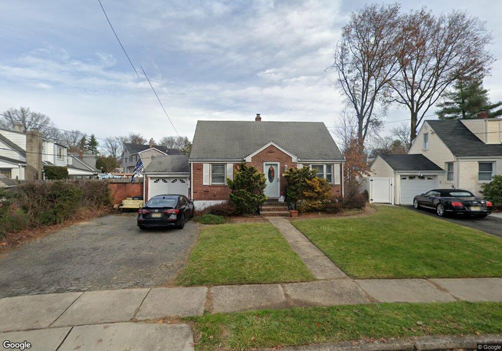
1013 Maple Dr New Milford, NJ 07646
Estimated Value: $565,000 - $645,000
--
Bed
--
Bath
1,556
Sq Ft
$378/Sq Ft
Est. Value
About This Home
This home is located at 1013 Maple Dr, New Milford, NJ 07646 and is currently estimated at $587,819, approximately $377 per square foot. 1013 Maple Dr is a home located in Bergen County with nearby schools including New Milford High School, Hovnanian School, and Grace Lutheran School.
Ownership History
Date
Name
Owned For
Owner Type
Purchase Details
Closed on
Sep 19, 2016
Sold by
Dunay Lysa M
Bought by
Pierre Reginald
Current Estimated Value
Home Financials for this Owner
Home Financials are based on the most recent Mortgage that was taken out on this home.
Original Mortgage
$255,000
Outstanding Balance
$114,691
Interest Rate
2.74%
Mortgage Type
New Conventional
Estimated Equity
$473,128
Purchase Details
Closed on
Sep 29, 2015
Sold by
Estate Of Ida Dunay
Bought by
Dunay Lysa M
Purchase Details
Closed on
Aug 24, 2015
Sold by
Dunay Lysa
Bought by
Dunay Lysa and Estate Of Ida Dunay
Create a Home Valuation Report for This Property
The Home Valuation Report is an in-depth analysis detailing your home's value as well as a comparison with similar homes in the area
Home Values in the Area
Average Home Value in this Area
Purchase History
| Date | Buyer | Sale Price | Title Company |
|---|---|---|---|
| Pierre Reginald | $285,000 | First American Title Ins Com | |
| Dunay Lysa M | -- | Attorney | |
| Dunay Lysa | -- | None Available |
Source: Public Records
Mortgage History
| Date | Status | Borrower | Loan Amount |
|---|---|---|---|
| Open | Pierre Reginald | $255,000 |
Source: Public Records
Tax History Compared to Growth
Tax History
| Year | Tax Paid | Tax Assessment Tax Assessment Total Assessment is a certain percentage of the fair market value that is determined by local assessors to be the total taxable value of land and additions on the property. | Land | Improvement |
|---|---|---|---|---|
| 2025 | $10,697 | $566,700 | $399,000 | $167,700 |
| 2024 | $10,379 | $265,100 | $161,500 | $103,600 |
| 2023 | $9,870 | $265,100 | $161,500 | $103,600 |
| 2022 | $9,870 | $265,100 | $161,500 | $103,600 |
| 2021 | $9,671 | $265,100 | $161,500 | $103,600 |
| 2020 | $9,557 | $265,100 | $161,500 | $103,600 |
| 2019 | $9,393 | $265,100 | $161,500 | $103,600 |
| 2018 | $9,146 | $265,100 | $161,500 | $103,600 |
| 2017 | $8,960 | $265,100 | $161,500 | $103,600 |
| 2016 | $8,807 | $265,100 | $161,500 | $103,600 |
| 2015 | $8,379 | $265,100 | $161,500 | $103,600 |
| 2014 | $8,122 | $265,100 | $161,500 | $103,600 |
Source: Public Records
Map
Nearby Homes
- 194 River Ln
- 13 Canterbury Ln
- 204 Woodland Rd
- 205 Rambler Ave
- 1093 Lynwood Ave
- 179 Huguenot Dr
- 181 Huguenot Dr
- 42 Howland Ave
- 1146 Roosevelt Ave
- 130 Howland Ave
- 291 Bogert Rd Unit 2A
- 291 Bogert Rd Unit 1B
- 352 Birchwood Rd
- 12 Gainesborough Terrace Unit 1B
- 421 Lafayette Ave
- 251 Bogert Rd Unit 2A
- 222 Zabriskie Place
- 160 Kensington Rd
- 214 Zabriskie Place
- 793 Dearborn St
- 1017 Maple Dr
- 166 River Ln
- 1008 Arlington Rd
- 1012 Arlington Rd
- 1021 Maple Dr
- 174 River Ln
- 178 River Ln Unit 7
- 178 River Ln
- 1016 Arlington Rd
- 1018 Maple Dr
- 182 River Ln
- 1020 Arlington Rd
- 160 River Ln
- 1025 Maple Dr
- 169 River Ln
- 1022 Maple Dr
- 163 River Ln
- 1024 Arlington Rd
- 173 River Ln
- 1013 Arlington Rd