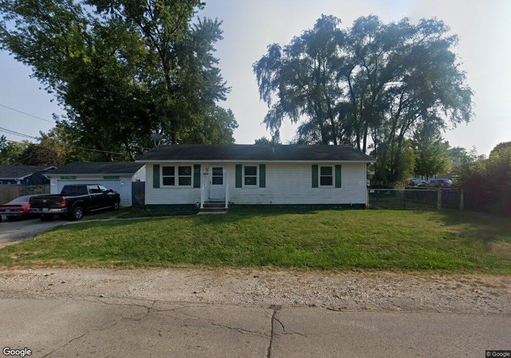
1013 Morningside Dr Round Lake Beach, IL 60073
Estimated Value: $225,000 - $248,000
3
Beds
1
Bath
1,056
Sq Ft
$225/Sq Ft
Est. Value
About This Home
This home is located at 1013 Morningside Dr, Round Lake Beach, IL 60073 and is currently estimated at $237,230, approximately $224 per square foot. 1013 Morningside Dr is a home located in Lake County with nearby schools including Raymond Ellis Elementary School, Round Lake Middle School, and Round Lake High School.
Ownership History
Date
Name
Owned For
Owner Type
Purchase Details
Closed on
Nov 5, 2001
Sold by
Estes Lloyd E
Bought by
Estes Lloyd E and Estes Amy
Current Estimated Value
Home Financials for this Owner
Home Financials are based on the most recent Mortgage that was taken out on this home.
Original Mortgage
$112,500
Outstanding Balance
$52,045
Interest Rate
9.25%
Estimated Equity
$185,185
Purchase Details
Closed on
Mar 21, 1997
Sold by
Fischer Timothy G and Fischer Sandra J
Bought by
Estes Lloyd E
Home Financials for this Owner
Home Financials are based on the most recent Mortgage that was taken out on this home.
Original Mortgage
$90,250
Interest Rate
7.74%
Mortgage Type
FHA
Create a Home Valuation Report for This Property
The Home Valuation Report is an in-depth analysis detailing your home's value as well as a comparison with similar homes in the area
Home Values in the Area
Average Home Value in this Area
Purchase History
| Date | Buyer | Sale Price | Title Company |
|---|---|---|---|
| Estes Lloyd E | -- | -- | |
| Estes Lloyd E | $91,000 | -- |
Source: Public Records
Mortgage History
| Date | Status | Borrower | Loan Amount |
|---|---|---|---|
| Open | Estes Lloyd E | $112,500 | |
| Closed | Estes Lloyd E | $90,250 |
Source: Public Records
Tax History Compared to Growth
Tax History
| Year | Tax Paid | Tax Assessment Tax Assessment Total Assessment is a certain percentage of the fair market value that is determined by local assessors to be the total taxable value of land and additions on the property. | Land | Improvement |
|---|---|---|---|---|
| 2024 | $4,403 | $60,910 | $10,998 | $49,912 |
| 2023 | $4,336 | $53,240 | $9,613 | $43,627 |
| 2022 | $4,336 | $49,631 | $8,516 | $41,115 |
| 2021 | $4,608 | $47,703 | $8,185 | $39,518 |
| 2020 | $4,437 | $45,693 | $7,788 | $37,905 |
| 2019 | $4,298 | $43,839 | $7,472 | $36,367 |
| 2018 | $4,204 | $38,495 | $7,276 | $31,219 |
| 2017 | $4,108 | $36,210 | $6,844 | $29,366 |
| 2016 | $3,918 | $33,426 | $6,318 | $27,108 |
| 2015 | $3,787 | $30,537 | $5,772 | $24,765 |
| 2014 | $4,332 | $35,059 | $5,342 | $29,717 |
| 2012 | $4,338 | $36,615 | $5,579 | $31,036 |
Source: Public Records
Map
Nearby Homes
- 1503 Cherokee Dr
- 1506 Brentwood Dr
- 1315 Cherokee Dr
- 24513 W Stub Ave
- 24471 W Poplar St
- 1110 N Fairfield Rd
- 35330 N Nielsen Dr
- 1248 N Red Oak Cir Unit 2
- 1316 N Red Oak Cir Unit 2
- 347 N Red Oak Cir Unit 406
- 1376 W Split Oak Cir
- 1256 N Split Oak Cir
- 630 Morningside Dr
- 1160 N Red Oak Cir Unit 1160-1
- 1221 N Village Dr
- 930 N Fairfield Rd
- 908 Flintwood Ct
- 1724 Lotus Dr
- 905 Buena Vista Dr
- 614 W Pheasant Ct
- 1419 Beverly Dr
- 1417 Beverly Dr
- 1420 Cherokee Dr
- 0 W Beverly Dr Unit 7077415
- 1012 Morningside Dr
- 1415 Beverly Dr
- 1418 Cherokee Dr
- 1424 Cherokee Dr
- 1416 Cherokee Dr
- 1420 Beverly Dr
- 1422 Beverly Dr
- 1425 Beverly Dr
- 1413 Beverly Dr
- 1418 Beverly Dr
- 1426 Cherokee Dr
- 1414 Cherokee Dr
- 1416 Beverly Dr
- 1427 Beverly Dr
- 1426 Beverly Dr
- 1428 Cherokee Dr