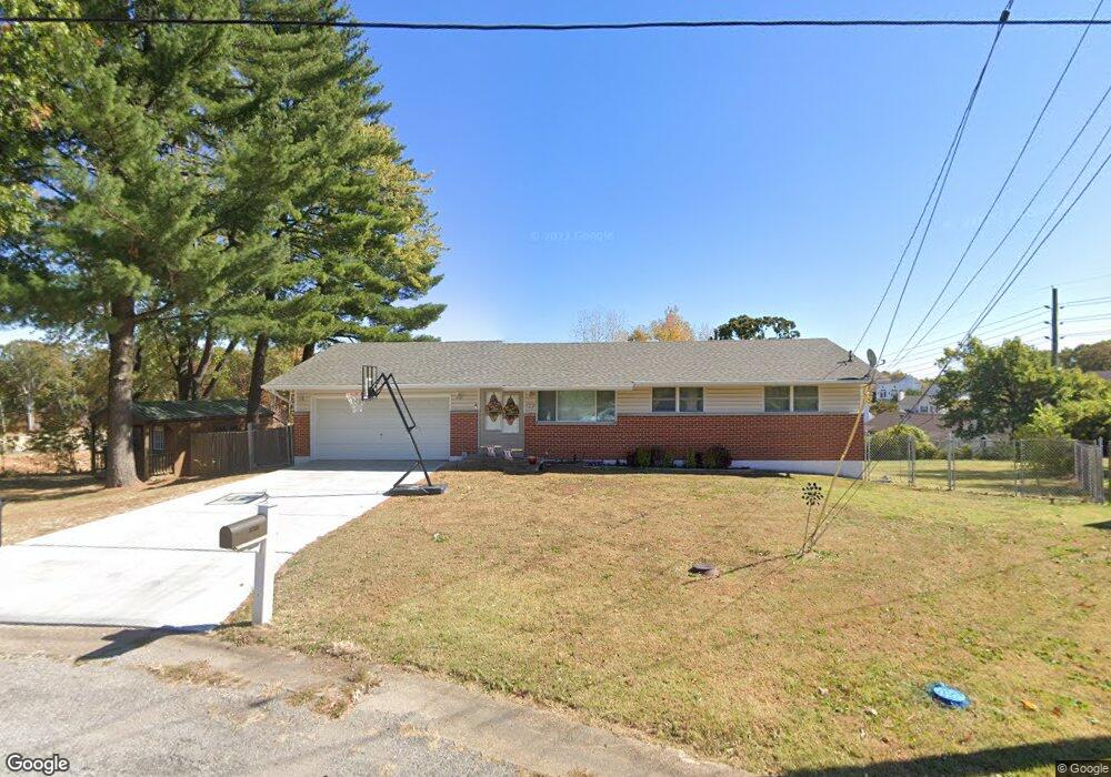
1013 Paula Dr Arnold, MO 63010
Estimated Value: $216,029 - $254,000
Studio
1
Bath
960
Sq Ft
$245/Sq Ft
Est. Value
About This Home
This home is located at 1013 Paula Dr, Arnold, MO 63010 and is currently estimated at $235,507, approximately $245 per square foot. 1013 Paula Dr is a home located in Jefferson County with nearby schools including Lone Dell Elementary School, Seckman Middle School, and Seckman Senior High School.
Ownership History
Date
Name
Owned For
Owner Type
Purchase Details
Closed on
Sep 27, 2021
Sold by
Hausner Kurt
Bought by
Hausner Kelly
Current Estimated Value
Home Financials for this Owner
Home Financials are based on the most recent Mortgage that was taken out on this home.
Original Mortgage
$152,000
Outstanding Balance
$137,097
Interest Rate
2.8%
Mortgage Type
Purchase Money Mortgage
Estimated Equity
$98,410
Purchase Details
Closed on
Aug 24, 2010
Sold by
Vance Terry Lynn
Bought by
Vance Lula Mae
Purchase Details
Closed on
Mar 3, 2006
Sold by
Drapp Rick
Bought by
Vance Lula Mae and Vance Terry Lynn
Purchase Details
Closed on
Aug 30, 2002
Sold by
Camp Clarence and Camp Mildred
Bought by
Drapp Rick
Create a Home Valuation Report for This Property
The Home Valuation Report is an in-depth analysis detailing your home's value as well as a comparison with similar homes in the area
Home Values in the Area
Average Home Value in this Area
Purchase History
| Date | Buyer | Sale Price | Title Company |
|---|---|---|---|
| Hausner Kelly | -- | True Title | |
| Hausner Kelly | -- | None Listed On Document | |
| Vance Lula Mae | -- | None Available | |
| Vance Lula Mae | -- | Security Title | |
| Drapp Rick | -- | Gateway Title Co |
Source: Public Records
Mortgage History
| Date | Status | Borrower | Loan Amount |
|---|---|---|---|
| Open | Hausner Kelly | $152,000 | |
| Closed | Hausner Kelly | $152,000 |
Source: Public Records
Tax History
| Year | Tax Paid | Tax Assessment Tax Assessment Total Assessment is a certain percentage of the fair market value that is determined by local assessors to be the total taxable value of land and additions on the property. | Land | Improvement |
|---|---|---|---|---|
| 2025 | $1,106 | $16,700 | $1,800 | $14,900 |
| 2024 | $1,106 | $15,500 | $1,800 | $13,700 |
| 2023 | $1,106 | $15,500 | $1,800 | $13,700 |
| 2022 | $1,099 | $15,500 | $1,800 | $13,700 |
| 2021 | $1,099 | $15,500 | $1,800 | $13,700 |
| 2020 | $1,018 | $13,600 | $1,400 | $12,200 |
| 2019 | $1,021 | $13,600 | $1,400 | $12,200 |
| 2018 | $1,013 | $13,600 | $1,400 | $12,200 |
| 2017 | $981 | $13,600 | $1,400 | $12,200 |
| 2016 | $837 | $12,500 | $1,700 | $10,800 |
| 2015 | $839 | $12,500 | $1,700 | $10,800 |
| 2013 | -- | $12,200 | $1,700 | $10,500 |
Source: Public Records
Map
Nearby Homes
- 1018 Paula Dr
- 1006 Paula Dr
- 3339 Vine Clad Hill Dr
- 3352 Vine Clad Hill Dr
- 3 Jeremy Ct
- 3392 Vine Clad Hill Dr
- 2107 Henley Woods Dr
- 2836 Harmony Ridge Dr
- 3600 Gary Rd
- 2282 Benton Dr
- 4543 Bella Terra Dr
- 4584 Bella Terra Dr
- 4573 Bella Terra Dr
- 4585 Bella Terra Dr
- 3 Ashford at Bella Terra
- 2 Royal II at Bella Terra
- 2 Berwick at Bella Terra
- 2 Maple at Bella Terra
- 4825 Sierra View Place
- 3 Sterling at Bella Terra
- 1014 Paula Dr
- 3023 Jamie Ct
- 3027 Jamie Ct
- 3019 Jamie Ct
- 3308 Vine Clad Hill Dr
- 1015 Paula Dr
- 1011 Paula Dr
- 3015 Jamie Ct
- 1035 Paula Dr
- 3031 Jamie Ct
- 1034 Paula Dr
- 3011 Jamie Ct
- 1016 Paula Dr
- 3022 Jamie Ct
- 1020 Paula Dr
- 3035 Jamie Ct
- 3320 Vine Clad Hill Dr
- 3300 Vine Clad Hill Dr
- 3030 Jamie Ct
- 3018 Jamie Ct
Your Personal Tour Guide
Ask me questions while you tour the home.