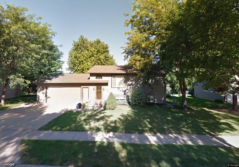
1013 S Dale Dr Sioux Falls, SD 57110
East Side NeighborhoodEstimated Value: $297,000 - $323,000
4
Beds
2
Baths
1,802
Sq Ft
$172/Sq Ft
Est. Value
About This Home
This home is located at 1013 S Dale Dr, Sioux Falls, SD 57110 and is currently estimated at $309,349, approximately $171 per square foot. 1013 S Dale Dr is a home located in Minnehaha County with nearby schools including Rosa Parks Elementary School, Washington High School, and Sioux Falls Christian Elementary School.
Ownership History
Date
Name
Owned For
Owner Type
Purchase Details
Closed on
Dec 7, 2018
Sold by
Schuld Dwight L and Schuld Linda K
Bought by
Vargas Joel J
Current Estimated Value
Home Financials for this Owner
Home Financials are based on the most recent Mortgage that was taken out on this home.
Original Mortgage
$171,121
Outstanding Balance
$151,062
Interest Rate
4.9%
Mortgage Type
New Conventional
Estimated Equity
$158,287
Create a Home Valuation Report for This Property
The Home Valuation Report is an in-depth analysis detailing your home's value as well as a comparison with similar homes in the area
Home Values in the Area
Average Home Value in this Area
Purchase History
| Date | Buyer | Sale Price | Title Company |
|---|---|---|---|
| Vargas Joel J | $200,000 | Stewart Title Company |
Source: Public Records
Mortgage History
| Date | Status | Borrower | Loan Amount |
|---|---|---|---|
| Open | Vargas Joel J | $171,121 |
Source: Public Records
Tax History
| Year | Tax Paid | Tax Assessment Tax Assessment Total Assessment is a certain percentage of the fair market value that is determined by local assessors to be the total taxable value of land and additions on the property. | Land | Improvement |
|---|---|---|---|---|
| 2024 | $3,611 | $238,800 | $35,600 | $203,200 |
| 2023 | $3,344 | $234,300 | $35,600 | $198,700 |
| 2022 | $3,372 | $223,200 | $35,600 | $187,600 |
| 2021 | $2,705 | $183,500 | $0 | $0 |
| 2020 | $2,705 | $170,500 | $0 | $0 |
| 2019 | $2,683 | $166,183 | $0 | $0 |
| 2018 | $2,514 | $159,689 | $0 | $0 |
| 2017 | $2,310 | $156,411 | $32,959 | $123,452 |
| 2016 | $2,310 | $143,302 | $32,959 | $110,343 |
| 2015 | $2,255 | $134,428 | $31,020 | $103,408 |
| 2014 | $2,218 | $133,700 | $31,459 | $102,241 |
Source: Public Records
Map
Nearby Homes
- 5105 E 17th St
- 5116 E 16th St
- 918 S Charlotte Ave
- 4301 E 19th St
- 905 S Charlotte Ave
- 1115 S Foss Ave
- 1201 S Foss Ave
- 932 S Kennedy Ave
- 604 S Charlotte Ave
- 600 S Charlotte Ave
- 4900 E Cattail Dr
- 5001 E Cattail Dr
- 4800 Grant St
- 3609 & 3611 E 18th St St
- 3921 E Claudette Dr
- 3917 E Claudette Dr
- 108 S Sycamore Ave
- 107 S Hampton Ave
- 4620 E Hanna Cir
- 709 S Annway Dr
- 1101 S Dale Dr
- 1009 S Dale Dr
- 1100 S Dale Dr
- 1008 S Suburban Dr
- 1012 S Dale Dr
- 1012 S Suburban Dr
- 1105 S Dale Dr
- 1005 S Dale Dr
- 1004 S Suburban Dr
- 1104 S Dale Dr
- 1100 S Suburban Dr
- 1008 S Dale Dr
- 1000 S Suburban Dr
- 1104 S Suburban Dr
- 1109 S Dale Dr
- 4705 E 16th St
- 1108 S Dale Dr
- 1004 S Dale Dr
- 1101 S Gordon Dr
- 1108 S Suburban Dr
Your Personal Tour Guide
Ask me questions while you tour the home.