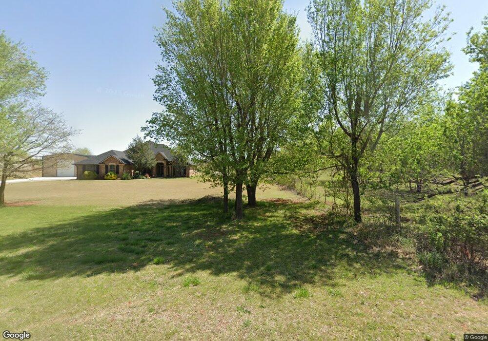
1013 S Morgan Rd Blanchard, OK 73010
Bridge Creek NeighborhoodEstimated Value: $356,000 - $434,000
3
Beds
2
Baths
1,902
Sq Ft
$200/Sq Ft
Est. Value
About This Home
This home is located at 1013 S Morgan Rd, Blanchard, OK 73010 and is currently estimated at $380,910, approximately $200 per square foot. 1013 S Morgan Rd is a home with nearby schools including Bridge Creek Elementary School, Bridge Creek Middle School, and Bridge Creek High School.
Ownership History
Date
Name
Owned For
Owner Type
Purchase Details
Closed on
Oct 28, 2013
Sold by
Black Donald F and Black To
Bought by
Smith Tiffany D and Smith Gary
Current Estimated Value
Purchase Details
Closed on
Oct 28, 2011
Sold by
Tri City Builder Llc
Bought by
Black Donald F and Black Tonya M
Home Financials for this Owner
Home Financials are based on the most recent Mortgage that was taken out on this home.
Original Mortgage
$187,301
Interest Rate
4.14%
Mortgage Type
VA
Create a Home Valuation Report for This Property
The Home Valuation Report is an in-depth analysis detailing your home's value as well as a comparison with similar homes in the area
Home Values in the Area
Average Home Value in this Area
Purchase History
| Date | Buyer | Sale Price | Title Company |
|---|---|---|---|
| Smith Tiffany D | $200,000 | -- | |
| Black Donald F | $182,000 | None Available |
Source: Public Records
Mortgage History
| Date | Status | Borrower | Loan Amount |
|---|---|---|---|
| Previous Owner | Black Donald F | $187,301 |
Source: Public Records
Tax History Compared to Growth
Tax History
| Year | Tax Paid | Tax Assessment Tax Assessment Total Assessment is a certain percentage of the fair market value that is determined by local assessors to be the total taxable value of land and additions on the property. | Land | Improvement |
|---|---|---|---|---|
| 2025 | $4,011 | $36,019 | $2,857 | $33,162 |
| 2024 | $3,818 | $34,304 | $2,721 | $31,583 |
| 2023 | $3,818 | $32,670 | $2,926 | $29,744 |
| 2022 | $2,988 | $26,811 | $2,859 | $23,952 |
| 2021 | $2,866 | $25,645 | $2,671 | $22,974 |
| 2020 | $2,759 | $24,424 | $2,162 | $22,262 |
| 2019 | $2,621 | $23,261 | $1,650 | $21,611 |
| 2018 | $2,505 | $22,153 | $1,963 | $20,190 |
| 2017 | $2,384 | $21,936 | $1,853 | $20,083 |
| 2016 | $2,413 | $21,968 | $1,684 | $20,284 |
| 2015 | $2,395 | $21,321 | $1,452 | $19,869 |
| 2014 | $2,395 | $22,000 | $2,200 | $19,800 |
Source: Public Records
Map
Nearby Homes
- 996 S Morgan Rd
- 979 County Street 2984
- 981 County Street 2984
- 1075 S Morgan Rd
- 0 Cr 2987 Unit 1146787
- 2343 County Road 1214
- 2380 Holden Ln
- 954 County Street 2983
- 965 County Street 2983
- 2330 Dixie Dr
- 1036 County Street 2982
- 1063 Somersworth Ct
- 2318 Baker St
- 2320 Baker St
- 2316 Baker St
- 915 Red Rock Rd St
- 2297 Barrington Dr
- 3921 NW 6th St
- 882 Oakley Dr
- 0 S County Line Rd
- 1009 S Morgan Rd
- 1011 S Morgan Rd
- 1016 S Morgan Rd
- 1004 S Morgan Rd
- 2398 Lake Front Dr
- 1025 S Morgan Rd
- 1000 S Morgan
- 1020 S Morgan Rd
- 2423 Fox Ln
- 1013 Lake Front Dr
- 2408 County Road 1223
- 2408 Fox Ln
- 1017 Lake Front Dr
- 1019 Lake Front Dr
- 2412 Fox Ln
- 2402 County Road 1223
- 2417 Fox Ln
- 1005 Lake Front Dr
- 996 County Street 2980
- 2412 County Road 1223