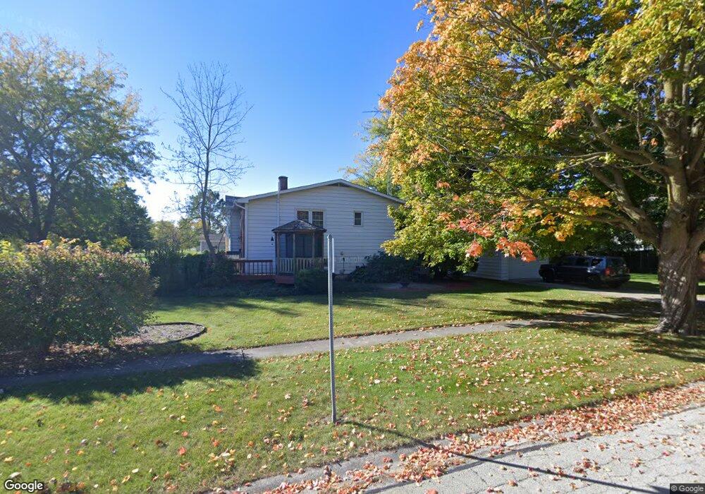
1013 Sharon Dr Dekalb, IL 60115
Estimated Value: $276,000 - $333,000
Studio
--
Bath
1,500
Sq Ft
$206/Sq Ft
Est. Value
About This Home
This home is located at 1013 Sharon Dr, Dekalb, IL 60115 and is currently estimated at $308,586, approximately $205 per square foot. 1013 Sharon Dr is a home located in DeKalb County with nearby schools including Tyler Elementary School, Huntley Middle School, and De Kalb High School.
Ownership History
Date
Name
Owned For
Owner Type
Purchase Details
Closed on
Nov 22, 2019
Sold by
Burski Steven L
Bought by
Keneway Scott and Keneway Karen
Current Estimated Value
Home Financials for this Owner
Home Financials are based on the most recent Mortgage that was taken out on this home.
Original Mortgage
$195,000
Outstanding Balance
$172,059
Interest Rate
3.75%
Mortgage Type
Commercial
Estimated Equity
$136,527
Purchase Details
Closed on
Jul 29, 2005
Sold by
Schreiber Patricia G
Bought by
Burski Steven L
Home Financials for this Owner
Home Financials are based on the most recent Mortgage that was taken out on this home.
Original Mortgage
$165,000
Interest Rate
5.71%
Mortgage Type
New Conventional
Create a Home Valuation Report for This Property
The Home Valuation Report is an in-depth analysis detailing your home's value as well as a comparison with similar homes in the area
Home Values in the Area
Average Home Value in this Area
Purchase History
| Date | Buyer | Sale Price | Title Company |
|---|---|---|---|
| Keneway Scott | $192,000 | Attorney | |
| Burski Steven L | -- | Attorney | |
| Burski Steven L | $231,500 | -- |
Source: Public Records
Mortgage History
| Date | Status | Borrower | Loan Amount |
|---|---|---|---|
| Open | Keneway Scott | $195,000 | |
| Previous Owner | Burski Steven L | $165,000 |
Source: Public Records
Tax History
| Year | Tax Paid | Tax Assessment Tax Assessment Total Assessment is a certain percentage of the fair market value that is determined by local assessors to be the total taxable value of land and additions on the property. | Land | Improvement |
|---|---|---|---|---|
| 2024 | $7,053 | $86,816 | $15,040 | $71,776 |
| 2023 | $6,909 | $75,697 | $13,114 | $62,583 |
| 2022 | $6,909 | $69,111 | $14,966 | $54,145 |
| 2021 | $7,095 | $64,820 | $14,037 | $50,783 |
| 2020 | $7,250 | $63,786 | $13,813 | $49,973 |
| 2019 | $6,412 | $61,279 | $13,270 | $48,009 |
| 2018 | $6,237 | $59,201 | $12,820 | $46,381 |
| 2017 | $6,270 | $56,907 | $12,323 | $44,584 |
| 2016 | $6,181 | $55,470 | $12,012 | $43,458 |
| 2015 | -- | $52,558 | $11,381 | $41,177 |
| 2014 | -- | $53,213 | $16,467 | $36,746 |
| 2013 | -- | $55,896 | $17,297 | $38,599 |
Source: Public Records
Map
Nearby Homes
- 1177 Golf Ct
- 1169 Golf Ct
- 910 Dawn Ct
- 1212 Bellevue Dr
- 1205 S 1st St
- 838 Glidden Ave
- 430 Turnbury Ct E
- 110 Pooler Ave
- 100 Warren Place
- 673 Haish Blvd
- 631 Haish Blvd
- 1118 Holmes Place
- 720 S 2nd St
- 216 Pardridge Place
- 1734 Sunglow Ln
- 1723 Goldenrod Turn
- 1663 Furrow St
- 1692 Furrow St
- 1748 Furrow St
- 451 Thresher St
- 1015 Sharon Dr
- 1016 Ashley Dr Unit 16
- 1015 Ashley Dr Unit 15
- 1017 Ashley Dr Unit 17
- 1014 Ashley Dr Unit 14
- 1013 Ashley Dr Unit 13
- 1018 Ashley Dr Unit 18
- 1003 Susan Ct
- 1016 Sharon Dr
- 1012 Ashley Dr Unit 12
- 1026 Ashley Dr Unit 26
- 1019 Ashley Dr Unit 19
- 931 Sharon Dr
- 1020 Ashley Dr Unit 20
- 1020 Ashley Dr Unit 1
- 1025 Ashley Dr Unit 25
- 1022 Ashley Dr Unit 22
- 1021 Ashley Dr Unit 21
- 1011 Ashley Dr Unit 11
- 1024 Ashley Dr Unit 24
Your Personal Tour Guide
Ask me questions while you tour the home.