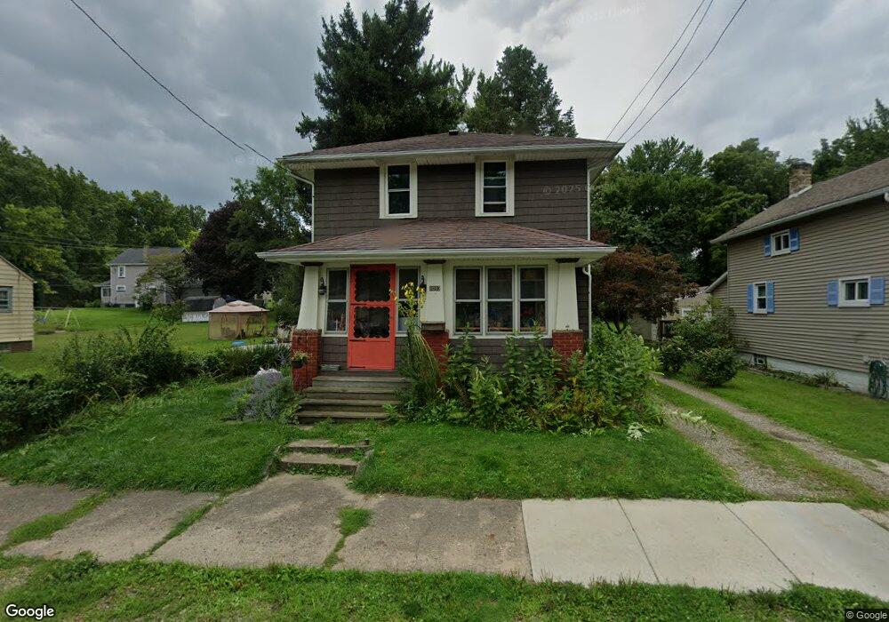
1013 South St Alliance, OH 44601
Estimated Value: $79,363 - $102,000
3
Beds
1
Bath
1,144
Sq Ft
$81/Sq Ft
Est. Value
About This Home
This home is located at 1013 South St, Alliance, OH 44601 and is currently estimated at $93,091, approximately $81 per square foot. 1013 South St is a home located in Stark County with nearby schools including Alliance Elementary School at Rockhill, Alliance Intermediate School at Northside, and Alliance Middle School.
Create a Home Valuation Report for This Property
The Home Valuation Report is an in-depth analysis detailing your home's value as well as a comparison with similar homes in the area
Home Values in the Area
Average Home Value in this Area
Tax History Compared to Growth
Tax History
| Year | Tax Paid | Tax Assessment Tax Assessment Total Assessment is a certain percentage of the fair market value that is determined by local assessors to be the total taxable value of land and additions on the property. | Land | Improvement |
|---|---|---|---|---|
| 2025 | -- | $20,870 | $2,980 | $17,890 |
| 2024 | -- | $20,870 | $2,980 | $17,890 |
| 2023 | $698 | $17,370 | $3,050 | $14,320 |
| 2022 | $703 | $17,370 | $3,050 | $14,320 |
| 2021 | $703 | $17,370 | $3,050 | $14,320 |
| 2020 | $610 | $14,070 | $2,660 | $11,410 |
| 2019 | $601 | $14,070 | $2,660 | $11,410 |
| 2018 | $604 | $14,070 | $2,660 | $11,410 |
| 2017 | $538 | $12,330 | $2,210 | $10,120 |
| 2016 | $543 | $12,330 | $2,210 | $10,120 |
| 2015 | $547 | $12,330 | $2,210 | $10,120 |
| 2014 | $395 | $8,480 | $2,030 | $6,450 |
| 2013 | $197 | $8,480 | $2,030 | $6,450 |
Source: Public Records
Map
Nearby Homes
- 1233 Woodland Ave
- 1395 S Webb Ave
- 729 Waugh St
- 815 Grace St
- 814 Milner St
- 1044 S Liberty Ave
- 551 South St
- 831 Wade Ave
- 1175 S Freedom Ave
- 1005 S Freedom Ave
- 1437 S Linden Ave
- 390 E College St
- 1846 S Freedom Ave
- 452 E Summit St
- 1475 Chatauqua Ct
- 442 S Liberty Ave
- 317 E State St
- 112 E College St
- 432 S Linden Ave
- V/L S Fredeom Ave