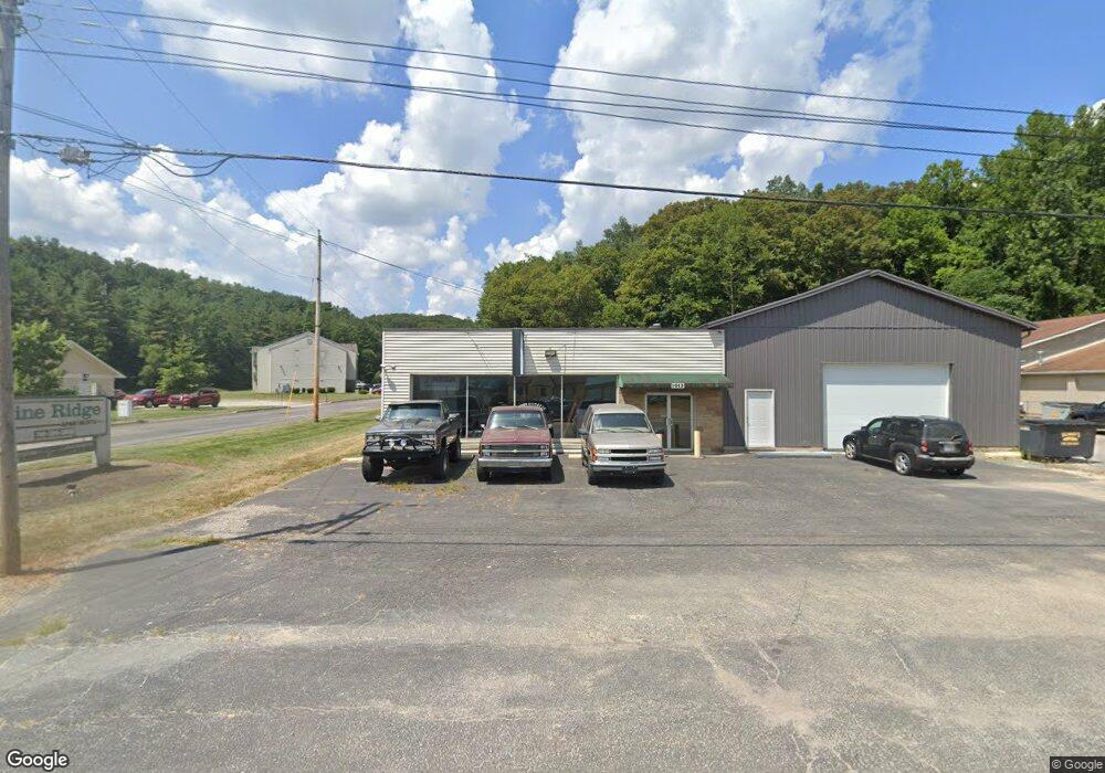
Estimated Value: $101,665
--
Bed
--
Bath
4,160
Sq Ft
$24/Sq Ft
Est. Value
About This Home
This home is located at 1013 State Route 93 N, Logan, OH 43138 and is currently estimated at $101,665, approximately $24 per square foot. 1013 State Route 93 N is a home located in Hocking County with nearby schools including Central Elementary School, St. John the Evangelist School, and Logan Christian School.
Ownership History
Date
Name
Owned For
Owner Type
Purchase Details
Closed on
Aug 26, 2021
Sold by
Mcbride Ralph A
Bought by
Pizza Baker Inc
Current Estimated Value
Purchase Details
Closed on
Apr 5, 2012
Sold by
Lestourgeion Marion B
Bought by
Mcbride Ralph A
Home Financials for this Owner
Home Financials are based on the most recent Mortgage that was taken out on this home.
Original Mortgage
$110,000
Interest Rate
3.95%
Mortgage Type
Commercial
Purchase Details
Closed on
Sep 12, 2004
Bought by
Mcbride Ralph A Jr 10561 Walnut
Create a Home Valuation Report for This Property
The Home Valuation Report is an in-depth analysis detailing your home's value as well as a comparison with similar homes in the area
Home Values in the Area
Average Home Value in this Area
Purchase History
| Date | Buyer | Sale Price | Title Company |
|---|---|---|---|
| Pizza Baker Inc | $77,800 | None Available | |
| Mcbride Ralph A | $110,000 | None Available | |
| Mcbride Ralph A Jr 10561 Walnut | $110,000 | -- |
Source: Public Records
Mortgage History
| Date | Status | Borrower | Loan Amount |
|---|---|---|---|
| Previous Owner | Mcbride Ralph A | $110,000 |
Source: Public Records
Tax History Compared to Growth
Tax History
| Year | Tax Paid | Tax Assessment Tax Assessment Total Assessment is a certain percentage of the fair market value that is determined by local assessors to be the total taxable value of land and additions on the property. | Land | Improvement |
|---|---|---|---|---|
| 2024 | $1,152 | $25,260 | $3,910 | $21,350 |
| 2023 | $1,152 | $25,260 | $3,910 | $21,350 |
| 2022 | $1,134 | $25,260 | $3,910 | $21,350 |
| 2021 | $718 | $14,980 | $2,600 | $12,380 |
| 2020 | $714 | $14,980 | $2,600 | $12,380 |
| 2019 | $721 | $14,980 | $2,600 | $12,380 |
| 2018 | $704 | $14,980 | $2,600 | $12,380 |
| 2017 | $693 | $14,980 | $2,600 | $12,380 |
| 2016 | $667 | $14,980 | $2,600 | $12,380 |
| 2015 | $989 | $21,820 | $9,440 | $12,380 |
| 2014 | $989 | $21,820 | $9,440 | $12,380 |
| 2013 | $995 | $21,820 | $9,440 | $12,380 |
Source: Public Records
Map
Nearby Homes
- 1353 Colorado Ave
- 825 Edgehill Dr
- 1138 Ohio Ave
- 347 Belva Ct
- 707 Edgehill Dr
- 335 Vine St
- 733 Walnut Dr
- 288 Walnut Dr
- 862 Walnut Dowler Rd
- 582 N Walnut St
- 165 N Homer Ave
- 687 N Walnut St
- 586 E Main St
- 571 E Main St
- 90 S Culver St
- State Route 328
- 0 Clay Bank Rd
- 993 Tolliver Rd
- 605 Glenwood Dr
- 67 W Front St
- 33601 Pine Ridge Dr
- 1077 State Route 93 N
- 1026 State Route 93 N
- 1109 State Route 93 N
- 1109 State Route 93 N
- 1013 Ohio 93
- 941 State Route 93 N
- 919 State Route 93 N
- 1159 State Route 93 N
- 1023 State Route 93 N
- 1078 State Route 93 N
- 1161 State Route 93 N
- 1191 State Route 93 N
- 883 State Route 93 N
- 564 Edgehill Cir
- 570 Edgehill Cir
- 558 Edgehill Cir
- 12731 State Route 93 N
- 552 Edgehill Cir
- 557 Edgehill Cir
