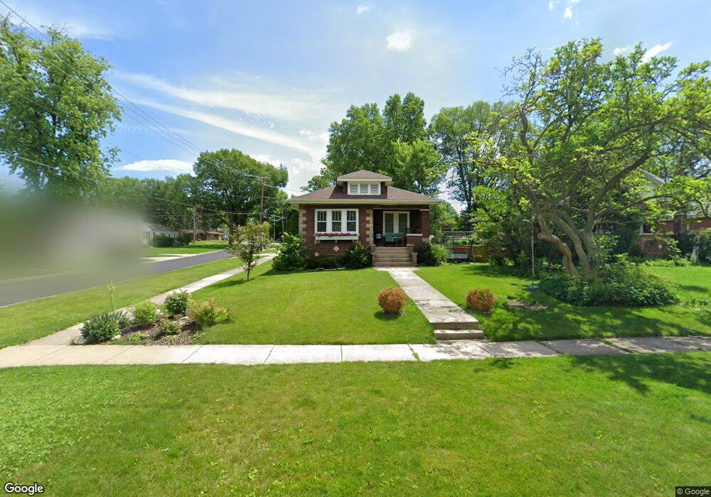
1013 Webster Ave Wheaton, IL 60187
Hawthorne NeighborhoodEstimated Value: $352,000 - $400,864
2
Beds
2
Baths
1,015
Sq Ft
$373/Sq Ft
Est. Value
About This Home
This home is located at 1013 Webster Ave, Wheaton, IL 60187 and is currently estimated at $378,966, approximately $373 per square foot. 1013 Webster Ave is a home located in DuPage County with nearby schools including Hawthorne Elementary School, Franklin Middle School, and Wheaton North High School.
Ownership History
Date
Name
Owned For
Owner Type
Purchase Details
Closed on
Aug 21, 2014
Sold by
Lewis Mark and Lewis Mary
Bought by
Mangin Andrew P and Mangin Katy A
Current Estimated Value
Home Financials for this Owner
Home Financials are based on the most recent Mortgage that was taken out on this home.
Original Mortgage
$215,270
Outstanding Balance
$167,214
Interest Rate
4.62%
Mortgage Type
New Conventional
Estimated Equity
$211,752
Purchase Details
Closed on
Apr 20, 2007
Sold by
Newenhuyse Frederick J and Newenhuyse Elizabeth C
Bought by
Lewis Mark and Lewis Mary
Create a Home Valuation Report for This Property
The Home Valuation Report is an in-depth analysis detailing your home's value as well as a comparison with similar homes in the area
Home Values in the Area
Average Home Value in this Area
Purchase History
| Date | Buyer | Sale Price | Title Company |
|---|---|---|---|
| Mangin Andrew P | $226,000 | Regency Title Services Inc | |
| Lewis Mark | $242,500 | None Available |
Source: Public Records
Mortgage History
| Date | Status | Borrower | Loan Amount |
|---|---|---|---|
| Open | Mangin Andrew P | $215,270 |
Source: Public Records
Tax History
| Year | Tax Paid | Tax Assessment Tax Assessment Total Assessment is a certain percentage of the fair market value that is determined by local assessors to be the total taxable value of land and additions on the property. | Land | Improvement |
|---|---|---|---|---|
| 2024 | $6,854 | $114,343 | $25,128 | $89,215 |
| 2023 | $6,572 | $105,250 | $23,130 | $82,120 |
| 2022 | $6,473 | $99,470 | $21,860 | $77,610 |
| 2021 | $6,448 | $97,110 | $21,340 | $75,770 |
| 2020 | $6,427 | $96,200 | $21,140 | $75,060 |
| 2019 | $6,276 | $93,660 | $20,580 | $73,080 |
| 2018 | $5,445 | $81,170 | $19,390 | $61,780 |
| 2017 | $5,356 | $78,170 | $18,670 | $59,500 |
| 2016 | $5,277 | $75,040 | $17,920 | $57,120 |
| 2015 | $5,228 | $71,590 | $17,100 | $54,490 |
| 2014 | $5,038 | $70,510 | $16,590 | $53,920 |
| 2013 | $4,909 | $70,720 | $16,640 | $54,080 |
Source: Public Records
Map
Nearby Homes
- 817 E Forest Ave
- 720 E Harrison Ave
- 820 Cherry St
- 1607 Stoddard Ave
- 582 Glendale Ave
- 314 E Jefferson Ave
- 312 E Lincoln Ave
- 412 Lawrence Ave
- 404 Lawrence Ave
- 808 Bridle Ln
- 123 S Blanchard St
- 1017 N Main St
- 1115 N Main St
- 1603 Ashton Ct
- 1906 N Summit St
- 111 W Prairie Ave
- 114 W Prairie Ave
- 328 Lorraine St
- 110 Travers Ave
- 353 E Liberty Dr
- 1009 Webster Ave
- 1005 Webster Ave
- 903 E Forest Ave
- 1014 N President St
- 1010 N President St
- 1001 Webster Ave
- 1025 Webster Ave
- 1006 N President St
- 816 E Forest Ave
- 919 E Forest Ave
- 919 E Forest Ave
- 1029 Webster Ave
- 929 Webster Ave
- 1002 N President St
- 1028 N President St
- 1026 Webster Ave
- 1002 Webster Ave
- 925 Webster Ave
- 1102 N President St
- 1105 Webster Ave
Your Personal Tour Guide
Ask me questions while you tour the home.