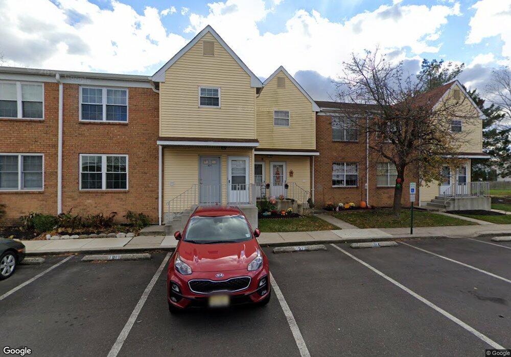
1013 Woodchip Rd Unit 1013 Lumberton, NJ 08048
Estimated Value: $201,000 - $222,497
--
Bed
--
Bath
1,001
Sq Ft
$213/Sq Ft
Est. Value
About This Home
This home is located at 1013 Woodchip Rd Unit 1013, Lumberton, NJ 08048 and is currently estimated at $213,374, approximately $213 per square foot. 1013 Woodchip Rd Unit 1013 is a home located in Burlington County with nearby schools including Ashbrook Elementary School, Bobby’s Run School, and Lumberton Middle School.
Ownership History
Date
Name
Owned For
Owner Type
Purchase Details
Closed on
Feb 26, 2008
Sold by
Moonesar Rusta and Moonesar Castulie
Bought by
Asbury Teresa A and Windham Jamaal R
Current Estimated Value
Home Financials for this Owner
Home Financials are based on the most recent Mortgage that was taken out on this home.
Original Mortgage
$118,655
Outstanding Balance
$73,243
Interest Rate
5.57%
Mortgage Type
Purchase Money Mortgage
Estimated Equity
$140,131
Purchase Details
Closed on
Oct 31, 2005
Sold by
Massa Diane G and Marvin Diane
Bought by
Moonesar Rusta and Moonesar Castulie
Home Financials for this Owner
Home Financials are based on the most recent Mortgage that was taken out on this home.
Original Mortgage
$17,850
Interest Rate
5.69%
Mortgage Type
Stand Alone Second
Create a Home Valuation Report for This Property
The Home Valuation Report is an in-depth analysis detailing your home's value as well as a comparison with similar homes in the area
Home Values in the Area
Average Home Value in this Area
Purchase History
| Date | Buyer | Sale Price | Title Company |
|---|---|---|---|
| Asbury Teresa A | $124,900 | Weichert Title Agency | |
| Moonesar Rusta | $119,000 | Executive Title & Abstract I |
Source: Public Records
Mortgage History
| Date | Status | Borrower | Loan Amount |
|---|---|---|---|
| Open | Asbury Teresa A | $118,655 | |
| Previous Owner | Moonesar Rusta | $17,850 |
Source: Public Records
Tax History Compared to Growth
Tax History
| Year | Tax Paid | Tax Assessment Tax Assessment Total Assessment is a certain percentage of the fair market value that is determined by local assessors to be the total taxable value of land and additions on the property. | Land | Improvement |
|---|---|---|---|---|
| 2025 | $3,482 | $130,800 | $20,000 | $110,800 |
| 2024 | $3,274 | $130,800 | $20,000 | $110,800 |
| 2023 | $3,274 | $130,800 | $20,000 | $110,800 |
| 2022 | $3,198 | $130,800 | $20,000 | $110,800 |
| 2021 | $3,189 | $130,800 | $20,000 | $110,800 |
| 2020 | $3,161 | $130,800 | $20,000 | $110,800 |
| 2019 | $3,126 | $130,800 | $20,000 | $110,800 |
| 2018 | $3,079 | $130,800 | $20,000 | $110,800 |
| 2017 | $3,021 | $130,800 | $20,000 | $110,800 |
| 2016 | $2,956 | $130,800 | $20,000 | $110,800 |
| 2015 | $2,934 | $130,800 | $20,000 | $110,800 |
| 2014 | $2,823 | $130,800 | $20,000 | $110,800 |
Source: Public Records
Map
Nearby Homes
- 103 Sandstone Ct Unit 103
- 4 Saffron Dr
- 16 Basil Dr
- 21 Mulberry Ct
- 48 Whitebirch Ct
- 50 Blue Spruce Ct
- 692 Eayrestown Rd
- 511 Hamilton Ave
- 225 Ashley Ln
- 11 Abington Way
- 39 Tynemouth Dr
- 240 Pine St
- 143 Hulme St
- 137 Hulme St
- 001 Fieldstone Dr
- 107 Hulme St
- 18 Westminster Dr
- The Laurelton Plan at East Gate at Wexford
- The Marigold Plan at East Gate at Wexford
- The Ashton Plan at East Gate at Wexford
- 1016 Woodchip Rd Unit 1016
- 1015 Woodchip Rd Unit 1015
- 1014 Woodchip Rd Unit 1014
- 1011 Woodchip Rd
- 1012 Woodchip Rd Unit 1012
- 1010 Woodchip Rd Unit 1010
- 1009 Woodchip Rd Unit 1009
- 1007 Woodchip Rd Unit 1007
- 1008 Woodchip Rd Unit 1008
- 75 Fawn Ct
- 73 Fawn Ct
- 805 Woodchip Rd Unit 805
- 1006 Woodchip Rd Unit 1006
- 71 Fawn Ct
- 1005 Woodchip Rd
- 806 Woodchip Rd
- 901 Woodchip Rd Unit 901
- 69 Fawn Ct
- 904 Woodchip Rd
- 1003 Woodchip Rd