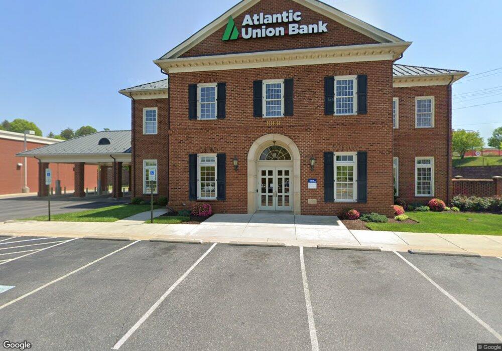
10131 Jefferson Davis Hwy Fredericksburg, VA 22407
Leavells NeighborhoodEstimated Value: $4,905,010
--
Bed
--
Bath
7,926
Sq Ft
$619/Sq Ft
Est. Value
About This Home
This home is located at 10131 Jefferson Davis Hwy, Fredericksburg, VA 22407 and is currently estimated at $4,905,010, approximately $618 per square foot. 10131 Jefferson Davis Hwy is a home located in Spotsylvania County with nearby schools including Parkside Elementary School, Spotsylvania Middle School, and Massaponax High School.
Ownership History
Date
Name
Owned For
Owner Type
Purchase Details
Closed on
Sep 28, 2018
Sold by
Fall Hill Union Llc
Bought by
Land 600 Llc
Current Estimated Value
Home Financials for this Owner
Home Financials are based on the most recent Mortgage that was taken out on this home.
Original Mortgage
$2,400,000
Outstanding Balance
$2,092,943
Interest Rate
4.5%
Mortgage Type
Commercial
Estimated Equity
$2,812,067
Purchase Details
Closed on
Jun 13, 2008
Sold by
Cc Retail Ide Llc
Bought by
Carl D Silver Holding Co Llc
Create a Home Valuation Report for This Property
The Home Valuation Report is an in-depth analysis detailing your home's value as well as a comparison with similar homes in the area
Home Values in the Area
Average Home Value in this Area
Purchase History
| Date | Buyer | Sale Price | Title Company |
|---|---|---|---|
| Land 600 Llc | $3,000,000 | Attorney | |
| Carl D Silver Holding Co Llc | $2,384,615 | -- |
Source: Public Records
Mortgage History
| Date | Status | Borrower | Loan Amount |
|---|---|---|---|
| Open | Land 600 Llc | $2,400,000 |
Source: Public Records
Tax History Compared to Growth
Tax History
| Year | Tax Paid | Tax Assessment Tax Assessment Total Assessment is a certain percentage of the fair market value that is determined by local assessors to be the total taxable value of land and additions on the property. | Land | Improvement |
|---|---|---|---|---|
| 2025 | $32,244 | $4,391,100 | $1,766,800 | $2,624,300 |
| 2024 | $32,244 | $4,391,100 | $1,766,800 | $2,624,300 |
| 2023 | $30,062 | $3,895,500 | $1,711,600 | $2,183,900 |
| 2022 | $28,737 | $3,895,500 | $1,711,600 | $2,183,900 |
| 2021 | $29,384 | $3,630,300 | $1,656,400 | $1,973,900 |
| 2020 | $29,384 | $3,630,300 | $1,656,400 | $1,973,900 |
| 2019 | $27,623 | $3,259,700 | $1,545,900 | $1,713,800 |
| 2018 | $27,153 | $3,259,700 | $1,545,900 | $1,713,800 |
| 2017 | $26,692 | $3,140,200 | $1,435,500 | $1,704,700 |
| 2016 | $26,692 | $3,140,200 | $1,435,500 | $1,704,700 |
| 2015 | -- | $2,923,100 | $1,380,300 | $1,542,800 |
| 2014 | -- | $2,923,100 | $1,380,300 | $1,542,800 |
Source: Public Records
Map
Nearby Homes
- 6200 E Dranesville Dr
- 10205 Iverson Ave
- 9649 Patriot Hwy
- 5417 E Rich Mountain Way
- 5623 E Kesslers Crossing
- 6303 W Dranesville Dr
- 5910 W Carnifex Ferry Rd
- 5033 Sewells Pointe Way
- 4534 Papillion Ct
- 5307 W Philippi Place
- 5105 Sewells Pointe Dr
- 5108 Sewells Pointe Dr
- 5112 Commonwealth Dr
- 534 Pleasants Dr
- 5114 Commonwealth Dr
- 4403 Battery Hill Ln
- 301 Patterson Ave
- 218 Sagun Dr
- 4303 Wickham Ct
- Lot72&76 Patriot Hwy
- 10141 Jefferson Davis Hwy
- 10101 Jefferson Davis Hwy
- 10109 Jefferson Davis Hwy
- 9865 Jefferson Davis Hwy
- 10115 Patriot Hwy
- 90179029 Jefferson Davis Hwy
- 10065 Jefferson Davis Hwy
- 10108 Patriot Hwy
- 9855 Jefferson Davis Hwy
- 5700 Southpoint Centre Blvd
- 5610 Southpoint Centre Blvd
- 5620 Southpoint Centre Blvd
- 9849 Jefferson Davis Hwy
- 10059 Jefferson Davis Hwy
- 4820 Southpoint Dr Unit 205
- 4820 Southpoint Dr Unit 201
- 4820 Southpoint Dr Unit 103
- 4820 Southpoint Dr Unit 204
- 4820 Southpoint Dr Unit 105
- 4820 Southpoint Dr