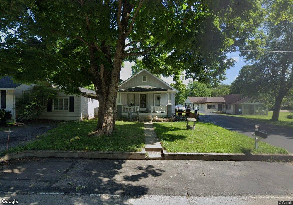
10132 Lincoln Rd Camp Dennison, OH 45111
Estimated Value: $207,000 - $262,000
3
Beds
1
Bath
1,078
Sq Ft
$212/Sq Ft
Est. Value
About This Home
This home is located at 10132 Lincoln Rd, Camp Dennison, OH 45111 and is currently estimated at $228,604, approximately $212 per square foot. 10132 Lincoln Rd is a home located in Hamilton County with nearby schools including Indian Hill Primary School, Indian Hill Elementary School, and Indian Hill Middle School.
Ownership History
Date
Name
Owned For
Owner Type
Purchase Details
Closed on
Nov 20, 2024
Sold by
Sparks Terry L
Bought by
Sparks Terry L and Sparks Judith K
Current Estimated Value
Purchase Details
Closed on
Aug 28, 2003
Sold by
Sparks Virgil R and Sparks Sylvia
Bought by
Sparks Terry L
Create a Home Valuation Report for This Property
The Home Valuation Report is an in-depth analysis detailing your home's value as well as a comparison with similar homes in the area
Home Values in the Area
Average Home Value in this Area
Purchase History
| Date | Buyer | Sale Price | Title Company |
|---|---|---|---|
| Sparks Terry L | -- | None Listed On Document | |
| Sparks Terry L | -- | None Listed On Document | |
| Sparks Terry L | -- | None Listed On Document | |
| Sparks Terry L | -- | -- |
Source: Public Records
Tax History Compared to Growth
Tax History
| Year | Tax Paid | Tax Assessment Tax Assessment Total Assessment is a certain percentage of the fair market value that is determined by local assessors to be the total taxable value of land and additions on the property. | Land | Improvement |
|---|---|---|---|---|
| 2024 | $2,382 | $51,975 | $9,191 | $42,784 |
| 2023 | $2,326 | $51,975 | $9,191 | $42,784 |
| 2022 | $1,978 | $35,844 | $8,257 | $27,587 |
| 2021 | $1,966 | $35,844 | $8,257 | $27,587 |
| 2020 | $1,743 | $35,844 | $8,257 | $27,587 |
| 2019 | $1,644 | $33,187 | $7,644 | $25,543 |
| 2018 | $1,646 | $33,187 | $7,644 | $25,543 |
| 2017 | $1,586 | $33,187 | $7,644 | $25,543 |
| 2016 | $1,361 | $27,839 | $7,875 | $19,964 |
| 2015 | $1,351 | $27,839 | $7,875 | $19,964 |
| 2014 | $1,327 | $27,839 | $7,875 | $19,964 |
| 2013 | $1,335 | $27,027 | $7,644 | $19,383 |
Source: Public Records
Map
Nearby Homes
- 221 Miami Lakes Dr
- 5 White Water Way
- 18 Big Oak Ln
- 674 Hobby Horse Ln
- 5763 Price Rd
- 8200 Kroger Farm Rd
- 764 Forest Ave
- 732 St Rt 28
- 12 Valley View Cir
- 772 Price Knoll Ln
- 574 Main St
- 22 Robbie Ridge
- Hoover Plan at Hawley Farms
- Rockford Plan at Hawley Farms
- Truman Plan at Hawley Farms
- Longwood Plan at Hawley Farms
- Avalon Plan at Hawley Farms
- Somerset Plan at Hawley Farms
- Sanibel Plan at Hawley Farms
- Dallas Plan at Hawley Farms
- 10128 Lincoln Rd
- 10128 Lincoln Rd
- 10136 Lincoln Rd
- 10148 Lincoln Rd
- 10126 Lincoln Rd
- 10123 Lincoln Rd
- 7887 Munson St
- 10123 Campbell St
- 10106 Lincoln Rd
- 10156 Lincoln Rd
- 7832 Glendale Milford Rd
- 10147 Lincoln Rd
- 10147 Lincoln Rd
- 10147 Lincoln Rd
- 10147 Lincoln Rd
- 7864 Glendale Milford Rd
- 10162 Lincoln Rd
- 10155 Lincoln Rd
- 7814 Glendale Milford Rd
- 7888 Munson St