Estimated Value: $435,825 - $455,000
4
Beds
2
Baths
2,698
Sq Ft
$164/Sq Ft
Est. Value
About This Home
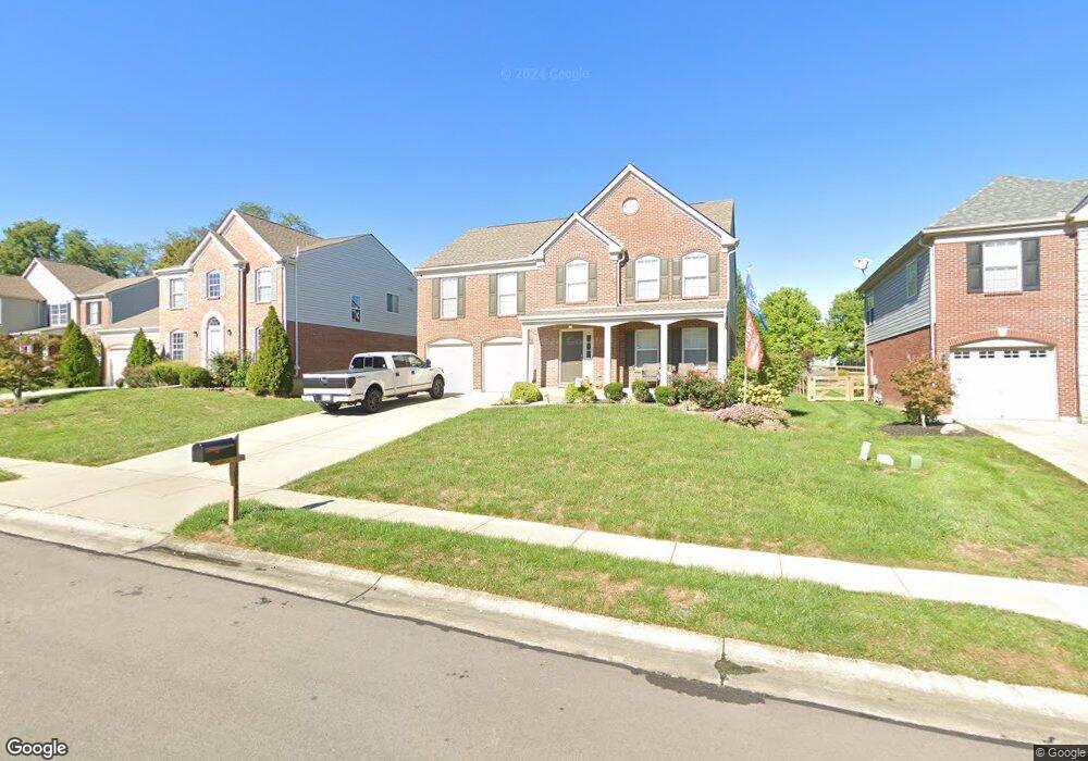
This home is located at 10132 Whittlesey Dr, Union, KY 41091 and is currently estimated at $443,206, approximately $164 per square foot. 10132 Whittlesey Dr is a home located in Boone County with nearby schools including Shirley Mann Elementary School, Gray Middle School, and Larry A. Ryle High School.
Ownership History
Date
Name
Owned For
Owner Type
Purchase Details
Closed on
Apr 24, 2019
Sold by
Brockman Craig S and Brockman Jessica M
Bought by
Galliher Terry J and Galliher Emily M
Current Estimated Value
Home Financials for this Owner
Home Financials are based on the most recent Mortgage that was taken out on this home.
Original Mortgage
$255,284
Outstanding Balance
$224,440
Interest Rate
4.3%
Mortgage Type
New Conventional
Estimated Equity
$218,766
Purchase Details
Closed on
Mar 31, 2017
Sold by
Kaneko Ryuji and Kaneko Mari
Bought by
Brockman Craig S and Brockman Jessica M
Home Financials for this Owner
Home Financials are based on the most recent Mortgage that was taken out on this home.
Original Mortgage
$184,450
Interest Rate
4.15%
Mortgage Type
New Conventional
Create a Home Valuation Report for This Property
The Home Valuation Report is an in-depth analysis detailing your home's value as well as a comparison with similar homes in the area
Home Values in the Area
Average Home Value in this Area
Purchase History
| Date | Buyer | Sale Price | Title Company |
|---|---|---|---|
| Galliher Terry J | $281,500 | 360 American Title Svcs Llc | |
| Brockman Craig S | $217,000 | 360 American Title Services |
Source: Public Records
Mortgage History
| Date | Status | Borrower | Loan Amount |
|---|---|---|---|
| Open | Galliher Terry J | $255,284 | |
| Previous Owner | Brockman Craig S | $184,450 |
Source: Public Records
Tax History Compared to Growth
Tax History
| Year | Tax Paid | Tax Assessment Tax Assessment Total Assessment is a certain percentage of the fair market value that is determined by local assessors to be the total taxable value of land and additions on the property. | Land | Improvement |
|---|---|---|---|---|
| 2024 | $3,502 | $312,000 | $35,000 | $277,000 |
| 2023 | $3,551 | $312,000 | $35,000 | $277,000 |
| 2022 | $3,160 | $281,500 | $35,000 | $246,500 |
| 2021 | $3,242 | $281,500 | $35,000 | $246,500 |
| 2020 | $3,223 | $281,500 | $35,000 | $246,500 |
| 2019 | $3,261 | $281,500 | $35,000 | $246,500 |
| 2018 | $2,551 | $217,000 | $35,000 | $182,000 |
| 2017 | $2,741 | $240,240 | $35,000 | $205,240 |
| 2015 | $2,708 | $240,240 | $35,000 | $205,240 |
| 2013 | -- | $228,000 | $30,000 | $198,000 |
Source: Public Records
Map
Nearby Homes
- 10067 Hempsteade Dr
- 2011 Holderness Dr
- 943 Lakepointe Ct
- 1110 Mount Zion Rd
- 10002 Irish Way
- 10077 Russwill Ln
- 1449 R J Ln
- 3832 Sonata Dr
- 10208 Cedarwood Dr
- 9807 Cherbourg Dr
- 3 Lots Tiburon Dr
- 1134 Donner Dr
- 10445 Jasons Bluff
- 2030 Stonewall Trail
- 2029 Stonewall Trail
- 760 Oakridge Dr
- 10481 Brookhurst Ln N
- 1802 Mimosa Trail
- 1247 Adison Ridge
- 3010 Danbury Dr
- 10136 Whittlesey Dr
- 10128 Whittlesey Dr
- 10140 Whittlesey Dr
- 10124 Whittlesey Dr
- 10081 Brandsteade Ct
- 10085 Brandsteade Ct
- 10077 Brandsteade Ct
- 10144 Whittlesey Dr
- 10120 Whittlesey Dr
- 10177 Whittlesey Dr
- 10089 Brandsteade Ct
- 10133 Whittlesey Dr
- 10129 Whittlesey Dr
- 10137 Whittlesey Dr
- 10073 Brandsteade Ct
- 10125 Whittlesey Dr
- 10093 Brandsteade Ct
- 10141 Whittlesey Dr
- 10148 Whittlesey Dr
- 10116 Whittlesey Dr