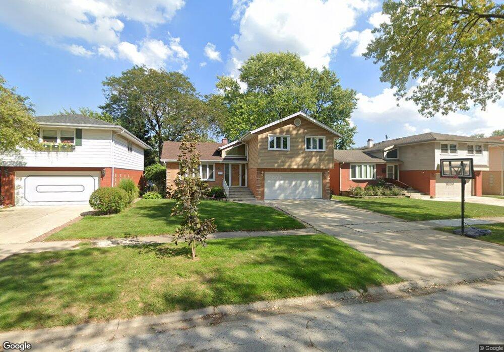
10133 Alice Ct Oak Lawn, IL 60453
Estimated Value: $329,000 - $418,000
4
Beds
1
Bath
1,761
Sq Ft
$211/Sq Ft
Est. Value
About This Home
This home is located at 10133 Alice Ct, Oak Lawn, IL 60453 and is currently estimated at $372,263, approximately $211 per square foot. 10133 Alice Ct is a home located in Cook County with nearby schools including Sward Elementary School, J Covington Elementary School, and Kolmar Avenue Elementary School.
Ownership History
Date
Name
Owned For
Owner Type
Purchase Details
Closed on
Jun 17, 2025
Sold by
Strozak Rafal S and Strozak Margaret H
Bought by
Strozak Family Revocable Living Trust and Strozak
Current Estimated Value
Purchase Details
Closed on
Dec 4, 1998
Sold by
Strozak Margaret and Osuchowski Margaret
Bought by
Strozak Rafal and Strozak Margaret
Home Financials for this Owner
Home Financials are based on the most recent Mortgage that was taken out on this home.
Original Mortgage
$120,400
Interest Rate
6.78%
Purchase Details
Closed on
Oct 13, 1998
Sold by
Bridgeview Bank & Trust
Bought by
Strozak Rafal and Osuchowski Margaret H
Home Financials for this Owner
Home Financials are based on the most recent Mortgage that was taken out on this home.
Original Mortgage
$120,400
Interest Rate
6.78%
Create a Home Valuation Report for This Property
The Home Valuation Report is an in-depth analysis detailing your home's value as well as a comparison with similar homes in the area
Home Values in the Area
Average Home Value in this Area
Purchase History
| Date | Buyer | Sale Price | Title Company |
|---|---|---|---|
| Strozak Family Revocable Living Trust | -- | None Listed On Document | |
| Strozak Rafal | -- | -- | |
| Strozak Rafal | $172,000 | Burnet Title Llc |
Source: Public Records
Mortgage History
| Date | Status | Borrower | Loan Amount |
|---|---|---|---|
| Previous Owner | Strozak Rafal | $120,400 |
Source: Public Records
Tax History Compared to Growth
Tax History
| Year | Tax Paid | Tax Assessment Tax Assessment Total Assessment is a certain percentage of the fair market value that is determined by local assessors to be the total taxable value of land and additions on the property. | Land | Improvement |
|---|---|---|---|---|
| 2024 | $8,252 | $29,000 | $3,848 | $25,152 |
| 2023 | $6,966 | $29,000 | $3,848 | $25,152 |
| 2022 | $6,966 | $21,092 | $3,367 | $17,725 |
| 2021 | $6,814 | $21,090 | $3,366 | $17,724 |
| 2020 | $6,833 | $21,090 | $3,366 | $17,724 |
| 2019 | $6,631 | $20,726 | $3,046 | $17,680 |
| 2018 | $6,381 | $20,726 | $3,046 | $17,680 |
| 2017 | $6,484 | $20,726 | $3,046 | $17,680 |
| 2016 | $5,902 | $17,586 | $2,565 | $15,021 |
| 2015 | $5,767 | $17,586 | $2,565 | $15,021 |
| 2014 | $5,705 | $17,586 | $2,565 | $15,021 |
| 2013 | $6,198 | $20,703 | $2,565 | $18,138 |
Source: Public Records
Map
Nearby Homes
- 5300 Oakdale Dr
- 5509 Oak Center Dr
- 5549 W 102nd St
- 10021 Cook Ave
- 10210 Washington Ave Unit 311
- 10210 Washington Ave Unit 305
- 5125 W 101st St
- 5120 W 101st St
- 10016 Harnew Rd W
- 10241 S Central Ave Unit 1B
- 10010 Harnew Rd W Unit 1
- 5630 W 103rd St Unit 308
- 10309 Parkside Ave
- 9828 Warren Ave
- 5168 W 99th St
- 10420 Washington Ave
- 10308 Circle Dr Unit 301
- 5700 Circle Dr Unit 101
- 5621 W 104th St Unit B2
- 9807 Washington Ave
- 10129 Alice Ct
- 10137 Alice Ct
- 10141 Alice Ct
- 10125 Alice Ct
- 10132 Minnick Ave
- 10136 Minnick Ave
- 10128 Minnick Ave
- 10121 Alice Ct
- 10145 Alice Ct
- 10140 Minnick Ave
- 10124 Minnick Ave
- 10132 Alice Ct
- 10136 Alice Ct
- 10124 Alice Ct
- 10120 Minnick Ave
- 10144 Minnick Ave
- 10140 Alice Ct
- 10117 Alice Ct
- 10120 Alice Ct
- 5340 W 102nd St