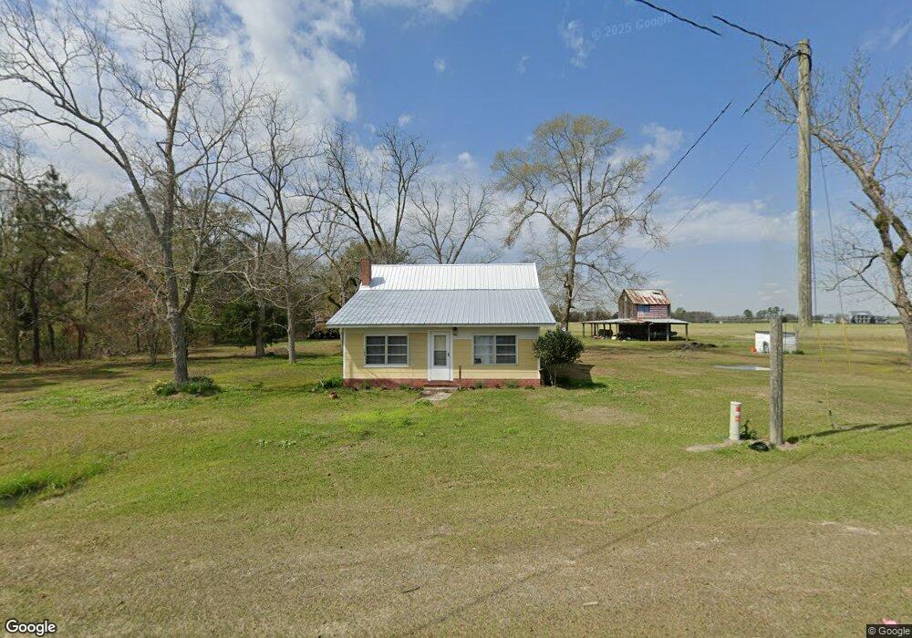
10133 Old Union Rd Sparks, GA 31647
Estimated Value: $92,000 - $765,169
--
Bed
--
Bath
812
Sq Ft
$403/Sq Ft
Est. Value
About This Home
This home is located at 10133 Old Union Rd, Sparks, GA 31647 and is currently estimated at $327,292, approximately $403 per square foot. 10133 Old Union Rd is a home with nearby schools including Cook Primary School, Cook Elementary School, and Cook County Middle School.
Ownership History
Date
Name
Owned For
Owner Type
Purchase Details
Closed on
Jan 21, 2025
Sold by
Bush Clint Alan
Bought by
Bush Clint A Trust and Bush Clint A Tr
Current Estimated Value
Purchase Details
Closed on
Mar 15, 2013
Sold by
Bush Clint Alan
Bought by
Bush Clint Alan and Bush Marcie Shierling
Home Financials for this Owner
Home Financials are based on the most recent Mortgage that was taken out on this home.
Original Mortgage
$401,287
Interest Rate
3.57%
Mortgage Type
New Conventional
Create a Home Valuation Report for This Property
The Home Valuation Report is an in-depth analysis detailing your home's value as well as a comparison with similar homes in the area
Home Values in the Area
Average Home Value in this Area
Purchase History
| Date | Buyer | Sale Price | Title Company |
|---|---|---|---|
| Bush Clint A Trust | -- | -- | |
| Bush Clint Alan | -- | -- |
Source: Public Records
Mortgage History
| Date | Status | Borrower | Loan Amount |
|---|---|---|---|
| Previous Owner | Bush Clint Alan | $401,287 |
Source: Public Records
Tax History Compared to Growth
Tax History
| Year | Tax Paid | Tax Assessment Tax Assessment Total Assessment is a certain percentage of the fair market value that is determined by local assessors to be the total taxable value of land and additions on the property. | Land | Improvement |
|---|---|---|---|---|
| 2024 | $1,707 | $154,726 | $143,203 | $11,523 |
| 2023 | $1,634 | $153,439 | $143,203 | $10,236 |
| 2022 | $1,589 | $138,096 | $127,860 | $10,236 |
| 2021 | $1,624 | $136,669 | $127,860 | $8,809 |
| 2020 | $1,586 | $136,669 | $127,860 | $8,809 |
| 2019 | $1,552 | $136,669 | $127,860 | $8,809 |
| 2018 | $3,952 | $136,669 | $127,860 | $8,809 |
| 2017 | $1,441 | $136,669 | $127,860 | $8,809 |
| 2016 | $1,410 | $136,669 | $127,860 | $8,809 |
| 2015 | $1,347 | $136,669 | $127,860 | $8,809 |
| 2014 | $1,349 | $136,669 | $127,860 | $8,809 |
| 2013 | -- | $141,868 | $133,460 | $8,408 |
Source: Public Records
Map
Nearby Homes
- 134 Brandy Ct
- 15150 U S 41
- 103 N College St
- 4711 Highway 37
- 515 John Keigans Memorial
- 0 Barneyville Rd
- 123 Westover Dr
- 120 Westover Dr
- 2590 McConnell Bridge Rd
- 284 Barrett Rd
- 105 Orchard Cir
- 703 N Elm St
- 0 Murray McCranie Rd Unit 25079284
- 0 Murray McCranie Rd Unit 11586683
- 2302 Thomas St
- 2603 Dianne St
- 1402 Bear Creek Rd
- 1306 Bear Creek Rd
- 2503 Dianne St
- 411 S Robinson St
- 10501 Old Union Rd
- 309 Peanut Ln
- 519 Peanut Ln
- 2918 Rountree Bridge Rd
- 362 Em Rogers Rd
- 3094 Rountree Bridge Rd
- 9418 Old Union Rd
- 3029 Rountree Bridge Rd
- 9313 Old Union Rd
- 1175 Em Rogers Rd
- 2779 Rountree Bridge Rd
- 242 Em Rogers Rd
- 3129 Springhill Rd
- 2755 Springhill Rd
- 3495 Rountree Bridge Rd
- 3007 Springhill Rd
- 2560 Springhill Rd
- 2500 Springhill Rd
- 2525 Rountree Bridge Rd
- 9176 Old Union Rd