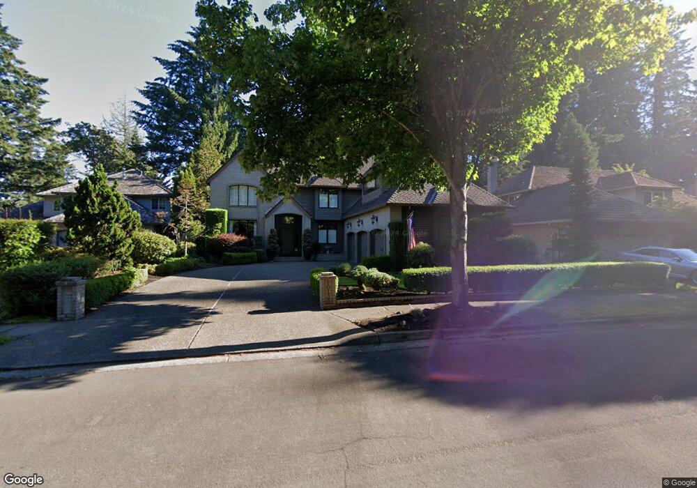
10135 SW Alsea Ct Tualatin, OR 97062
Estimated Value: $868,514 - $1,026,000
--
Bed
3
Baths
3,648
Sq Ft
$254/Sq Ft
Est. Value
About This Home
This home is located at 10135 SW Alsea Ct, Tualatin, OR 97062 and is currently estimated at $924,879, approximately $253 per square foot. 10135 SW Alsea Ct is a home located in Washington County with nearby schools including Byrom Elementary School, Hazelbrook Middle School, and Tualatin High School.
Ownership History
Date
Name
Owned For
Owner Type
Purchase Details
Closed on
Apr 28, 2001
Sold by
Martin Patricia S
Bought by
Bowlsby Lacy G and Bowlsby Patricia Martin
Current Estimated Value
Purchase Details
Closed on
Jul 8, 1998
Sold by
Taylor Robert C and Taylor Jana D
Bought by
Lovin Randall G and Lovin Julie A
Home Financials for this Owner
Home Financials are based on the most recent Mortgage that was taken out on this home.
Original Mortgage
$310,400
Outstanding Balance
$63,687
Interest Rate
7.03%
Estimated Equity
$861,192
Create a Home Valuation Report for This Property
The Home Valuation Report is an in-depth analysis detailing your home's value as well as a comparison with similar homes in the area
Home Values in the Area
Average Home Value in this Area
Purchase History
| Date | Buyer | Sale Price | Title Company |
|---|---|---|---|
| Bowlsby Lacy G | -- | Pacific Nw Title | |
| Lovin Randall G | $388,000 | Chicago Title Insurance Co |
Source: Public Records
Mortgage History
| Date | Status | Borrower | Loan Amount |
|---|---|---|---|
| Open | Lovin Randall G | $310,400 |
Source: Public Records
Tax History Compared to Growth
Tax History
| Year | Tax Paid | Tax Assessment Tax Assessment Total Assessment is a certain percentage of the fair market value that is determined by local assessors to be the total taxable value of land and additions on the property. | Land | Improvement |
|---|---|---|---|---|
| 2025 | $10,704 | $629,310 | -- | -- |
| 2024 | $10,424 | $610,990 | -- | -- |
| 2023 | $10,424 | $593,200 | $0 | $0 |
| 2022 | $9,973 | $593,200 | $0 | $0 |
| 2021 | $9,631 | $559,160 | $0 | $0 |
| 2020 | $9,069 | $542,880 | $0 | $0 |
| 2019 | $8,892 | $527,070 | $0 | $0 |
| 2018 | $8,630 | $511,720 | $0 | $0 |
| 2017 | $7,939 | $496,820 | $0 | $0 |
| 2016 | $7,492 | $482,350 | $0 | $0 |
| 2015 | $7,102 | $468,310 | $0 | $0 |
| 2014 | $7,028 | $454,670 | $0 | $0 |
Source: Public Records
Map
Nearby Homes
- 10220 SW Paulina Dr
- 9995 SW Siuslaw Ln
- 21689 SW Klickitat Ct
- 21873 SW 106th Ave
- 8833 Chokecherry Ln
- 8854 SW Vermillion Dr
- 8834 SW Vermillion Dr
- 8874 SW Vermillion Dr
- 20900 SW Winema Dr
- 22020 SW 106th Place
- 22000 SW Grahams Ferry Rd Unit C
- 22250 SW 103rd Ave
- 20752 SW 104th Ave
- 9433 SW Siuslaw Ln
- 22030 SW Grahams Ferry Rd Unit D
- 9495 SW Cherry Ln
- 10695 SW Meier Dr
- 22040 SW Grahams Ferry Rd Unit B
- 21777 SW Fuller Dr
- 22382 SW 107th Ave
- 10085 SW Alsea Ct
- 10155 SW Alsea Ct
- 10140 SW Paulina Dr
- 10065 SW Alsea Ct
- 10160 SW Paulina Dr
- 10120 SW Paulina Dr
- 10175 SW Alsea Ct
- 10200 SW Paulina Dr
- 10195 SW Alsea Ct
- 10045 SW Alsea Ct
- 21675 SW Hedges Dr
- 21670 SW Hedges Dr
- 21685 SW Hedges Dr
- 10025 SW Alsea Ct
- 10060 SW Paulina Dr
- 10145 SW Paulina Dr
- 10125 SW Paulina Dr
- 10205 SW Paulina Dr
- 10105 SW Paulina Dr