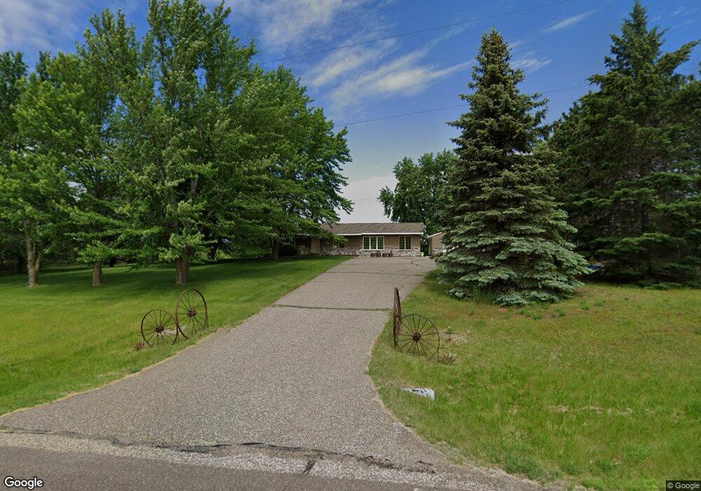
1014 192nd Ave New Richmond, WI 54017
Estimated Value: $398,191 - $467,000
3
Beds
2
Baths
2,350
Sq Ft
$178/Sq Ft
Est. Value
About This Home
This home is located at 1014 192nd Ave, New Richmond, WI 54017 and is currently estimated at $417,548, approximately $177 per square foot. 1014 192nd Ave is a home located in St. Croix County with nearby schools including Somerset Elementary School, Somerset Middle School, and Somerset High School.
Ownership History
Date
Name
Owned For
Owner Type
Purchase Details
Closed on
Jun 7, 2019
Sold by
Johnson Eric and Johnson Erin L
Bought by
Brooke Card Michael and Brooke Noah
Current Estimated Value
Home Financials for this Owner
Home Financials are based on the most recent Mortgage that was taken out on this home.
Original Mortgage
$244,625
Outstanding Balance
$215,085
Interest Rate
4.1%
Mortgage Type
New Conventional
Estimated Equity
$202,463
Purchase Details
Closed on
Nov 23, 2016
Sold by
Hein Douglas L and Hein Linda S
Bought by
Johnson Eric and Johnson Erin L
Home Financials for this Owner
Home Financials are based on the most recent Mortgage that was taken out on this home.
Original Mortgage
$168,650
Interest Rate
3.5%
Mortgage Type
FHA
Purchase Details
Closed on
Jul 3, 2013
Sold by
Schmidt Richard F and Schmidt Amy E
Bought by
Hein Douglas L and Hein Linda S
Home Financials for this Owner
Home Financials are based on the most recent Mortgage that was taken out on this home.
Original Mortgage
$136,000
Interest Rate
3.62%
Mortgage Type
New Conventional
Create a Home Valuation Report for This Property
The Home Valuation Report is an in-depth analysis detailing your home's value as well as a comparison with similar homes in the area
Home Values in the Area
Average Home Value in this Area
Purchase History
| Date | Buyer | Sale Price | Title Company |
|---|---|---|---|
| Brooke Card Michael | $257,500 | None Available | |
| Johnson Eric | $195,000 | Titlesmart Inc | |
| Hein Douglas L | $170,000 | None Available |
Source: Public Records
Mortgage History
| Date | Status | Borrower | Loan Amount |
|---|---|---|---|
| Open | Brooke Card Michael | $244,625 | |
| Previous Owner | Johnson Eric | $168,650 | |
| Previous Owner | Hein Douglas L | $136,000 |
Source: Public Records
Tax History Compared to Growth
Tax History
| Year | Tax Paid | Tax Assessment Tax Assessment Total Assessment is a certain percentage of the fair market value that is determined by local assessors to be the total taxable value of land and additions on the property. | Land | Improvement |
|---|---|---|---|---|
| 2024 | $33 | $243,400 | $37,000 | $206,400 |
| 2023 | $3,690 | $243,400 | $37,000 | $206,400 |
| 2022 | $3,243 | $243,400 | $37,000 | $206,400 |
| 2021 | $3,220 | $243,400 | $37,000 | $206,400 |
| 2020 | $3,167 | $243,400 | $37,000 | $206,400 |
| 2019 | $2,823 | $243,400 | $37,000 | $206,400 |
| 2018 | $2,641 | $162,400 | $31,000 | $131,400 |
| 2017 | $2,554 | $158,900 | $31,000 | $127,900 |
| 2016 | $2,554 | $158,900 | $31,000 | $127,900 |
| 2015 | $2,550 | $158,900 | $31,000 | $127,900 |
| 2014 | $2,269 | $158,900 | $31,000 | $127,900 |
| 2013 | $2,373 | $154,600 | $31,000 | $123,600 |
Source: Public Records
Map
Nearby Homes
- Lot 4 Nighthawk Dr
- Lot 5 Riverdale Ct
- TBD Nighthawk Dr ( Apple River Lot) Lot 9
- TBD Nighthawk Dr ( Apple River Lot) Lot 5
- TBD Nighthawk Dr ( Apple River Lot) Lot 6
- TBD Nighthawk Dr ( Apple River Lot) Lot 4
- TBD Nighthawk Dr ( Apple River Lot) Lot 10
- TBD Nighthawk Dr ( Apple River Lot) Lot 7
- 919 189th Ave
- TBD County Road C
- XXXX 110th St
- 893 183rd Ct
- 885 183rd Ct
- 872 183rd Ct
- 1256 195th Ave
- 2118 100th St
- 1787 Saint Andrews Place
- 883 174th Ave
- 1152 County Road C
- 1888 80th St