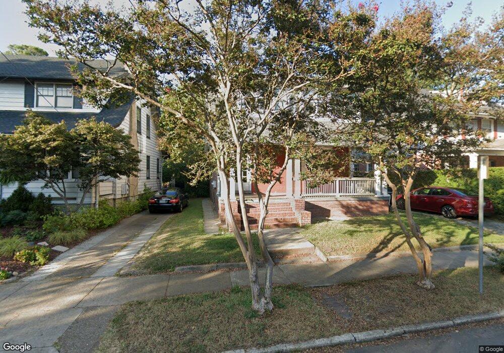
1014 Brandon Ave Norfolk, VA 23507
West Ghent NeighborhoodEstimated Value: $408,000 - $503,000
4
Beds
2
Baths
2,540
Sq Ft
$181/Sq Ft
Est. Value
About This Home
This home is located at 1014 Brandon Ave, Norfolk, VA 23507 and is currently estimated at $459,170, approximately $180 per square foot. 1014 Brandon Ave is a home located in Norfolk City with nearby schools including W.H. Taylor Elementary School, Blair Middle School, and Maury High School.
Ownership History
Date
Name
Owned For
Owner Type
Purchase Details
Closed on
Dec 2, 2022
Sold by
Belkov Family R/E Limited Partnership
Bought by
Bennett Thomas L and Bennett Rachel C
Current Estimated Value
Home Financials for this Owner
Home Financials are based on the most recent Mortgage that was taken out on this home.
Original Mortgage
$361,250
Outstanding Balance
$350,410
Interest Rate
6.95%
Mortgage Type
New Conventional
Estimated Equity
$108,760
Create a Home Valuation Report for This Property
The Home Valuation Report is an in-depth analysis detailing your home's value as well as a comparison with similar homes in the area
Home Values in the Area
Average Home Value in this Area
Purchase History
| Date | Buyer | Sale Price | Title Company |
|---|---|---|---|
| Bennett Thomas L | $425,000 | None Listed On Document |
Source: Public Records
Mortgage History
| Date | Status | Borrower | Loan Amount |
|---|---|---|---|
| Open | Bennett Thomas L | $361,250 |
Source: Public Records
Tax History
| Year | Tax Paid | Tax Assessment Tax Assessment Total Assessment is a certain percentage of the fair market value that is determined by local assessors to be the total taxable value of land and additions on the property. | Land | Improvement |
|---|---|---|---|---|
| 2025 | $5,126 | $410,100 | $151,300 | $258,800 |
| 2024 | $4,958 | $403,100 | $151,300 | $251,800 |
| 2023 | $4,779 | $382,300 | $151,300 | $231,000 |
| 2022 | $4,543 | $363,400 | $136,600 | $226,800 |
| 2021 | $4,258 | $340,600 | $129,800 | $210,800 |
| 2020 | $4,184 | $334,700 | $129,800 | $204,900 |
| 2019 | $4,060 | $324,800 | $129,800 | $195,000 |
| 2018 | $3,884 | $310,700 | $129,800 | $180,900 |
| 2017 | $3,496 | $304,000 | $129,800 | $174,200 |
| 2016 | $3,391 | $298,900 | $129,800 | $169,100 |
| 2015 | $3,437 | $298,900 | $129,800 | $169,100 |
| 2014 | $3,437 | $298,900 | $129,800 | $169,100 |
Source: Public Records
Map
Nearby Homes
- 1024 Gates Ave Unit 6B
- 913 Spotswood Ave Unit 1
- 849 Baldwin Ave Unit 1C
- 1419 Armistead Bridge Rd
- 800 Gates Ave Unit C-2
- 919 Graydon Ave
- 1008 Westover Ave Unit 6A
- 800 W Princess Anne Rd Unit D4
- 738 Shirley Ave
- 1106 Redgate Ave
- 742 Washington Park Unit C1
- 734 Shirley Ave
- 820 Westover Ave
- 1115 Colley Ave Unit A3
- 805 Graydon Ave Unit 101
- 2406 Colley Ave
- 900 Colley Ave Unit 10
- 622 Maury Ave
- 2702 Bowdens Ferry Rd
- 610 W Princess Anne Rd Unit B4
- 1014 Brandon Ave Unit 1
- 1014 Brandon Ave Unit 2
- 1016 Brandon Ave
- 1012 Brandon Ave
- 1018 Brandon Ave
- 1008 Brandon Ave Unit B-5
- 1008 Brandon Ave
- 1015 Brandon Ave
- 1020 Brandon Ave
- 1017 Brandon Ave
- 1013 Brandon Ave
- 1007 Gates Ave
- 1009 Brandon Ave
- 1709 Hampton Blvd
- 1709 Hampton Blvd Unit 1
- 1019 Brandon Ave
- 1006 Brandon Ave Unit A-8
- 1707 Hampton Blvd
- 1021 Brandon Ave
- 1001 Gates Ave Unit 17C
Your Personal Tour Guide
Ask me questions while you tour the home.