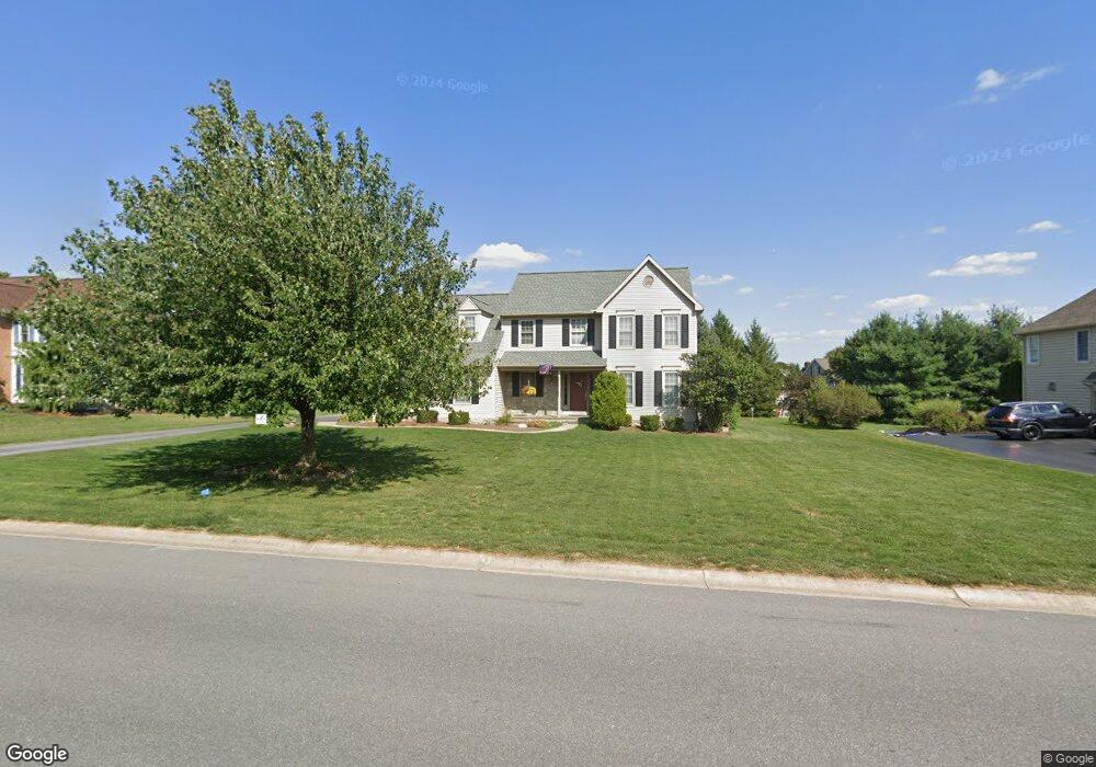
1014 Buckwalter Rd Lititz, PA 17543
Kissel Hill NeighborhoodEstimated Value: $445,000 - $675,000
4
Beds
3
Baths
2,508
Sq Ft
$242/Sq Ft
Est. Value
About This Home
This home is located at 1014 Buckwalter Rd, Lititz, PA 17543 and is currently estimated at $605,750, approximately $241 per square foot. 1014 Buckwalter Rd is a home located in Lancaster County with nearby schools including Reidenbaugh Elementary School, Landis Run Intermediate School, and Manheim Township Middle School.
Ownership History
Date
Name
Owned For
Owner Type
Purchase Details
Closed on
Dec 13, 2001
Sold by
Pijar Michael C and Pijar Margaret A
Bought by
Schwartz Matthew A and Schwartz Rebecca D
Current Estimated Value
Home Financials for this Owner
Home Financials are based on the most recent Mortgage that was taken out on this home.
Original Mortgage
$179,200
Outstanding Balance
$70,231
Interest Rate
6.61%
Estimated Equity
$535,519
Create a Home Valuation Report for This Property
The Home Valuation Report is an in-depth analysis detailing your home's value as well as a comparison with similar homes in the area
Home Values in the Area
Average Home Value in this Area
Purchase History
| Date | Buyer | Sale Price | Title Company |
|---|---|---|---|
| Schwartz Matthew A | $224,000 | First American Title Ins Co |
Source: Public Records
Mortgage History
| Date | Status | Borrower | Loan Amount |
|---|---|---|---|
| Open | Schwartz Matthew A | $179,200 | |
| Closed | Schwartz Matthew A | $15,000 |
Source: Public Records
Tax History Compared to Growth
Tax History
| Year | Tax Paid | Tax Assessment Tax Assessment Total Assessment is a certain percentage of the fair market value that is determined by local assessors to be the total taxable value of land and additions on the property. | Land | Improvement |
|---|---|---|---|---|
| 2025 | $7,445 | $344,100 | $99,600 | $244,500 |
| 2024 | $7,445 | $344,100 | $99,600 | $244,500 |
| 2023 | $7,251 | $344,100 | $99,600 | $244,500 |
| 2022 | $7,129 | $344,100 | $99,600 | $244,500 |
| 2021 | $6,970 | $344,100 | $99,600 | $244,500 |
| 2020 | $6,970 | $344,100 | $99,600 | $244,500 |
| 2019 | $6,902 | $344,100 | $99,600 | $244,500 |
| 2018 | $8,382 | $344,100 | $99,600 | $244,500 |
| 2017 | $6,608 | $259,700 | $58,100 | $201,600 |
| 2016 | $6,349 | $249,500 | $58,100 | $191,400 |
| 2015 | $1,596 | $249,500 | $58,100 | $191,400 |
| 2014 | $4,543 | $249,500 | $58,100 | $191,400 |
Source: Public Records
Map
Nearby Homes
- 512 Northampton Dr Unit 43
- 421 Southampton Dr
- 533 Northampton Dr
- 513 Northampton Dr
- 505 Northampton Dr Unit 2
- 297 Sarsen Dr
- 381 Sarsen Dr
- 905 Sloan St
- 677 Dorset St
- 648 Dorset St
- 1049 Kent Garden
- 1047 Kent Garden
- 327 Squire Ln
- 335 Royal Hunt Way
- 391 Ecker Dr
- 0 Woodcrest Ave Unit PALA2055934
- 0 Woodcrest Ave Unit PALA2055748
- 2717 Kreider Rd
- 464 Resolution Dr
- 600 Allegiance Dr
- 1010 Buckwalter Rd
- 1018 Buckwalter Rd
- 160 Olde Field Dr
- 164 Olde Field Dr
- 156 Olde Field Dr
- 1006 Buckwalter Rd
- 168 Olde Field Dr
- 152 Olde Field Dr
- 163 Olde Field Dr
- 1002 Buckwalter Rd
- 172 Olde Field Dr
- 157 Olde Field Dr
- 45 Thresher Ct
- 148 Olde Field Dr
- 151 Olde Field Dr
- 9 Thresher Ct
- 173 Olde Field Dr
- 39 Thresher Ct
- 998 Buckwalter Rd
- 145 Olde Field Dr