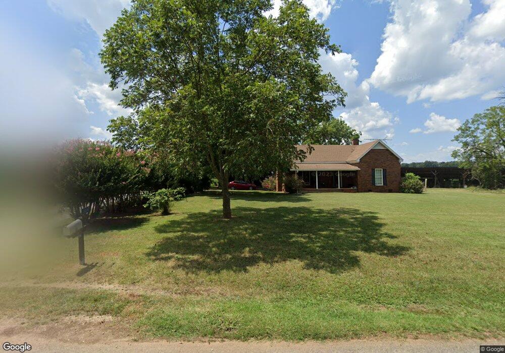
1014 Kings Rd Lavonia, GA 30553
Estimated Value: $364,000
--
Bed
1
Bath
--
Sq Ft
74.67
Acres
About This Home
This home is located at 1014 Kings Rd, Lavonia, GA 30553 and is currently estimated at $364,000. 1014 Kings Rd is a home located in Hart County with nearby schools including Hart County High School.
Ownership History
Date
Name
Owned For
Owner Type
Purchase Details
Closed on
Nov 26, 2013
Sold by
King William Morris
Bought by
King David Douglas
Current Estimated Value
Home Financials for this Owner
Home Financials are based on the most recent Mortgage that was taken out on this home.
Original Mortgage
$35,000
Interest Rate
4.31%
Mortgage Type
New Conventional
Purchase Details
Closed on
Oct 1, 2002
Purchase Details
Closed on
Aug 1, 1950
Create a Home Valuation Report for This Property
The Home Valuation Report is an in-depth analysis detailing your home's value as well as a comparison with similar homes in the area
Home Values in the Area
Average Home Value in this Area
Purchase History
| Date | Buyer | Sale Price | Title Company |
|---|---|---|---|
| King David Douglas | $35,000 | -- | |
| -- | -- | -- | |
| -- | -- | -- |
Source: Public Records
Mortgage History
| Date | Status | Borrower | Loan Amount |
|---|---|---|---|
| Closed | King David Douglas | $35,000 |
Source: Public Records
Tax History Compared to Growth
Tax History
| Year | Tax Paid | Tax Assessment Tax Assessment Total Assessment is a certain percentage of the fair market value that is determined by local assessors to be the total taxable value of land and additions on the property. | Land | Improvement |
|---|---|---|---|---|
| 2024 | $687 | $176,281 | $164,831 | $11,450 |
| 2023 | $654 | $146,756 | $135,306 | $11,450 |
| 2022 | $612 | $130,463 | $120,756 | $9,707 |
| 2021 | $622 | $128,006 | $120,756 | $7,250 |
| 2020 | $634 | $118,431 | $111,181 | $7,250 |
| 2019 | $626 | $118,431 | $111,181 | $7,250 |
| 2018 | $619 | $118,431 | $111,181 | $7,250 |
| 2017 | $609 | $118,431 | $111,181 | $7,250 |
| 2016 | $615 | $103,125 | $95,875 | $7,250 |
| 2015 | $530 | $104,011 | $97,313 | $6,698 |
| 2014 | $530 | $104,131 | $97,433 | $6,698 |
| 2013 | -- | $127,421 | $99,242 | $28,179 |
Source: Public Records
Map
Nearby Homes
- 0 Hwy 59 and Ross Place Unit 10499138
- 4094 Lankford Rd
- 0 State Route 366
- LOT TBD 3 State Route 366
- 86 Luckie St
- 266 Randall St
- 2276 Providence Church Rd
- 138 Victoria Ln
- 89 Huntington Dr
- 222 Charity Dr
- 181 Charity Dr
- 56 Harriet Dr
- 68 Harriet Dr
- 148 Allen Dr
- 125 Charity Dr
- 5710 Vickery St
- 0 Highway 59 Unit 10615036
- 0 Highway 59 Unit 10632364
- 5494 Vickery St
- 5474 Vickery St